
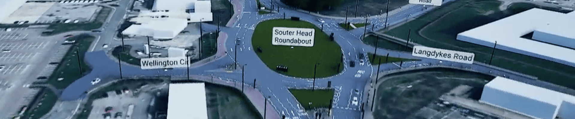
Public Consultation Boards
Access the public consultation story boards.
Wellington Road Junction Improvements (WRJI) Public Exhibition
Wellington Road Junction Improvements - Design Manual for Roads and Bridges Stage 2 Route Options Assessment - Public Consultation
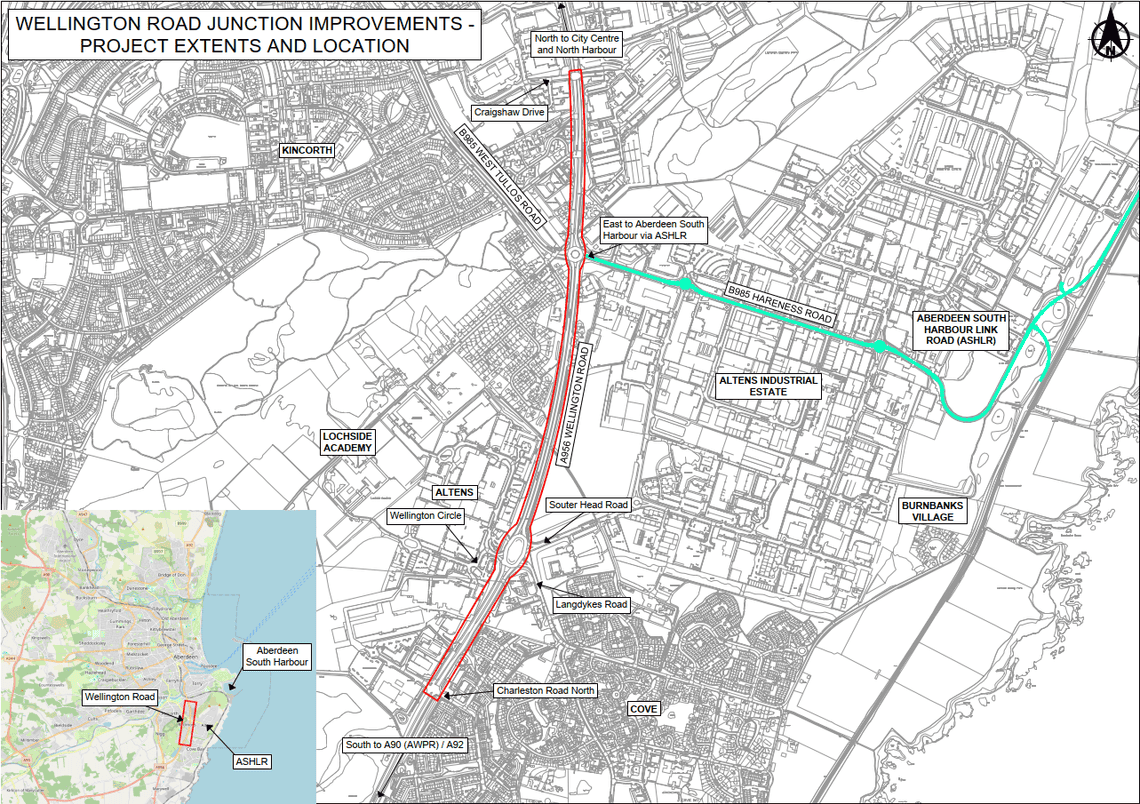
Wellington Road Junction Improvements is a project focusing on approximately 2km of Wellington Road from Charleston Road North to Craigshaw Drive.
The project will also consider walking/cycling facilities, and buses and freight transport.
The intentions of the project are:
- Prioritise sustainable transport along Wellington Road;
- Support freight movement;
- Improve access to education along the corridor;
- Ensure road safety; and
- Enhance air quality and public health.
Project Background
The Aberdeen City Region Deal Strategic Transport Appraisal identified opportunity to progress elements of designs from the previous Wellington Road Multi-Modal Corridor Study with the anticipation of achieving additional benefits to the surrounding area.
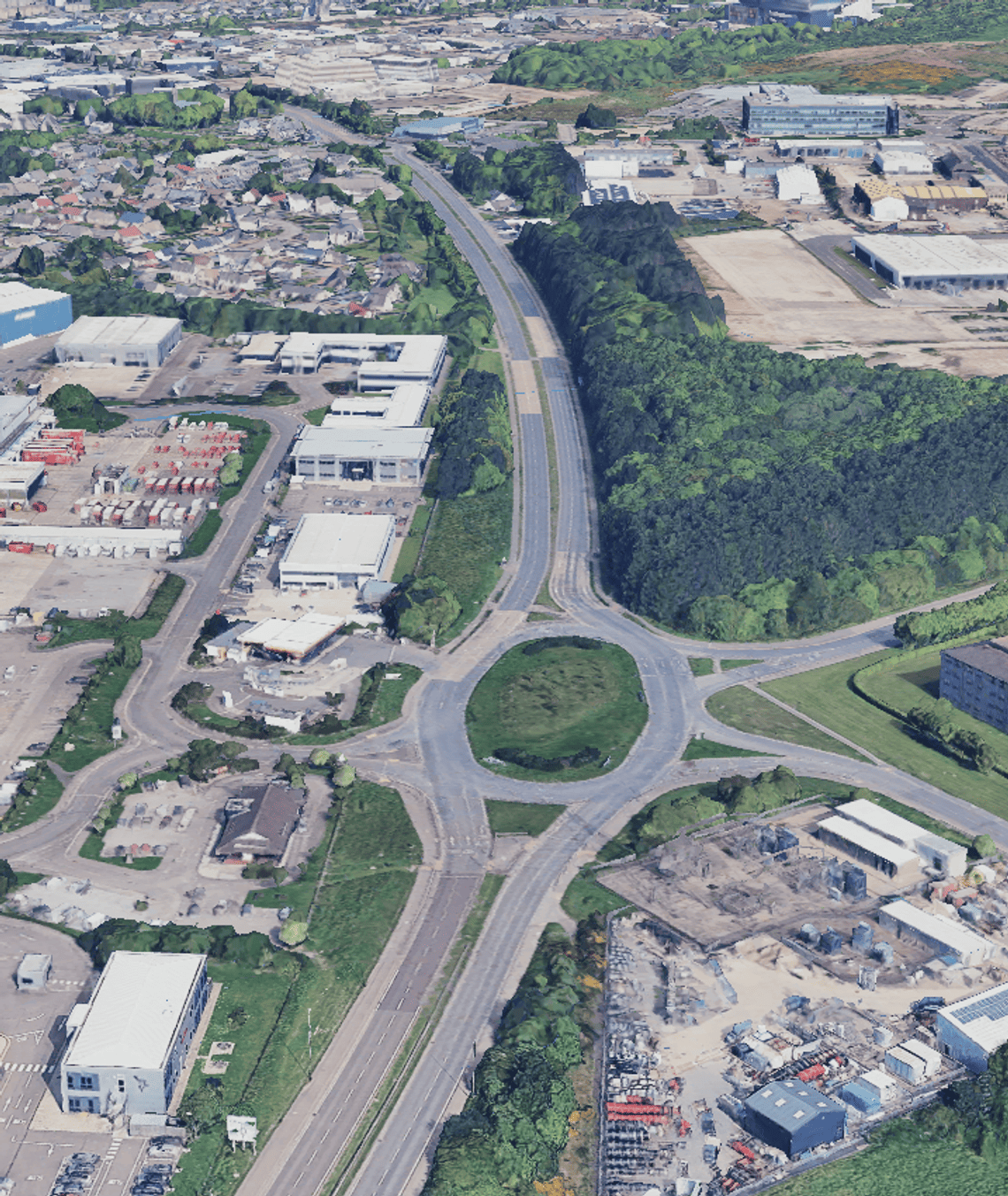
This is restricted to the length from Charleston Road North to Craigshaw Drive including Souterhead roundabout and Hareness roundabout.
The previous work on the Wellington Road corridor, the Wellington Road Multi-Modal Corridor Study, identified a hybrid package of multi-modal improvements along the length of the corridor.
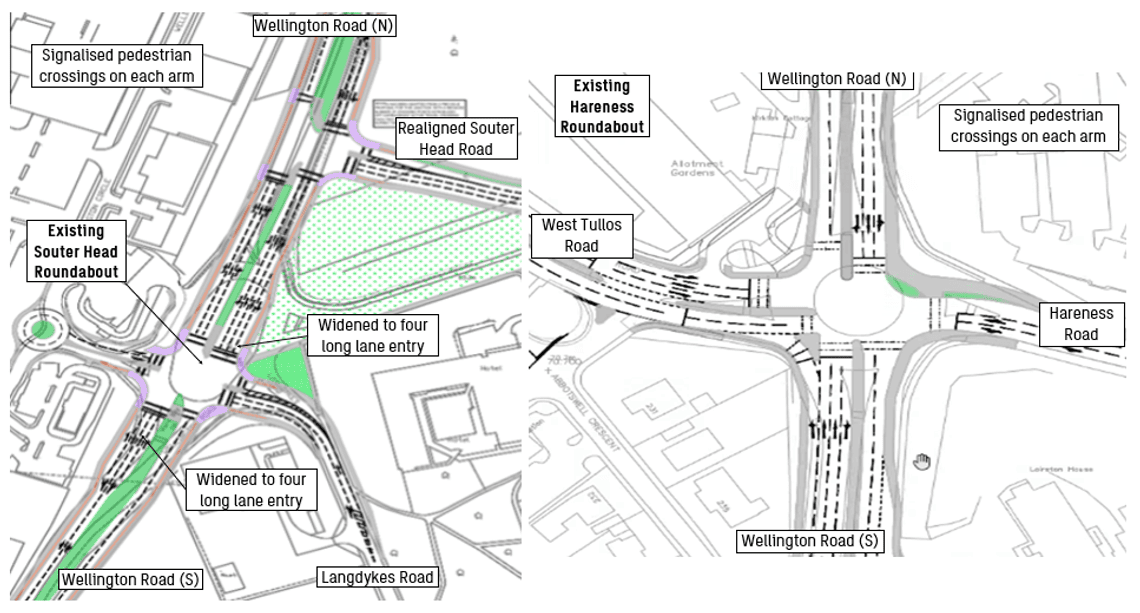
The design elements brought forward constituted the signalisation of the Souterhead and Hareness Road roundabouts and walking/cycling facilities.
Signalisation Feasibility
Traffic modelling was undertaken to understand the impacts if Souterhead roundabout and Hareness roundabout were signalised.
The traffic modelling concluded that signalising the roundabouts had a significant effect on traffic and journey times making it an undesirable option to progress to the next design stage.
Click 'Next' to view the last page.
What's been done?
The Design Manual for Roads and Bridges Stage 2 Route Options Assessment is a concept design phase of a project. At this stage, a long list of options was produced which resulted in a shortlist of options A – F then G – K below.
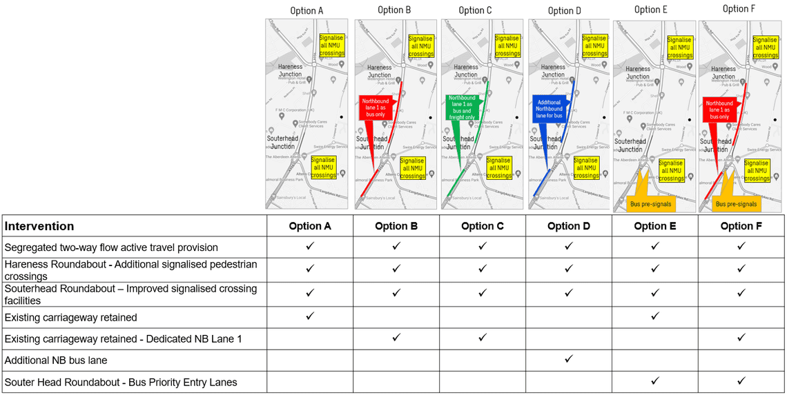
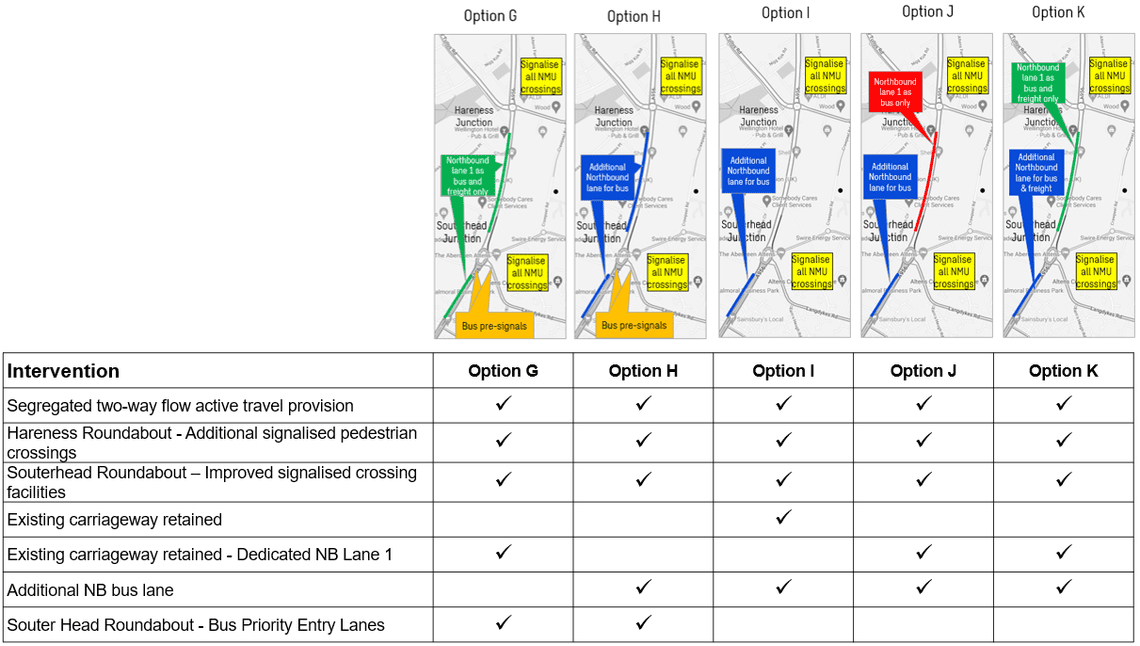
Each option had an estimated cost associated with it, journey time impact and whole life carbon emissions.
Following careful consideration, Option K was selected as the preferred public transport and freight movement option due to its hybrid approach, lower environmental impact and lower cost.
What's been done?
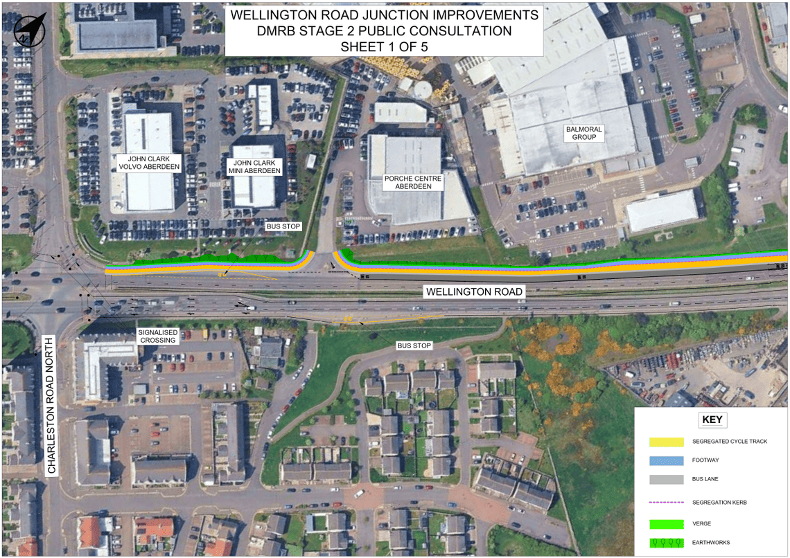
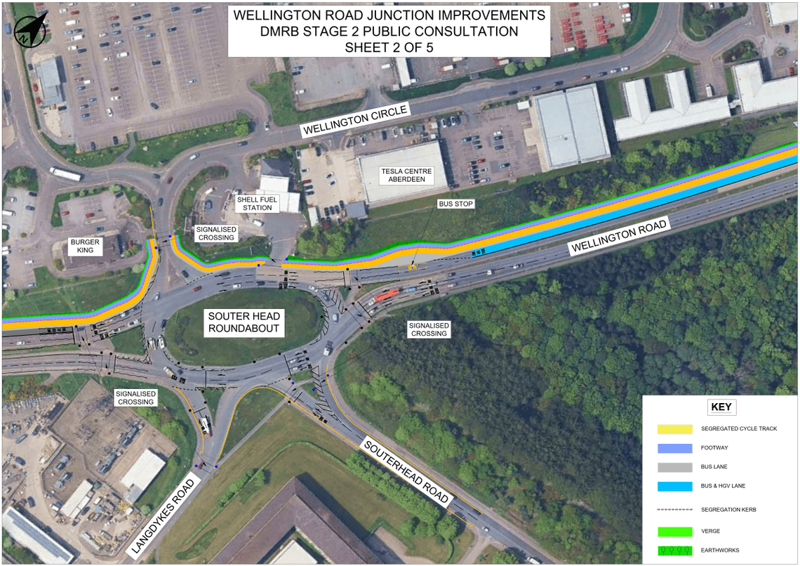
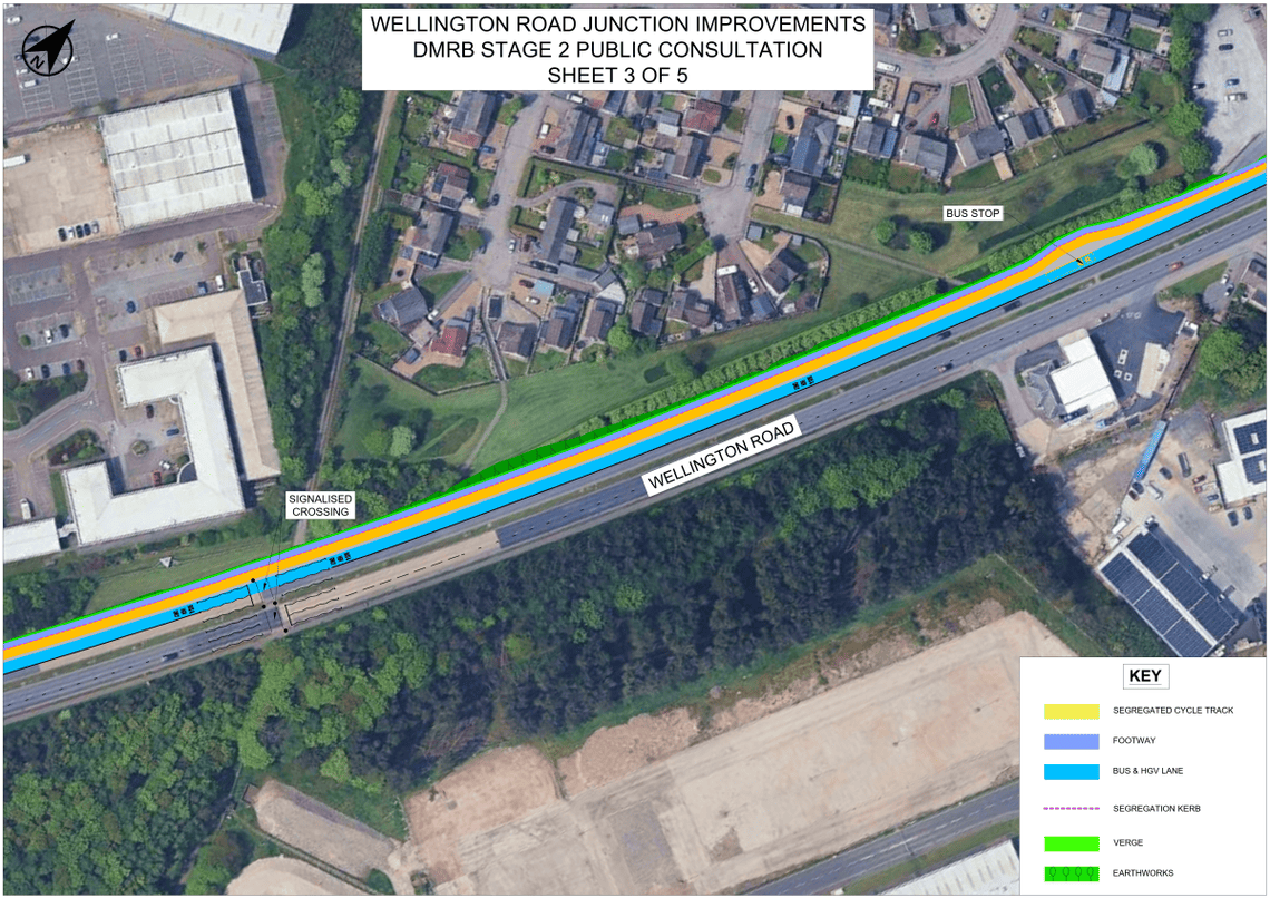
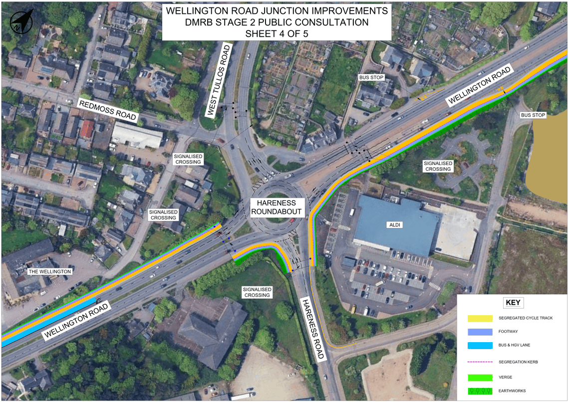
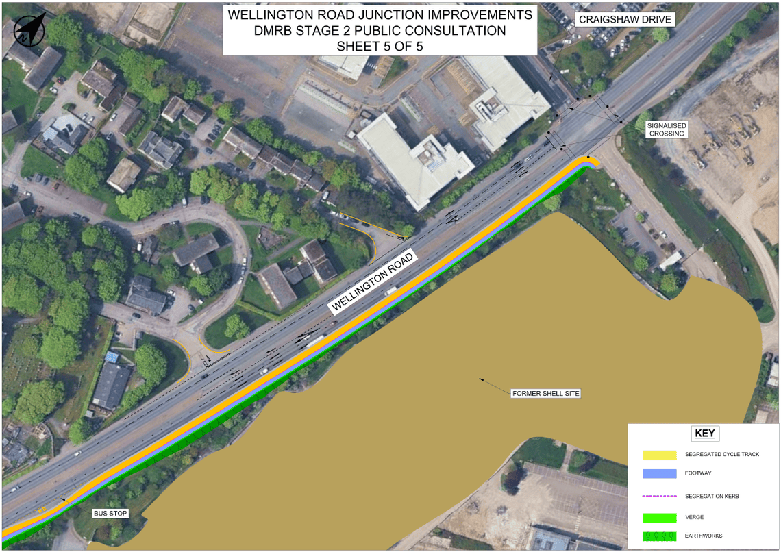
With an option selected for buses and freight transport, walking/cycling improvements along the length of the project were also considered.
The Design Manual for Roads and Bridges Stage 2 Route Options Assessment investigated the physical constraints on the route to understand potential obstructions and opportunities.
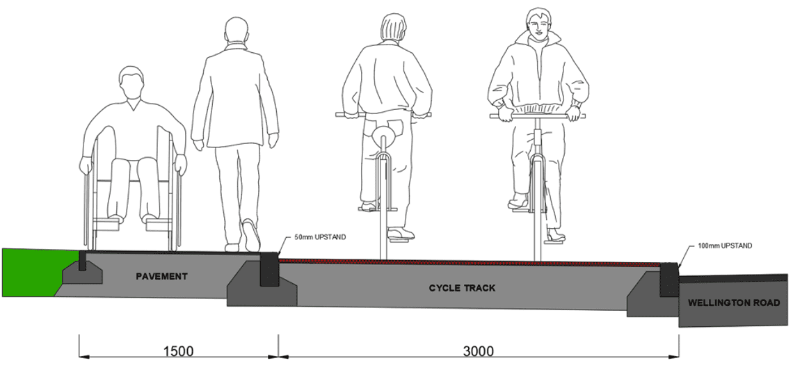
The cross section of the walking/cycling facilities features a 50mm upstand kerb to separate the pavement and cycle track. The cycle track includes a buffer zone when adjacent to Wellington Road.
Next steps
The next steps of the project include developing the preferred design and progressing through The Design Manual for Roads and Bridges Stage 3 Scheme Assessment. Preferred option K will be assessed against environmental and engineering issues.
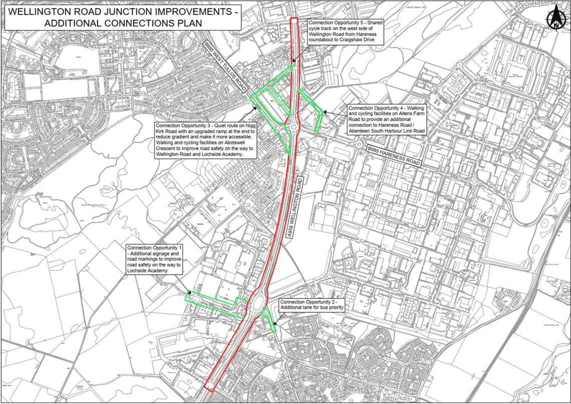
We are also looking at additional walking/cycling improvements to Wellington Road from neighbouring residential communities.
We would welcome your feedback on the preferred option and the additional connections from neighbouring residential communities. See additional connections plan for context.
Additional Connections Plan
Visualisation Link
Wellington Road Junction Improvements DMRB Stage 2 Visualisation
Aberdeen City Region Deal
The Aberdeen City Region Deal is a partnership between Aberdeen City Council, Aberdeenshire Council, Opportunity North East, other regional partners, the private sector, Scottish Government and UK Government. The Deal is one delivery mechanism for the regional economic strategy and is investing in sector innovation projects and infrastructure to support economic diversification and resilience.
Signed in November 2016, both Governments committed to jointly investing up to £250 million over a 10-year period. These commitments form part of an overarching £826 million funding package for the Aberdeen City Region Deal.
The Wellington Road Junction Improvements project forms part of an overarching £826million funding package for the Aberdeen City Region Deal. Part of this deal is to upgrade the existing transportation links to the recently opened Aberdeen South Harbour.

Discover more

Feedback Questionnaire
Feedback questions to be completed at your leisure.
Wellington Road Junction Improvements - Pin Map
Feel free to drop a pin and provide comments.
Stay Informed
Follow our projects to get notified of upcoming engagements and the latest project related news.