
About This Consultation
Learn more about the consultation and view the final design for the Aberdeen South Harbour Link Road project.
Aberdeen South Harbour Link Road – Permanent Traffic Management Measures
Background
The Aberdeen South Harbour Link Road is a road improvement project connecting the new Aberdeen South Harbour to the wider transport network. It includes a new bridge over the Aberdeen to Dundee railway line and dedicated routes for walking and cycling.
Project Goals:
- Improve HGV travel efficiency between the harbour and the Aberdeen Western Peripheral Route (AWPR).
- Reduce environmental and community impact of HGV traffic in Torry and Cove.
- Enhance transport connectivity for all modes (cars, public transport, cycling, walking).
- Support the Energy Transition Zone (ETZ) by improving access and connectivity for energy-related businesses.
- Facilitate abnormal load transport with minimal disruption to residential and business areas.
During the scheme development process, concerns were raised regarding post-project traffic issues. Aberdeen City Council is therefore engaging with the community to gather feedback, identify concerns, and explore possible traffic management solutions.
Consultation Objectives:
- Provide background on the Aberdeen South Harbour Link Road and its post-completion layout.
- Invite the public to identify and describe traffic-related concerns.
- Present pros and cons of various permanent traffic management options.
- Gather public feedback by rating proposed solutions against identified concerns.
Scheme Layout
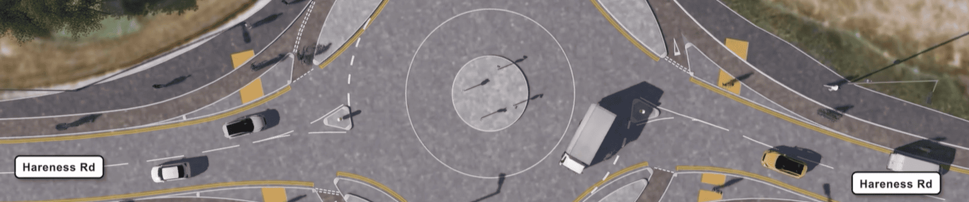
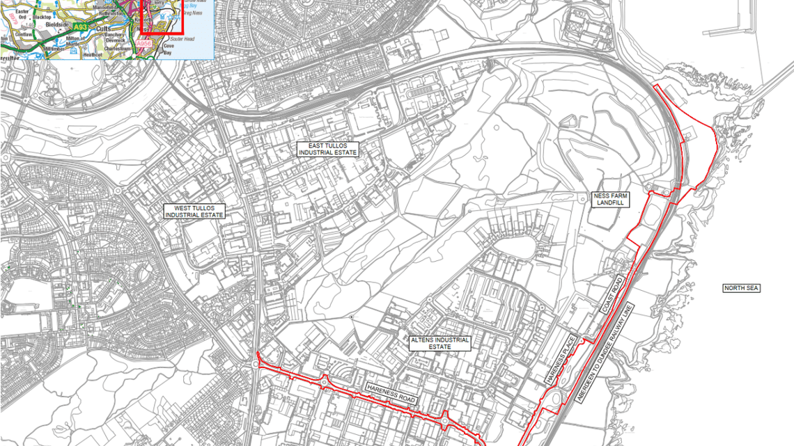
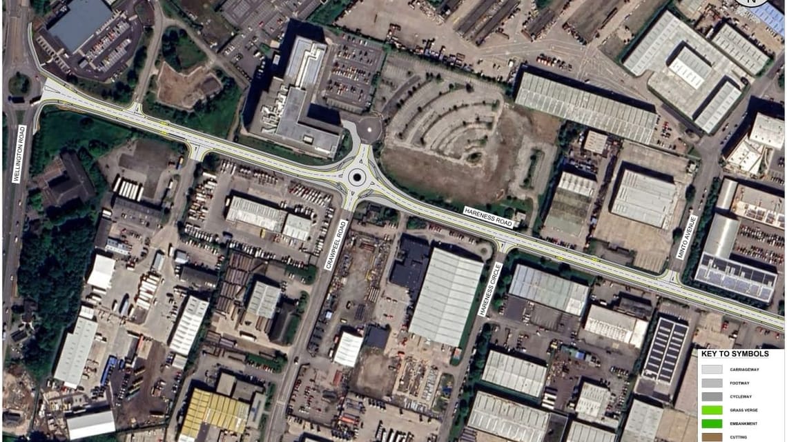
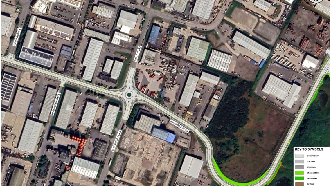
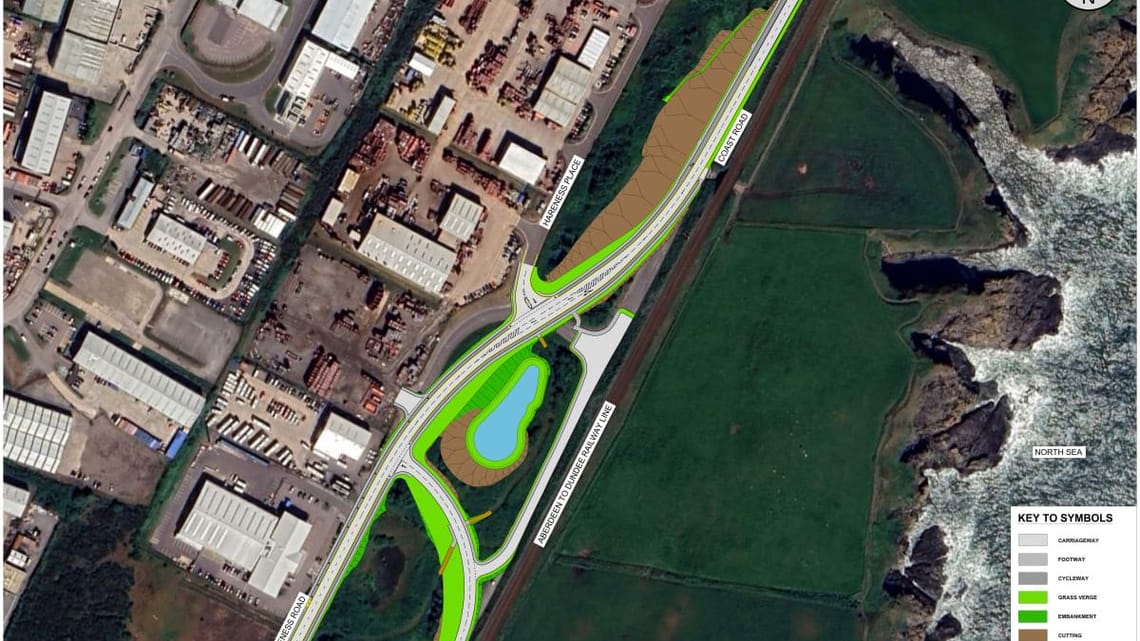
The project begins at the A956 Wellington Road roundabout and extends east through Altens Industrial Estate. It features a 7.3m wide carriageway with segregated cycle tracks and footways on both sides of Hareness Road, including redesigned roundabouts and pedestrian/cyclist crossing points with tactile paving.
At the Hareness Road/Coast Road junction, priority has been adjusted to allow continuous flow from Hareness Road to Coast Road. A ghost island layout and pedestrian refuge island improve safety and traffic flow. A new car park near the railway underbridge addresses informal parking and enhances access to the coastal path.
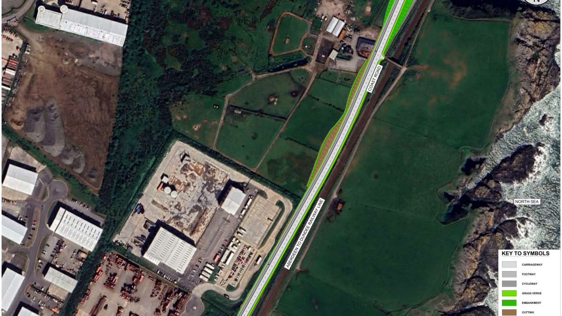
North of the junction, the walking, wheeling, and cycling path shifts to the west side of Coast Road, with a bi-directional cycle track and footway. A crossing point connects to the coastal path at the railway overbridge.
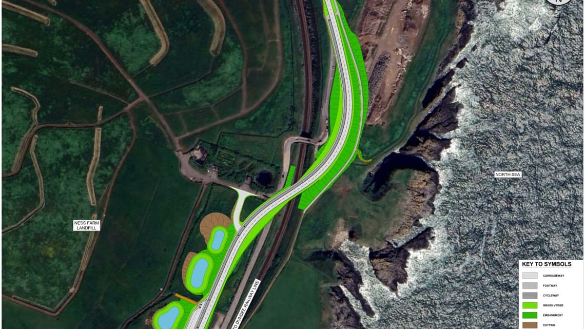
Further along, the project includes a new railway crossing, additional car parking for Tullos Wood access, drainage basins, and a realigned access to the former Ness Farm landfill. The walking and cycling path transitions to the east side of the road and reconnects with existing facilities. The core path along the railway is realigned to accommodate the new road footprint.
The following flythrough represents the project described and visualises how the scheme will look following construction.
Embed
Discover more


Stay Informed
Follow our projects to get notified of upcoming engagements and the latest project related news.