Local Cycling and Walking Infrastructure Plan for Bracknell Forest
Bracknell Forest Council is developing its Local Cycling and Walking Infrastructure Plan (LCWIP).
We are at an early stage in the plan development process and would like input from across our local communities to help shape the outcome. This is your opportunity to share your views and we'd be delighted to hear from you!
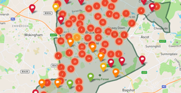
This platform provides an interactive map where you can place a 'pin' on any location in the borough and leave specific comments. To drop a pin on the map, click 'Have your say’ on the View map and comment page.
This engagement platform will remain open for comments until Sunday, 27 February.
About the project
Get your neighbours involved
The more people involved, the better the needs of the whole community will be reflected.
Share the project with people you know locally.
Meet the team

The council is responsible for developing the Local Cycling and Walking Infrastructure Plan (LCWIP).

WSP is one of the world's leading engineering professional services firms and is providing technical support to the council.
Team
Each of these teams is looking after a different aspect for this project. You may see some of us around the area interviewing residents and at community events.

The council is responsible for developing the Local Cycling and Walking Infrastructure Plan (LCWIP).

WSP is one of the world's leading engineering professional services firms and is providing technical support to the council.