Visit Calcasieu Parish, LA Homepage
Map of Waterworks District No. 12 Waterline Expansion Project

Big Lake / Nelson Water

The Calcasieu Parish Police Jury is expanding the waterline throughout the Waterworks District No. 12 of Ward 3 service area to improve water service. This initiative will benefit residents currently relying on water wells, providing a more reliable water source. Waterlines will be installed within public road right-of-ways where feasible.

Get Connected: Water service taps will be available at standard rates.
Support the Project: Some property owners will be asked to grant a servitude for the water lines. In return, the standard water service tap fee will be waived.
Your Costs: Property owners will be responsible for plumbing connections, deposits, and service fees.
What's Next?: Contact us to learn how this project may affect your property and what options are available.

Contact Us:
Phone: 337.721.4100
Email: engineering@calcasieu.gov
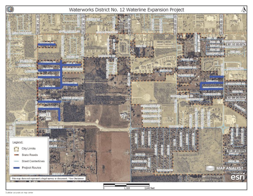
Aerial map titled “Waterworks District No. 12 Waterline Expansion Project.” The map shows a portion of north Lake Charles with streets, neighborhoods, and city limits. Proposed waterline expansion routes are highlighted in blue along multiple residential streets west and east of Nelson Road, including areas near Benoit Road, Miller Road, Ryan Road, Pecan Drive, Plantation Drive, and surrounding subdivisions. A legend identifies city limits, state roads, street centerlines, and project routes. A north arrow and scale bar are included.
Engineering map titled “Big Lake Waterline Expansion Project – Big Lake Road Phase 2 Parcel List.” The map illustrates proposed waterline expansion routes through residential areas near Big Lake Road and several connecting streets. Colored lines indicate projected waterline paths, acquired properties, maintenance servitudes, and existing easements or rights-of-way. Parcel numbers and property boundaries are shown throughout the map. Two parcel ownership tables on the right side list property owners and acquisition status. A color-coded legend explains the route and parcel classifications.
Follow Us

Stay Informed

Get notified on upcoming engagements and the latest project related news.