Proposal
What are we proposing?
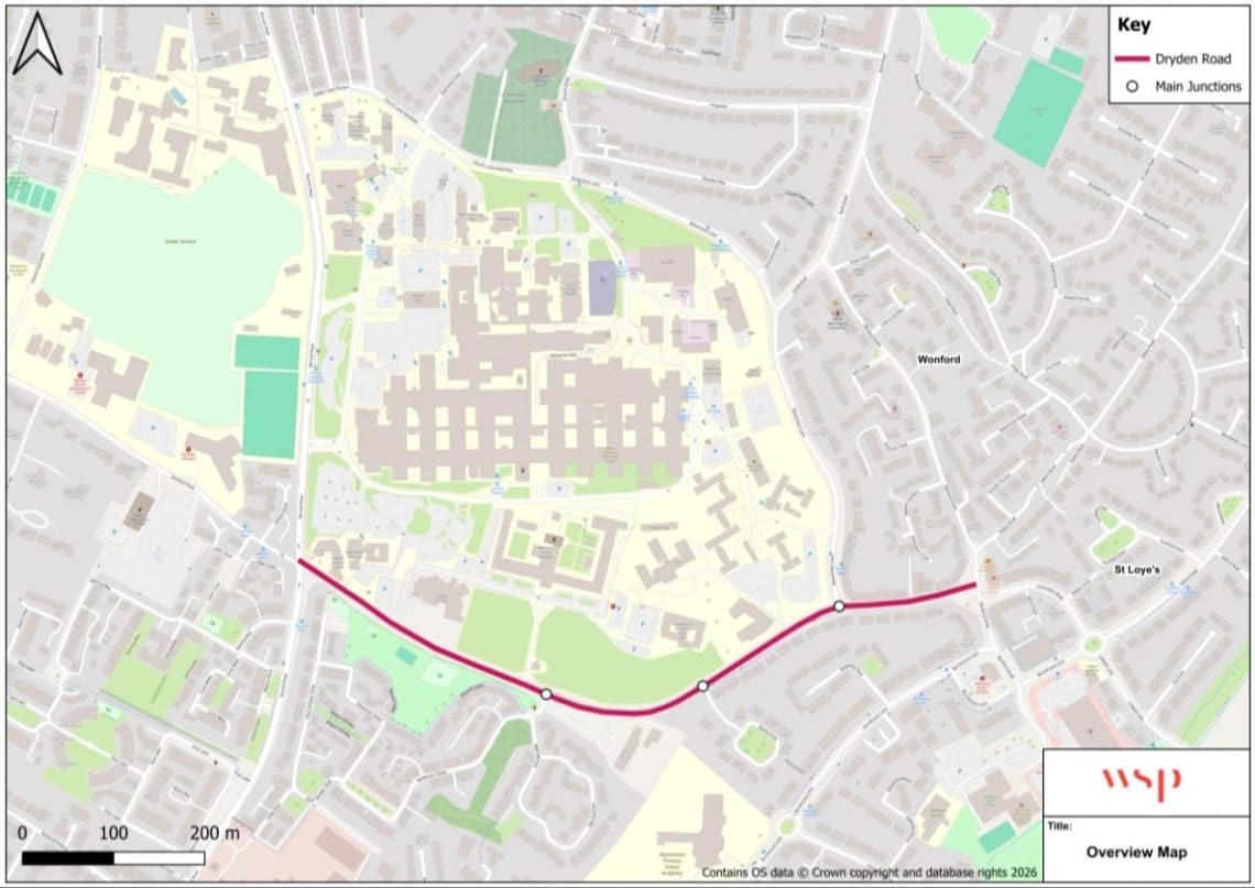
Dryden Road and Surrounding Area
To help shape the next stage of design, we are asking for feedback on three indicative layout options for Dryden Road, as well as four potential locations for new pedestrian crossing points. These options are not final designs, but early concepts intended to gather views from residents, businesses and road users.
Please see the full detailed drawings of each Option in the document library at the bottom of this page.
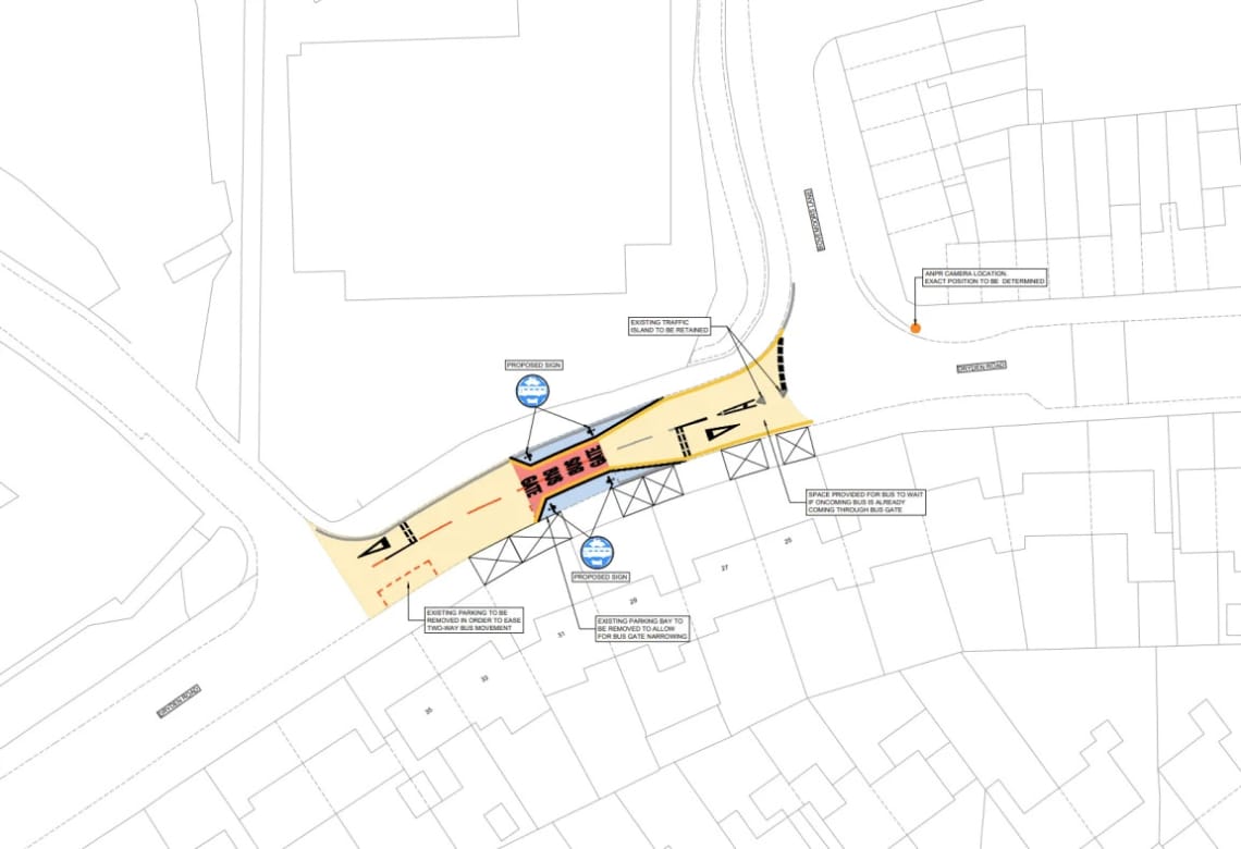
Option 1 - Bus gate / Authorised vehicles only
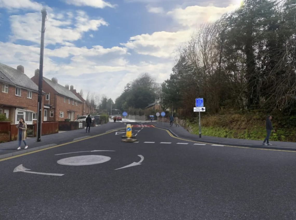
Indicative imagery of Option 1 - Bus gate / Authorised vehicles only
Option 1 would include:
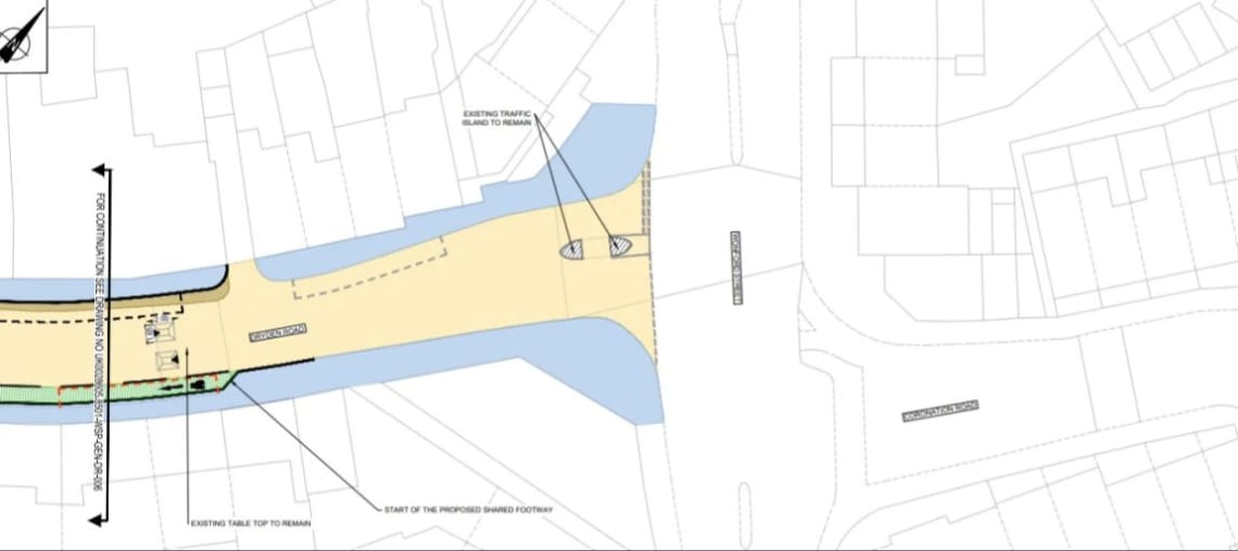
- A bus / authorised vehicle gate, allowing only authorised vehicles such as buses, taxis, refuse collection, and emergency services to pass, located on Dryden Road between Jasmine Lodge and Bovemoors Lane.
- 3 existing on-street parking spaces to be removed to ease two-way movements for larger vehicles and make space for the bus gate.
- Providing space on Dryden Road at the junction with Bovemoors Lane for buses to wait while there is oncoming traffic through the bus gate.
- Retaining the existing traffic island.
- Installing a new ANPR enforcement camera along Dryden Road to support the operation of the bus gate.
- Installing new traffic signage along Dryden Road to let road users know of the bus gate and authorised vehicle access.
- The existing 30mph section of Dryden Road from Barrack Road to Wonford House access would be reduced to 20mph, with traffic calming in the form of speed cushions.
- Junction modelling that is similar to the existing modelling, as assessed in the October 2025 HATOC paper.
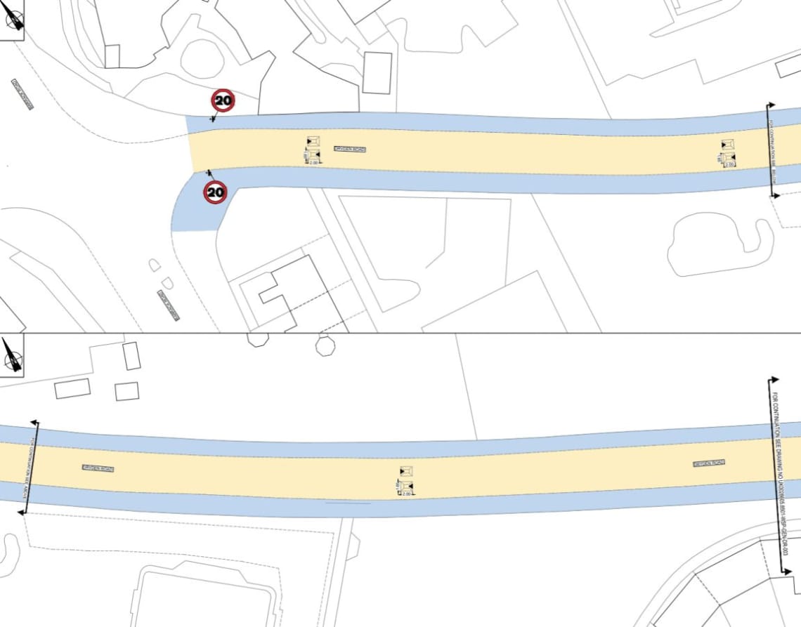
Option 1 - Bus gate / Authorised vehicles only
Option 2 - One-way arrangement (Westbound)
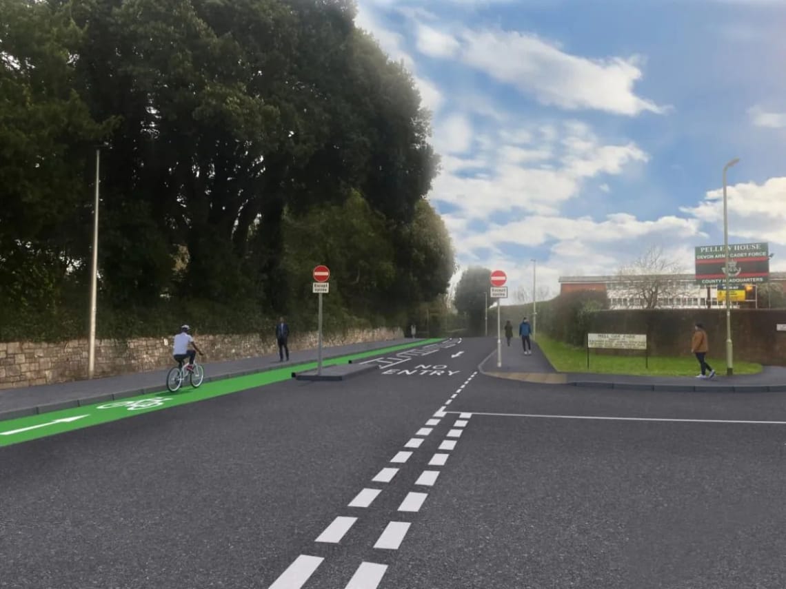
Indicative imagery of Option 2 - One-way arrangement (Westbound)
Option 2 would include:
- A one-way section for motorised vehicles heading westbound and a contraflow cycle lane for cycles heading eastbound on Dryden Road, between Well Oak Park and Kipling Drive.
- two-way traffic would remain as it operates today on along Dryden Road between Barrack Road and Well Oak Park, and between Bovemoors Lane and Kipling Drive.
- The existing 30mph section of Dryden Road from Barrack Road to Wonford House access would be changed to 20mph, with traffic calming in the form of speed cushions.
- The contraflow cycle lane would be identified with coloured surfacing, different to the existing carriageway, and painted cycle markings along the route.
- Installing new signage to let road users know of the changes to road layout and usage.
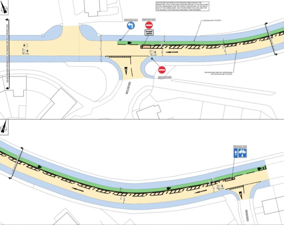
Option 2 - One-way arrangement (Westbound)
Sub Options 2a (with cycle lanes) and 2b(no cycle lanes) for the eastern side of Dryden Road between Bovemoors Lane and Wonford Street have been developed and seek your views in the survey.
This is because the 9th October HATOC resolution required safe, attractive routes for people walking and cycling on Dryden Road:
“Agree that a further public consultation be held on solutions that would address local traffic concerns while still offering safe, attractive routes for people walking and cycling on Dryden Road, and Bovemoors Lane, and the surrounding area”.
Based on the Department for Transport Cycle Infrastructure Design, the level of vehicle flow mixing with cycles on the carriageway (without cycle lanes) at this section of Dryden Road would be ‘(Medium) Provision not suitable for all people and will exclude some potential users and/or have safety concerns’.
This consists of:
- 2a - Cycle lane and removal of on-street parking on both sides of the road.
- 2b - No change.
Option 2a is shown below.
Sub Option 2a - Cycle Lane and removal of on-street parking on both sides of the road
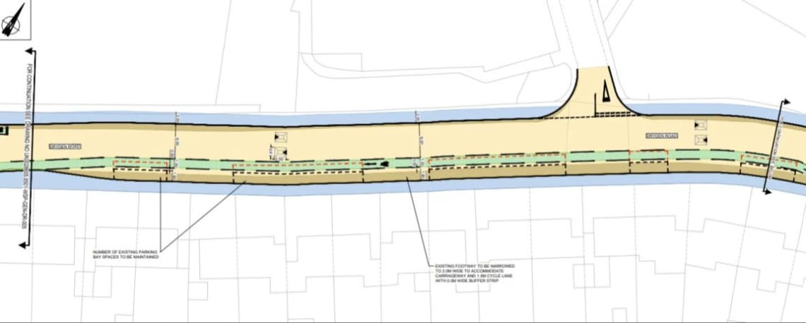
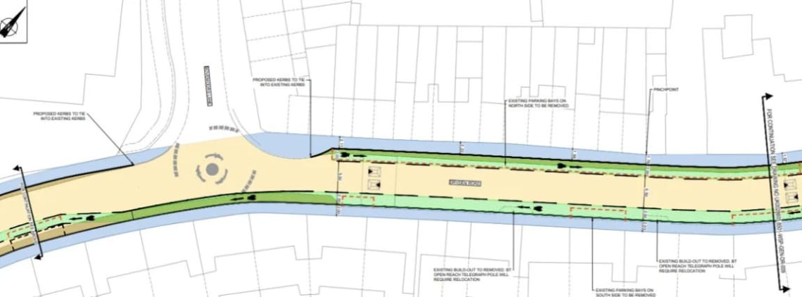
Option 3 - Two-way vehicles and two-way cycle facility
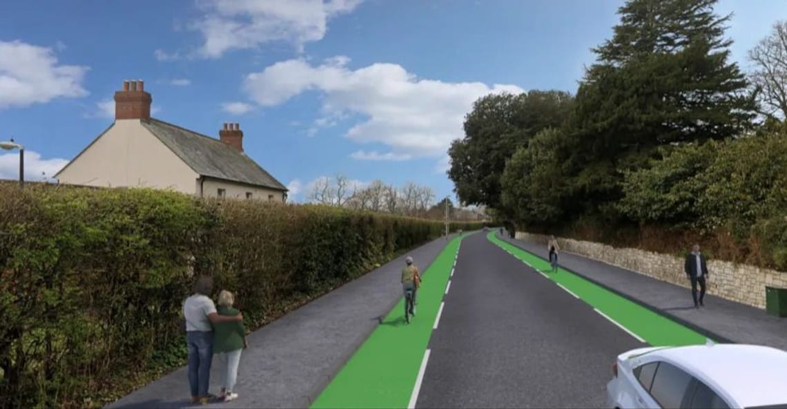
Indicative imagery of Option 3 - Two-way vehicles and two-way cycle facility
Option 3 would include:
- Two-way vehicle movements along the full length of Dryden Road.
- Two-way advisory cycle lanes with coloured surfacing separated from the main carriageway with dashed lines on Dryden Road between Barrack Road and Kipling Drive.
- Narrower footways to create space for the cycle lanes and two-way vehicle movement.
- The existing 30mph section of Dryden Road from Barrack Road to Wonford House access would be changed to 20mph, with traffic calming in the form of speed cushions.
- Cycle lane (westbound only) between Bovemoors Lane and Kipling Drive. To accommodate the retention of on-street parking, the footway will be narrowed.
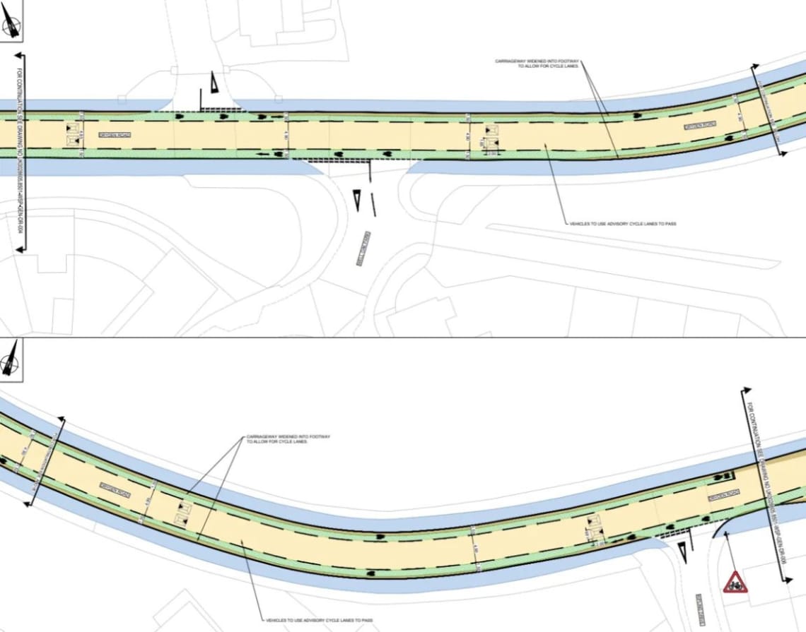
Option 3 - Two-way vehicles and two-way cycle facility
Sub Options 3a (with cycle lanes) and 3b (no cycle lanes) for the eastern side of Dryden Road between Bovemoors Lane and Wonford Street have been developed and seek your views in the survey.
This is because the 9th October HATOC resolution required safe, attractive routes for people walking and cycling on Dryden Road.
“Agree that a further public consultation be held on solutions that would address local traffic concerns while still offering safe, attractive routes for people walking and cycling on Dryden Road, and Bovemoors Lane, and the surrounding area”.
Based on the Department for Transport Cycle Infrastructure Design, the level of vehicle flow mixing with cycles on the carriageway (without cycle lanes) at this section of Dryden Road would be ‘(Poor) Provision suitable for few people and will exclude most potential users and/or have safety concerns’.
This consists of:
- 3a - Cycle lane and removal of on-street parking on both sides of the road.
- 3b - No change.
Option 3a is shown below.
Sub Option 3a - Cycle lane and removal of on-street parking on both sides of the road.
Sub Option 3a - Cycle lane and removal of on-street parking on both sides of the road.
Expected details of each option has been set out in the table below, and includes the following criteria:
- Indicative Cost – Low (£0 to £100k), Medium (£101k - £200k), High (£201k-£1m), Very High (£1m upwards).
- Loss of on street parking - Metres and expected spaces.
- Traffic Flow Changes (based on surveys before and after the current bollards, with factors to reflect Bus Gate on Wonford Road).
- Emergency vehicle access – Allows emergency vehicles to pass.
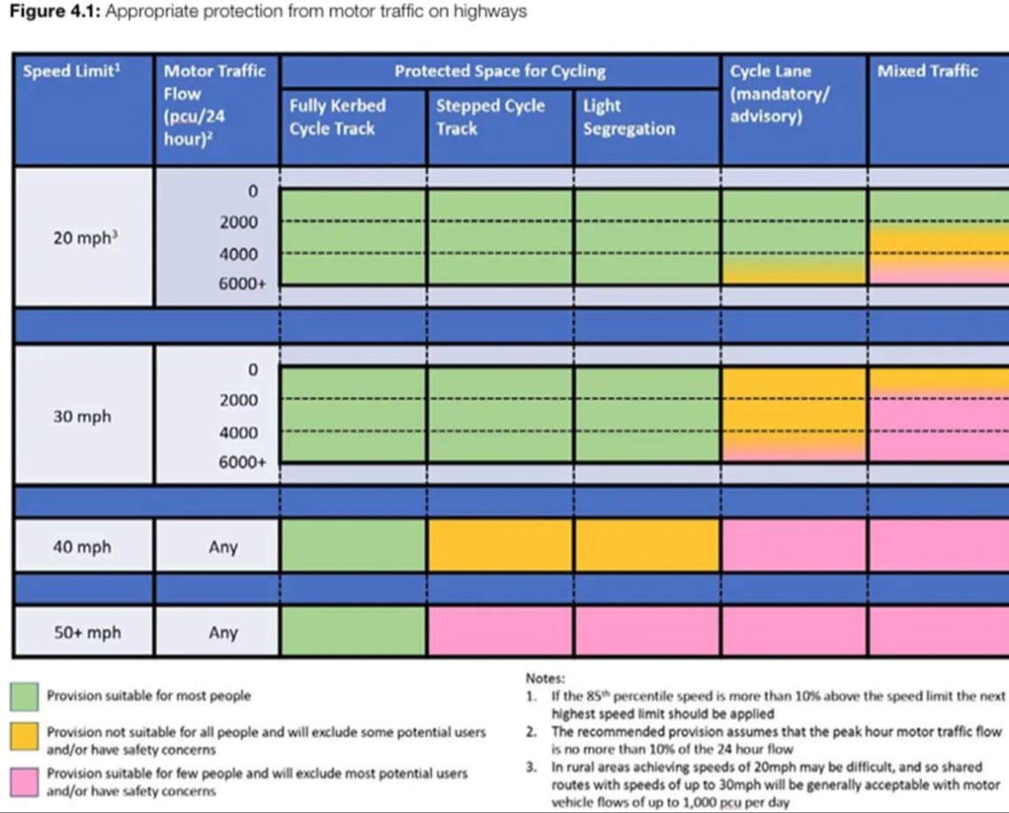
- Cycling Environment – Proposed Layout vs Traffic Flows based on Department for Transport Cycle Infrastructure Design Local Transport Note 1/20
Figure 4.1 ‘Appropriate Protection from motor traffic on highways’.
Option details
| Option 1 - Bus / authorised vehicle gate | Option 2 - One-way arrangement (Westbound) | Option 3 - Two-way vehicles and two-way cycle facility | |
|---|---|---|---|
| Cost | Low | Medium | High |
| Emergency Access | Yes | Yes | Yes |
| Loss of parking on Dryden Road | 3 spaces opposite properties 29 & 33 | Sub options 2a & 2b for Dryden Road between Bovemoors Lane and Wonford Street: 2a - removal of circa. 22 on-street parking. 2b - No change | Sub options 3a & 3b for Dryden Road between Bovemoors Lane and Wonford Street: 3a - removal of circa. 22 on-street parking. 3b - No change |
| Cycling Environment on Dryden Road (per section where traffic flows change) – Based on DfT’s Cycle Infrastructure Design Guide LTN1/20. Figure 4.1 | Barrack Road to Bovemoors Lane: (Good) Provision suitable for most people. Bovemoors Lane to Wonford Street: Medium. Provision not suitable for all people and will exclude some potential users and/or have safety concerns. | Barrack Road to One-Way end: (Medium) Provision not suitable for all people and will exclude some potential users and/or have safety concerns. One Way Section: (Good) Provision suitable for most people. One-Way Start to Bovemoors Lane: (Good) Provision suitable for most people. Bovemoors Lane to Wonford Street for sub options 2a & 2b: 2a - With removal of on-street parking and new cycle lane: (Good) Provision suitable for most people. 2b - No change: (Medium) Provision not suitable for all people and will exclude some potential users and/or have safety concerns. | Barrack Road to Bovemoors Lane: (Good) Provision suitable for most people. Bovemoors Lane to Wonford Street for sub options 3a & 3b: 3a - With removal of on-street parking and new cycle lane: (Good) Provision suitable for most people. 3b - No change: (Poor) Provision suitable for few people and will exclude most potential users and/or have safety concerns. |
| **Predicted traffic flow changes** | Minor reduction of traffic routing via Bovemoors Lane because the new location of the bus gate allows: * Vehicles to drive via Dryden Road between Wonford House and Cedar/Jasmine Lodge (Devon Partnership NHS Trust buildings). * Bus services to route via Druden instead of southern section of Bovemoors Lane. | Reduction of vehicles routing on Bovemoors Lane. Increase of vehicles routing on Dryden Road will be greater than those 're-routing' off Bovemoors Lane. Overall increase in vehicles routing through Wonford area compared to current arrangement (with bollard). | Expect traffic flows on Bovemoors Lane to reduce to pre bollard flow. Increase of vehicles routing on Dryden Road will be greater than those 're-routing' off Bovemoors Lane. Overall increase in vehicles routing through Wonford area compared to current arrangement (with bollard). |
| Other considerations | N/A | N/A | The scheme is not considered suitable if the bus gate on Wonford Road is removed in the future. This is because it would increase vehicle trips along Dryden Road. Resulting cycle environment would then be (Poor) Provision is suitable for few people and will exclude most potential users and/or have safety concerns. |
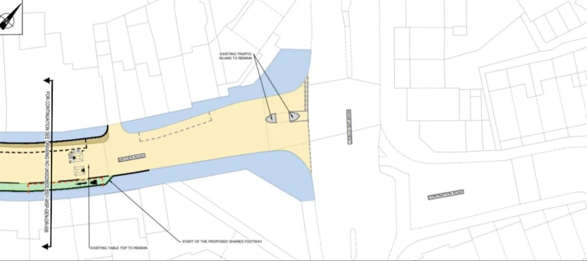
Pedestrian crossing points
We are also seeking views on potential new pedestrian crossing facilities to improve safety and accessibility in the area. The options include:
- A pedestrian island on Haldon View Terrace
- A zebra crossing on Bovemoors Lane, south of Church Street
- A zebra crossing on Bovemoors Lane, south of Carlile Road.
- A zebra crossing or pedestrian island on Bovemoors Lane.
Indicative design drawings can be downloaded from the Supporting Documents library below.
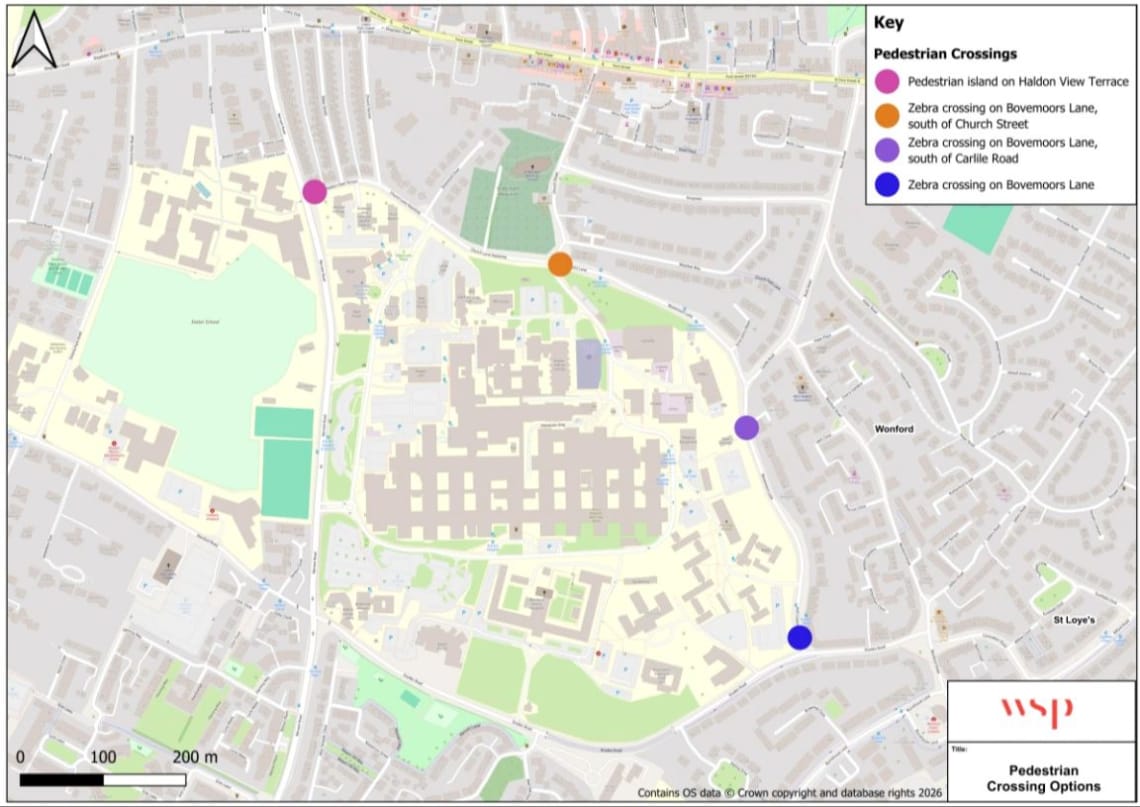
Map of proposed pedestrian crossing point options
Have your say
The consultation period is open until noon 05 April 2026.
We are seeking your views on the options and proposals to inform how these designs are progressed during the next steps. To provide your feedback, please click here to complete an online survey.
You may also like to attend our public drop-in event where you can find out more about the proposals and speak to members of the project team. There is no need to book for these events, just turn up:
- Wednesday 11 March 2026, 5:00pm - 8pm
Wonford Community Centre, Burnthouse Lane EX2 6NF
A document outlining the answers to frequently asked questions on the proposals, can be found here.
What happens next
Once this consultation closes on Sunday 05 April 2026, the project team will produce a report outlining the feedback received from members of the public and stakeholders. This report will help inform future stages of the project.
Accessibility
We take accessibility seriously and recognise that some of the information presented in the files available on this page may not be fully accessible to someone using assistive technology such as a screen reader.
If you need guidance or an alternative format, email transportplanning@devon.gov.uk with details of any preferred format and the assistive technology you use.
Supporting documents
Contact information
Address: Devon County Council, Transport Planning, Room 120, County Hall, Topsham Road, Exeter, EX2 4QD
Email: transportplanning@devon.gov.uk
Phone: 0345 155 1004