Automated Weather Observation System (AWOS)
About
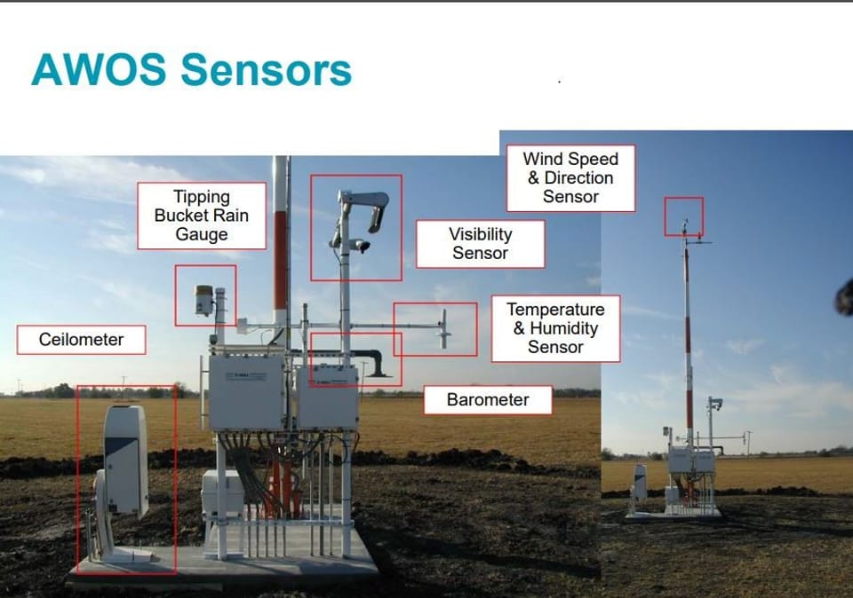
AWOS stands for Automated Weather Observation System. It delivers key weather observations-- temperature, wind speed, visibility, cloud cover, and barometric pressure-- to pilots, local authorities, and emergency responders. The primary, crucial function of the system is to transmit real-time weather information and reports for pilots to review for take-off and landing to support safe operations. This informaiton is transmitted over radio signals. A secondary purpose for AWOS is to relay weather information to the general public, including media entities. This secondary purpose is achieved through internet connections.
The new system is essential for:
- Ensuring safe, efficient, air traffic operations, especially in adverse weather conditions.
- Enhancing public safety by supplying critical weather data to emergency response teams.
- Support local economic activities, including aviation, tourism, and buisness operations.
We have partnered with TxDOT to replace the existing AWOS.
Initial estimated costs for the project as of January 2025:
Total- $150,000
TxDOT portion- $142,500
City portion- $7,500
Adjusted with the completion of the bid process, as of July 2025:
Total- $137,364
TxDOT portion- $130,495
City portion- $6,869
This project aligns with the city's ongoing efforts to improve infrastructure and operational efficiency.
To view real-time weather conditions reported directly from the Automated Weather Observation System (AWOS) at Gainesville Municipal Airport, including temperature, wind, visibility, and cloud conditions, follow this link: https://kgle.awos.live/home
Stay Informed
Get notified on upcoming engagements and the latest project related news.
