
Shenley: Settlement overview and required infrastructure
An overview of the settlement of Shenley, and the infrastructure required to support growth
Hertsmere Local Plan: Public Consultation
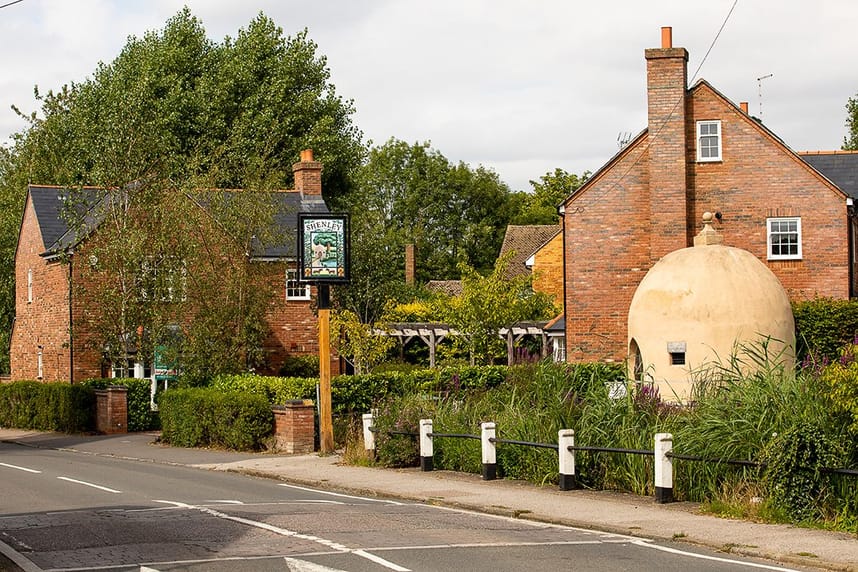
Shenley lies a relatively short distance to the north of Borehamwood and to the east of Radlett. It is the largest of the three identified ‘key villages’ in Hertsmere. The original village along London Road has its origins in early medieval times and was formed around what is known locally as ‘The Triangle’ before expanding mainly in a linear form south along London Road. The village later expanded predominantly to the east of London Road, due to the presence of Shenley Grange and its grounds on the western side, which has since been demolished. A large part of the village is designated as a conservation area, the largest in Hertsmere. There is a high density of listed buildings and structures within the village.
The newer part of the village, west of London Road and north of the original settlement, was developed on the site of a former hospital in the 1990s at Porters Park. This development more than doubled the size of Shenley in less than 10 years. It is a single large housing development with access onto London Road and Radlett Lane, punctuated by two significant areas of open space in the east and west and a neighbourhood centre, which includes a supermarket and a nursery. A small cluster of housing is also located at Shenleybury, to the north of Porters Park. Notwithstanding the growth of Shenley, it is one of the only parts of the borough to have experienced a reduction in population over the last two Census periods with a recorded reduction of 110 people between 2001 and 2021.
There are several shops, businesses and services, including a post office, GP and dental surgeries primarily split between the two ends of the village. There is also a primary school and a church within the historic core of the village together with a second, voluntary-aided faith school and small office park at Farm Close to the north of the village.
**Shenley Neighbourhood Plan **
The Shenley Neighbourhood Plan (SNP) is part of the development plan for the borough. It provides guidance on the type and location of development, and a detailed local perspective of the key characteristics, opportunities and challenges within the parish. The principles contained in the SNP may also inform the treatment of development sites in Shenley in so far as they are relevant to their setting and location and enable the efficient development of land.
Key issues and challenges
• Limited infilling has been allowed under the current Local Plan.
• Under the current Local Plan, the former Shenley Hospital housing estate was removed from the Green Belt and a Village Envelope was defined, the rest of the settlement remaining within the Green Belt.
• The identification of suitable land for development and a defensible green belt boundary to meet local needs will be a key consideration for the future sustainability of the village.
• No scope to physically expand the primary school thereby constraining the amount of growth in the village.
• The improvement of cycling and pedestrian links will reduce traffic congestion and improve air quality.
Shenley Village statistics
• Population: 3,558
• Built-up area: 0.4 sq miles / 0.9 sq km
• Population density: 9,754 people per sq mile / 3,766 people per sq km
• Population change between 2011 Census and 2021 Census: -0.17%
• New homes built in current Local Plan period (2012-27): 53
• Proposed new homes: 180
• Proposed Green Belt area: 7.2 hectares
• Change to number of new homes proposed in 2021: -38%
• Change to area of Green Belt proposed in 2021: -56%
Required infrastructure
The Hertsmere Infrastructure Delivery Plan (IDP) Phase 1 report and IDP Phase 2 report previously identified the following infrastructure upgrades needed. Infrastructure requirements for the Local Plan will continue to be reviewed before the plan is submitted for independent examination.
• Primary education - The education authority previously indicated that demand arising from the higher level of growth anticipated in the 2021 draft Local Plan could be accommodated within the existing capacity of primary school due, in part, to the quantum of specialist older persons housing proposing.
• Green infrastructure – There are broad deficits in various types of green infrastructure provision across Shenley, which the Local Plan will need to help address. Some new public open space is proposed as part of the development at Shenley Grange. Arrangements will need to be agreed to ensure that it is managed in perpetuity for the benefit of the local community.
• Primary healthcare - The Red House Group is the main health care provider in the area with Gateways Surgery operating as a satellite, together with the Park Street practice, to the main site in Radlett. Current analysis conducted by the CCG shows that the Red House Group has capacity to meet the future demands arising from the Local Plan.
• **Bus/active travel –**Public transport and active travel measures within or linking to Shenley, to be established through a sustainable transport study currently being commissioned. The study subsequently identified a proposed active travel link between Shenley and Radlett, via Radlett Lane/Shenley Road, as well as an improved active travel link within the village to Andrews Close.
Further information Further information can be found in the South West Hertfordshire Joint Strategic Plan, Strategic Infrastructure Baseline Study 2023.
Stay Informed
Get notified on upcoming engagements and the latest project related news.