Frequently Asked Questions
The Scheme
What is the A660?
The A660 is a main A-road between Leeds City Centre and the Outer Ring Road in north Leeds. It is made up of Woodhouse Lane, Headingley Lane and Otley Road and runs past Leeds University, through Headingley and on towards the Outer Ring Road.
Which wards are affected?
The route runs through three wards:
- Little London & Woodhouse
- Headingley & Hyde Park
- Weetwood
What is the scheme supposed to deliver?
The scheme is intended to provide improved walking, wheeling* and cycling facilities. It will also upgrade signal equipment to enable bus priority. The scheme aims to uplift areas where bus passengers and people that walk or cycle may want to use and improve the functionality of these places.
*Wheeling incorporates many methods for getting around, including using wheelchairs, mobility scooters, walking aids and travelling with a pram or pushchair.
In brief, the project aims to deliver the following:
- 2.7km of one-directional, kerbed segregated cycle paths on both sides of the road.
- Four bus priority junction improvements at North Lane junction, Hyde Park Corner / Victoria Road, Clarendon Road junction, and St Mark’s Road junction.
- Creating six additional signalised crossing points to improve connectivity, located at:
- Cliff Road junction.
- Clarendon Road junction (by the Packhorse Pub).
- On A660 Headingley Lane between Hyde Park Properties and SM Properties.
- On A660 Headingley Lane close to the Golden Beam pub (not part of this consultation).
- Victoria Road
- Rampart Road junction
- Modal filters (A modal filter, sometimes referred to as a point closure, is a road design that restricts the passage of certain types of vehicle), located at:
- Regent Park Avenue
- St Michael's Road - public space
- Creating continuous footways across 22 side roads
- Widening footways at various points along the A660.
- Creating 20mph zones in highly pedestrianised areas
- Reconfiguring street furniture to provide improved navigation
- Tree planting
Who is delivering the scheme?
Leeds City Council in partnership with the West Yorkshire Combined Authority and Active Travel England.
How is the scheme funded and how much does it cost?
Active Travel England have awarded funding for the scheme. It is grant funding from central Government.
Why are improvements to the A660 necessary?
The Leeds Transport Strategy sets its vision as "a city where you do not need a car to get around" and "where everyone has an affordable zero-carbon choice in how they travel". Connecting Leeds wants to connect communities, businesses and people together in the most sustainable ways.
The collision history on the A660 highlights that changes are required. We want to support and enable people to make healthier choices, with 21st century infrastructure, affordable transport and reduce car dependency.
What are the intended timescales?
Please see our timeline.
What are the benefits of the scheme?
- Prioritising people over cars through densely populated neighbourhoods
- Creating a healthier and safer environment where people can more easily have an active lifestyle
- Cost of travel is reduced by providing improved walking, wheeling and cycling infrastructure
- Easier to make short journeys by walking, wheeling and cycling
- Lower-carbon transport network created
How do these proposals link into other local schemes?
- The Lawnswood Roundabout proposed upgrades will improve safety for pedestrians and people who cycle - they're due to be on-site winter 2023.
- A temporary wand and orca scheme is being delivered between Shaw Lane junction and Lawnswood roundabout - currently being delivered.
- Development work is being undertaken to provide a link that will provide safe, accessible and convenient walking and cycling facilities between St Mark’s Road and the city centre - due to be consulted 2024.
Leeds City Council Strategies
How does this scheme support the Vision Zero strategy adopted by Leeds City Council?
Data shows that cars cause most harm on the road – any infrastructure improvements that support people to choose another mode of travel contributes to a Vision Zero strategy.
The scheme is designed to adopt a ‘safe system’ approach, where we accept people make mistakes, and through good design we can ensure that any mistakes that do happen do not end in serious or fatal casualties.
Responsibility for road safety extends to anyone who plays a part in shaping the wider traffic environment, as well as the road-users themselves. Those who plan, design, decide, invest, legislate, prioritise, build, maintain, enforce, educate and so on are responsible for ensuring that roads are safe for everyone to use. Acting together, they can reduce traffic risk and create a safe, holistic mobility system that is forgiving of human error and eliminates serious harm.
How does this scheme align with the Leeds Transport Strategy?
The scheme aims to improve health and wellbeing by ensuring, through good street design, that walking, wheeling and cycling are the first choice for the shortest journeys, improving our physical and mental health.
The scheme aims to tackle climate change by encouraging people to choose active travel and public transport options over the car.
It will help to deliver inclusive growth by developing and regenerating places through continued investment in transport infrastructure.
The Proposals
What are the aims of the scheme?
- To provide safe and convenient cycling infrastructure along the full length of the scheme, whilst ensuring the road user hierarchy (The Highway Code) is observed.
- Enhance the pedestrian environment within local centres and improve the connectivity between neighbourhoods.
- Design the scheme to address existing casualty record and follow the principles of the Vision Zero Strategy.
- Improve bus user experience
How will the scheme improve the bus experience on the A660?
- Relocating some bus stops to more spacious, better lit areas, closer to local amenities and residential areas.
- Improving journey times for buses by providing bus-responsive traffic signal upgrades. In some places general traffic will be held by signals and buses will be given priority signals to overtake general traffic (bus gate).
- By narrowing the carriageway, a bus can maintain its position on the road so it is easier to re-join traffic after collecting and dropping off passengers.
- During peak times, vehicles will be unable to overtake the bus and block its exit from the bus stop due to vehicles approaching from the opposite direction. This will create a clear passage for the bus to continue.
- Relocating some bus stops so it is easier for buses to pull out into the carriageway.
What assessments have informed the proposals?
- Collision data
- In 2020 a trial scheme was implemented with temporary light segregation, and data was collected assessing cycling levels before and after
- Detailed junction and wider network modelling
- Traffic count surveys during term time (Nov 2022)
- Automatic Vehicle Location bus data has been analysed to understand average bus speeds at various times of the day. We also looked at areas where the network could be improved and made more efficient to reduce bus journey times
- Carbon Impact Assessments to inform about the number of trees to replace those proposed to be removed
- Tree Health Survey along the route
- Pedestrian Level of Comfort assessment (Transport for London)
In some sections, the proposals aim to narrow the carriageway/road - what are the benefits of this?
- Extra space for other activities
- Reducing the width of the carriageway for vehicles allows extra space for walkers, wheelers and cyclists and additional business frontage activities (where licenced).
- Narrowing the road reduces the need to acquire land to widen the highway and allows Leeds City Council to preserve heritage assets and green space.
- Reduces overtaking
- Collisions have been caused between vehicles attempting to overtake buses with people who cycle or walk.
- Bus users and operators have mentioned that the buses do not pull into the bus clearway properly during peak hours as the drivers often find it takes so long for vehicles to let them back into the general traffic lane.
- Speed reduction
- Motorists must drive more carefully in a narrowed section of road to keep their vehicle in the correct road position, which can result in lower overall speeds on the road.
- Supports other speed calming measures in the area.
- Bus priority benefits
- Prevents cars overtaking buses, rather than the bus being stuck behind cars, cars hold their position behind buses.
- Giving buses priority over cars recognises the bus’s greater efficiency in the use of road space. Emphasis is placed on maximising the throughput of people, rather than the number of vehicles. Bus priority means buses run to time, and therefore improve reliability.
- Crossing benefits
- Carriageway narrowing reduces the crossing distance that people must cross. This allows more time on green for older pedestrians crossing a shorter distance.
Why are we rerouting some traffic further away from A660?
By making car journeys longer for those that do not live in the area, it reduces the attractiveness to motorists attempting to use the area to cut through. This will encourage motorists travelling to destinations outside the area to utilise the Outer Ring Road for longer vehicle journeys.
Where vehicles are being rerouted, people that cycle can use cycle lanes in Woodhouse Moor and access these via the new infrastructure.
Why do pedestrians need to cross the cycle path to get on/off the bus e.g. at Headingley Central (Arndale Centre)?
The ‘cycle bypass’ has been used in heavy footfall areas of the city, including the Headrow, and on the Cycle Superhighways.
The aim of the design supports people of all ages to cycle as some people do not feel confident overtaking buses.
At points where the cycle path meets the bus stop/shelter, the cycle path is usually brightly coloured and on a raised bed to help emphasis risk, whilst having zebra crossings which operate the same as those on a road.
How do your plans impact local green spaces and trees?
There will be a potential loss of 11 trees due to our proposals. We never want to lose any trees, however, the trees we would lose are of poor health or provide poor ecosystem services*, but there will be an opportunity to provide replanting. Leeds City Council has a policy to replant three trees for every tree which needs to be removed, and as part of the scheme we plan to install rain gardens along the route.
*Ecosystem services are the environmental benefits provided by urban trees. These benefits include trapping and slowing rain water, energy conservation, carbon sequestration, heat island reduction, and improvements to air and water quality. Preserving ecosystem services in urban areas is critical to making cities healthy, desirable places to live and work.
What are the consequences of not removing trees?
- We are unable to provide a cycle path/improved bus shelter facility.
- We are unable to align street furniture to improve the pedestrian experience.
- The trees will remain, but will need to be removed at a later date due to their reduced quality, causing further disruption to the road network.
Why do cyclists need a segregated cycle lane/shared-use path - can't they use bus lanes instead?
Confident cyclists will use bus lanes or the carriageway, but by providing a segregated cycle path or shared-use path (Avenue Walk, Woodhouse Moor) it gives people who are newer to cycling a safer option without feeling intimidated by cycling in a bus lane.
People who cycle in shared-use spaces should be travelling at slower speeds and giving way to pedestrians.
How many parking bays are being removed to enable the public realm on St Michael’s Road?
Eight standard parking bays will be replaced by four blue badge parking bays.
What will happen to the Yorkshire stone slabs and other heritage features within the area?
The paving will be retained, renovated or matched and enhanced, where possible.
What material will the cycle path be made of - what colour will it be?
The cycle path will be tarmac with a colour to represent the conservation areas (e.g. buff or natural). Across junctions or hazards we will lay green surfacing to further highlight these areas.
Why are you merging three bus stops into one?
Bus stop locations require a review due to changes in building uses in the area e.g. new residential developments. The three bus stops identified are low-frequency stops and located very close to one another.
Where we propose to merge bus stops it will be at a better location for congregating e.g. a larger area to stand, with better lighting. This will also free up space on the pavements.
Will removing the pedestrian guard rails make people less safe when walking in the area?
New data shows that guard rails can cause more injuries when people are squashed into them e.g. during a collision.
They can also be an obstruction to people wanting to get onto a pavement.
Where can I find more information on the scheme – not everyone has access to a digital device?
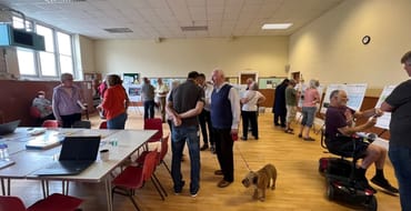
During the pandemic when consultations had to be online a lot of older people upskilled and moved into the digital age. However, we have arranged four drop-in events along the route, sent letters to local affected residents along the route and have worked with local partners and stakeholders to help spread the word. People are able to feedback by requesting paper copies of the proposals alongside a freepost envelope or can feedback via a paper survey at one of our events.
Discover more
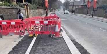
Construction
Learn about the next phase we are building and upcoming works
Street lighting survey
Feedback on proposed street lighting near Woodhouse Moor
Proposals and survey
View our proposals and have your say on the overall scheme or individual sections.
Events
View our drop in events.
Stay Informed
Follow our projects to get notified of upcoming engagements and the latest project related news.