
Universities
Driving to the city's universities using the ring road
Transforming our City Centre
Driving towards the universities
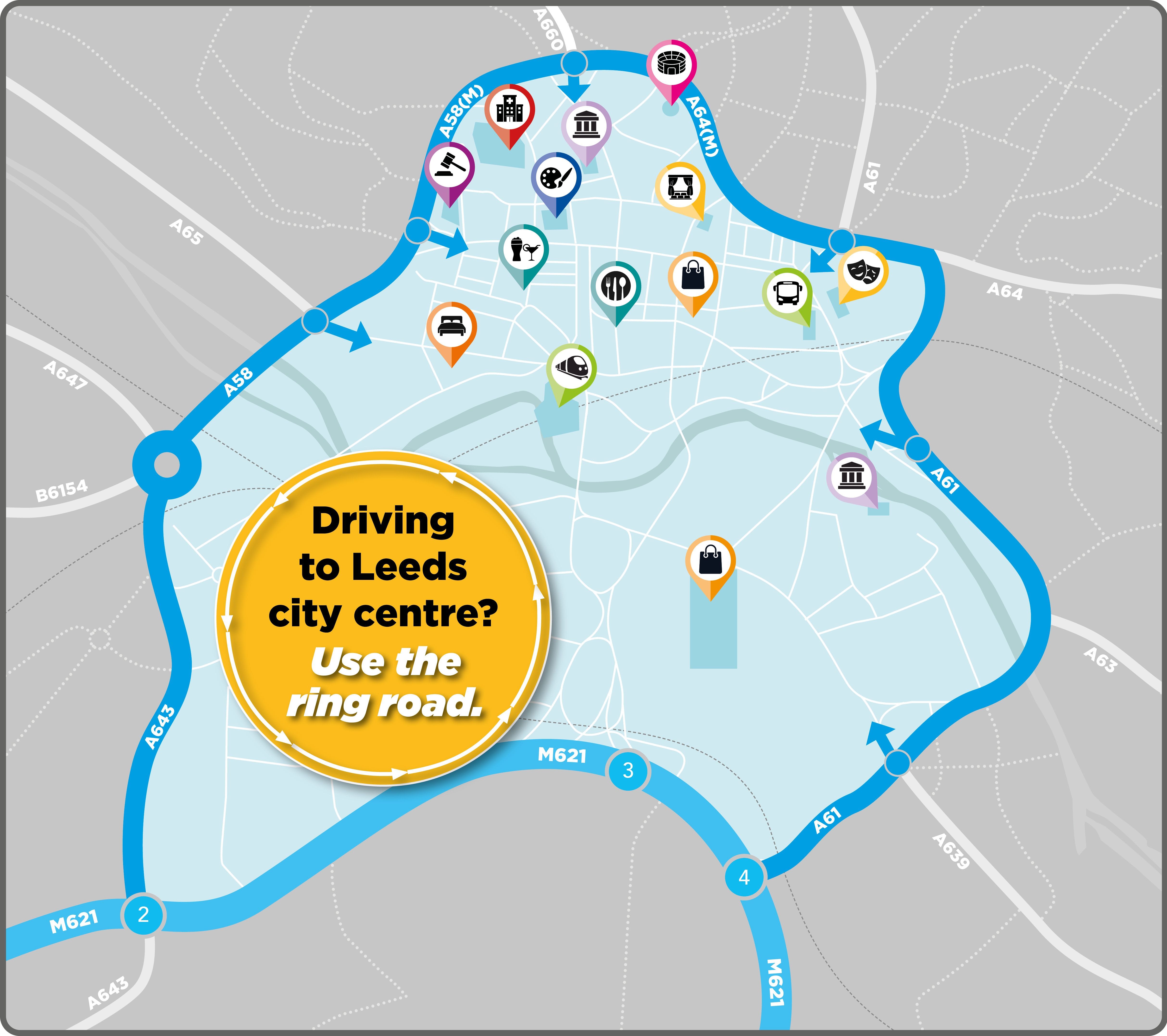
If you are travelling towards our university campuses from the south, east or west, we recommend using the city’s ring road.
From the M621 you can either use Junction 4 or Junction 2 and then loop around the city centre.
This is usually easier than using Junction 3 and driving through the city centre, as previous routes are likely to have changed and in some instances may now be closed to private vehicles.
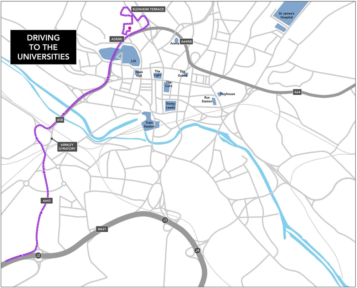
From M621 J2 – follow the A643 before joining the A58(M) Inner Ring Road. Leave the A58(M) at its exit for the A660. Follow the road around to Blackman Lane and turn right onto Blenheim Terrace before turning left onto Cavendish Road, and then left onto Hillary Place. Follow Hillary Place onto Vernon Road, and drive along to the university car park.
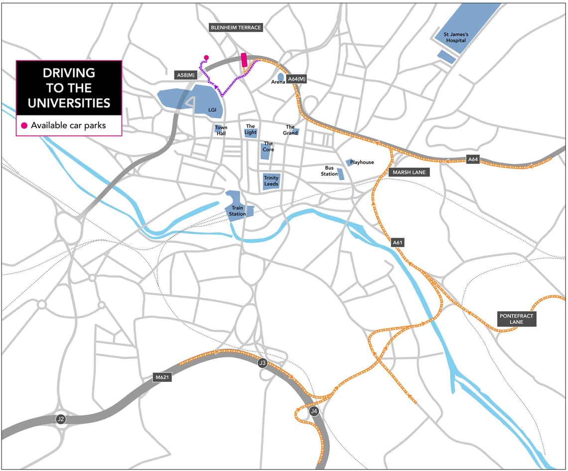
- From M621 J4 (University of Leeds and Leeds Beckett University): follow the A61 and and use the right-hand lanes to move onto East Street and then Marsh Lane before joining the A64(M) ring road – exit the A64(M) as directed by permanent signage to universities. From the A64(M) exit and either:
- turn left into the public multi-storey car park on Woodhouse Lane (represented by the end of the orange route); or
- continue to Portland Way to Calverley St to Willow Terrace Road then Vernon Road to the University of Leeds Multi Storey Car Park (represented by the purple section of the route).
The above information is accurate at the time of publication, and is reviewed and updated on a regular basis.
This information displayed would not necessarily reflect short-term and or temporary changes such as urgent utilities and highways works, and major events.
When planning your journey we would always encourage travellers to check:
- travel advice provided by the university or universities
- Leeds latest roadworks and closures
- @leedsTravelInfo on ‘X’ (formerly Twitter)
Along with other sources such as local radio and online mapping tools such as Google Maps and Waze, and any information provided by your destination.
Discover more
Leeds Inner Ring Road
Find out about essential repair works to Leeds Inner Ring Road
Headingley Stadiums
Driving to Headingley Stadiums using the city's ring road.

The Light
Driving to The Light using the city's ring road
Royal Armouries
Driving to the Royal Armouries using the city's ring road

The Core
Driving to The Core using the city's ring road
Kirkgate Market and Leeds Bus Station
Driving to Kirkgate Market or Leeds Bus Station using the ring road
First Direct Arena
Driving to the First Direct Arena using the city's ring road

Trinity Leeds
Driving to Trinity Leeds using the city's ring road
Leeds City Railway Station
Driving to Leeds City Railway Station using the ring road
Stay Informed
Follow our projects to get notified of upcoming engagements and the latest project related news.