
Flood Risk Supporting Paper
This is a HTML friendly version of the flood risk supporting paper.
Leeds Local Plan
Flood Risk Supporting Paper
Why are these policies needed?
As part of a changing climate MET Office statistics show that winters in the UK have got 12% wetter over the last 60 years and they predict that rainfall is likely to rise by a further 20% by 2070 with an increase in rainfall intensity leading to 20% more flash flooding.
Local rainfall data shows that since July 2019 Leeds has generally been experiencing higher rainfall than the East and North East England average.
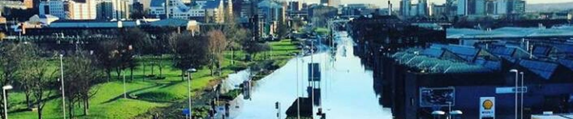
The predicted increases in rainfall could create problems for Leeds and potentially could lead to more people suffering the devastating impacts of flooding. The Boxing Day floods of 2015 resulted in the highest river levels ever recorded on both the River Wharfe and the River Aire notably more than a metre higher than the ‘Great Flood of Leeds’ 1866.
The Strategic Flood Risk Assessment (SFRA) 2022 maps the impact of climate change across the district. The Environment Agency guidelines on climate change allowances were updated on 27 July 2021, after publication of the modelling used to inform the SFRA. However, the range of revised upper end climate change allowances for river flow in the study area is 22-51%, which is extremely similar to the previous 20-50% range. This means that the current climate change flood outlines can still be used to assess the potential change in risk across the study area as a result of climate change.
The updated climate change allowances are calculated on the scale of individual river management catchment areas, while the previous allowances had been calculated on the scale of regional river basins. The study area includes two river management catchments – the Aire and Calder and the Wharfe and Lower Ouse. The current climate change allowances for these river management catchments are shown in Table 1 and Table 2. These allowances are usually used to adjust the 1 in 100 year annual probability (1% AEP) river flow.
Table 1: Climate Change Allowances for River Flow Increases in the Aire and Calder River Management Catchment
Allowance category | Total potential change anticipated for the ‘2020s’ (2015 to 2039) | Total potential change anticipated for the ‘2050s’ (2040 to 2069) | Total potential change anticipated for the ‘2080s’ (2070 to 2115) |
Upper end | 24 | 31 | 51 |
Higher central | 15 | 18 | 31 |
Central | 11 | 13 | 23 |
Table 2: Climate Change Allowances for River Flow Increases in the Wharfe and Lower Ouse River Management Catchment
Allowance category | Total potential change anticipated for the ‘2020s’ (2015 to 2039) | Total potential change anticipated for the ‘2050s’ (2040 to 2069) | Total potential change anticipated for the ‘2080s’ (2070 to 2115) |
Upper end | 22 | 29 | 48 |
Higher central | 14 | 18 | 31 |
Central | 11 | 13 | 23 |
The allowance to be applied to a proposed development site depends on the type of development proposed. Development is divided into vulnerability classifications according to the NPPF[1] and Table 3 shows which climate change allowances should be applied to each vulnerability classification in a given Flood Zone.
Table 3: Climate Change Allowances to be Applied for Each Development Vulnerability Classification
Flood Zone | Development Vulnerability | Climate Change Allowance |
2 and 3a | Essential Infrastructure | Higher Central |
Highly Vulnerable, More Vulnerable, Less Vulnerable and Water Compatible | Central | |
3b | Essential Infrastructure | Higher Central |
Highly Vulnerable, More Vulnerable and Less Vulnerable | Development should not be permitted | |
Water Compatible | Central |
Climate change allowances of 20%, 30% and 50% have been applied in most of the modelled flood outlines. A full set of climate change allowances has not been modelled for all watercourses, for example the 20% allowance is the only allowance available for Wortley Beck. A review of the geographic extent and scenarios was undertaken as part of the SFRA and the most appropriate model output was chosen to represent flood outlines for key flood events. Exact model outputs for each key event are not available for all areas and a suitable proxy was used instead. For example, comparing the 1 in 1000 year annual probability (0.1% AEP) flood extent to the 1 in 100 year annual probability (1% AEP) flood extent including a 50% allowance for climate change, where this has been modelled, shows that the differences in the two modelled flood extents are usually small. The 1 in 1000 year annual probability (0.1% AEP) event flood outline can therefore be used as a proxy for the 1 in 100 year annual probability (1% AEP) event with 50% allowance for climate change where required.
Chapter 10 of the SFRA provides an overview of the changes in flood extent resulting from climate change for each Main River watercourse.
There is limited access to flood insurance and where it does exist it can be expensive. ‘FloodRe’ provides flood risk insurance but only for houses built BEFORE 2009. Investment that can’t be insured is harmful to lives and to the economy. Therefore, Leeds needs to do all it can to avoid new development in high flood risk areas and when it has to go ahead it must be fully flood resilient and have safe access and escape in times of flood, for the lifetime of the development and without making flood risk worse for others.
Residents trust that planning applications approved in flood risk areas are resilient. If the planning system fails to adequately ensure safety then there is no other mechanism for doing it. The responsibility rests with the local authority.
Leeds is implementing a flood alleviation scheme on the River Aire, on the River Wharfe at Otley and on the Wyke Beck. In areas where the risk of flooding is reduced because of the presence of flood alleviation schemes or defences, proposed development will need to address the residual risks associated with a potential breach and over topping of the flood alleviation scheme or other defence, whichever is the worst case scenario. Breach modelling is needed to establish the extent of these residual risks so we can be sure that the proposals will be safe. The updates to the NPPG in August 2022 reinforce this point.
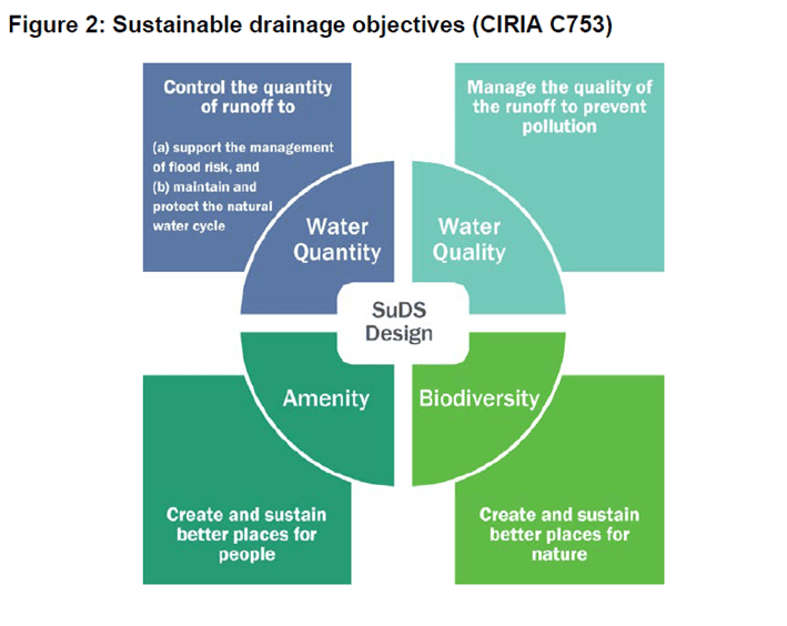
Surface water run off is also likely to lead to an increase in flash flooding events where the intensity of the rainfall means that the drainage system is overloaded. Sustainable drainage systems (SuDS) are designed to control surface water run off close to where it falls and mimic natural drainage as closely as possible and have additional benefits that can also help achieve other policy ambitions for biodiversity and amenity. SuDS include a number of different practices or mechanisms designed to drain or soak up surface water in a more sustainable approach to the conventional practice of draining water run-off through a pipe into a sewer.
What are these policies seeking to achieve?
The 2007 SFRA defined the zone 3b functional floodplain largely outside the urban area. In the urban area the 5% AEP area was categorised as flood zone 3aii rather than 3b. That meant that some sites in the urban area that are in zone 3aii are able to pass the sequential and exception tests and be redeveloped – and sometimes for a more vulnerable use such as residential, ultimately that could be creating problems for the future because it is not avoiding the risk and with the MET office long term forecasts for climate change, it could lead to more pressure on emergency planners and rescue services.
On Thursday 25th August 2022, Government published a comprehensive update to the Flood Risk and Coastal Change section of the Planning Practice Guidance. One of the changes is that the starting point for defining the functional floodplain is now 3.3% AEP rather than 5%. In Leeds the probable difference in extent in spatial terms is likely to be negligible, and defended areas (formally and informally) should not be classed as functional floodplain anyway.
The 2022 SFRA maps the 3.3% AEP layer and does not differentiate between areas outside the extent of the built up area and areas within the built up area. However emerging policy does take account of the fact that a lot of the functional floodplain is within built up areas of Leeds where there are buildings and structures in the urban areas that affect the storage and conveyance of flood water.
Most of the areas that have a 1 in 30 year annual probability (or 3.3% AEP) of flooding are ‘washland’ outside developed areas and these are areas where water has to flow or be stored in times of flood. These areas are defined as Functional Floodplain where only water compatible uses and essential infrastructure can be permitted.
In developed areas with a 1 in 30 annual probability (or 3.3% AEP), where water may go in times of flood but is restricted by the presence of existing infrastructure or solid buildings, whilst these areas will be subject to frequent flooding, it may not be practical to refuse all future development. Therefore the emerging approach for these areas is that only the existing building footprint can be redeveloped, where it can be demonstrated to exclude floodwater and no increase in the vulnerability of the use. The land surrounding these buildings are important flow paths and flood storage areas and properties within these areas will be subject to frequent flooding so there should be no reduction in flood storage. Where sites have already been allocated for development in this category, then a recognition is made of the fact that there is already a commitment to that site coming forward for development. This mainly affects sites that are to be protected by the Leeds Flood Alleviation Scheme when it is complete.
This approach aims to recognise the high level of flood risk but not necessarily ‘blight’ areas of existing development. And it recognises the importance of the undeveloped land surrounding buildings to provide space for floodwater and reduce risk to new and existing development.
National policy requires that people are not exposed to hazardous flooding, irrespective of the development’s vulnerability classification. The Environment Agency along with H. R. Wallingford produced a supplementary note on flood hazard ratings and new development which helps to clarify what is meant by ‘hazardous flooding’. The flood hazard to which people would be exposed on access or escape routes is affected by the depth and velocity of the water, the amount of debris in the water and the ‘people vulnerability’ for example, whether they are children, elderly or infirm. A depth of less than 0.75 metres is classed as a very low hazard. (source: Hazard to People Classification Table 13.1 of FD2320/TR2 -Extended version).
There is often a perception that where a flood alleviation scheme has been built the developer doesn’t need to do any further work, however this is not the case. A FAS is constructed to protect the existing development and not to enable new development to take place. The NPPG states that:
‘Areas behind flood defences are at particular risk from rapid onset of fast-flowing and deep-water flooding, with little or no warning if defences are breached. Measures need to be designed to:
- avoid internal flooding from residual risk from flood risk management infrastructure wherever possible; and
- ensure people are not exposed to hazardous flooding, irrespective of the development’s vulnerability classification.’
Where a new development is proposed that relies on the FAS for defence then the residual risk of a breach or failure of the defence must be taken into account. The breach modelling that is needed to demonstrate this can be expensive and therefore it is important that developers are made aware of this as early as possible in the development process.
Whilst we already have a policy to encourage the use of sustainable drainage systems in new development, this has not been taken up by developers as readily as we would have liked. We want to encourage more sustainable drainage systems to be used for managing surface water in preference to conventional systems because of the many other benefits that they bring, particularly for water quality, biodiversity and health and wellbeing.
The paving over of front gardens can result in increased flood risk caused by surface water runoff which is unable to drain naturally if impermeable materials are used. Additionally, the loss of vegetation can contribute to increased air pollution in urban areas and can affect the character and appearance of traditional streetscapes. The intensification of built development through the use of permitted development rights (eg to build extensions and garages) and the impact of climate change further compounds the problem.
Permitted development rights are set by the Government and set out types of development that do not require planning consent. Where planning permission is not required it is difficult for us to have much influence over controlling the loss of spaces that help manage run off.
Some permitted development rights allow the building of extensions, garages and other structures that reduce the extent of the area available for natural drainage and holding water.
Other permitted development rights allow for the provision of a new or replacement hard surface (such as a driveway) within the curtilage of the grounds of different buildings, such as houses, offices and industrial buildings. These permitted development rights are limited to ensure that permeable materials are used.
Leeds has a historical legacy of covered watercourse or culverts throughout the district. Many culverts were constructed as an attempt to improve and manage water flow, however these are based on water capacities that are now exceeded with the result that the culvert can make flood risk worse. This is because they can restrict water flow and thereby cause ponding of water near the entrance to the culvert or become blocked/partially obstructed by debris that has washed into them, especially if they have started to crumble. Screens designed to prevent debris entering a culvert, unless well-designed and maintained, can also cause blockages which heighten flood risk. Flood risk may become more pronounced as more extreme rainfall events are experienced and these are expected to become more frequent due to climate change.
Are these policies justified by the evidence?
The SFRA 2022 provides the evidence base to demonstrate the very serious threats to Leeds created by river flooding and increased surface water run-off.
The Environment Agency has updated the Climate Change Allowances for peak river flow and peak rainfall intensity. This has been mapped in the SFRA to give an indication of the increases in flood risk probability and the areas that aren’t at risk now but will be in the future.
The frequency of flooding events in Leeds has increased in recent years. Winter months have seen excessive rainfall over an extended period of time causing the rivers to exceed their capacity. Summer months have seen an increase in prolonged dry periods where the ground becomes baked and impenetrable followed by short intense downpours which run off quickly leading to surface water flooding.
The bar chart below shows the number of incidents reported to the Council where internal flooding of property took place or there was an imminent threat of internal flooding. This is perhaps the most destructive type of flooding but flooding that affects roads and other forms of transport can also be devastating to people’s lives. The distribution of these incidents across the district can be seen on the map in Appendix 1.
The bar chart shows that there has been an increase in incidents over the last ten years. The large number in 2015 was due to Storm Eva and the storms that took place throughout December which meant that the rivers and water table were already high when Storm Eva took place. Storm Eva led to a 1 in 1,000 annual probability flood risk event on Boxing Day 2015. The number of properties across Leeds that were flooded or affected by the flooding from Storm Eva is shown in the table below:
Flooded | Affected | Total | |
Residential | 2300 | 411 | 2711 |
| 247 | 144 | 391 |
| 2053 | 267 | 2320 |
Commercial | 541 | 137 | 678 |
Other (churches, allotments, sports clubs) | 4 | 3 | 7 |
Total | 2845 | 551 | 3396 |
LCC Flood Risk Management collate data on local flooding incidents. From January 2000 to January 2021 a total number of 2,886 Priority 1-3 incidents were reported (see the map in Appendix 1 showing distribution).
The Authority Monitoring Report shows that there has been an increase in the number of applications which the Environment Agency have objected to on the grounds of flood risk. Whilst these applications are not approved until the objection has been resolved and removed, the fact that there is an increase in the number indicates that flood risk is an increasing factor for more developments.
There is increasing evidence of the vital role that gardens play in helping adaptation and mitigation to climate change. Of note is the research published in Urban Forestry & Urban Greening in 2012, entitled ‘The domestic garden – Its contribution to urban green infrastructure’ by Ross W.F. Camerona, Tijana Blanusa, Jane E. Taylor, Andrew Salisbury, Andrew J. Halsteadb, Béatrice Henricot, and Ken Thompson. The review recognizes the benefit of domestic gardens in mitigating flooding. It states: ‘Gardens provide storm attenuation ‘services’ to the urban matrix. Vegetation, trees especially, intercept intense precipitation, hold water temporarily within their canopy thus reducing peak flow and easing demand on urban drains (Xiao and McPherson, 2002). In addition, vegetation mitigates flood risk by increasing infiltration into the soil reducing surface flow (Dunne et al., 1991).’ Research carried out by Perry and Nawaz in 2008 found that despite the advantages of gardens, hard paving in domestic gardens is increasing. Their research found a 13% increase in impervious surfaces over 30 years in Leeds, 75% of which was due to paving of residential front gardens and this was linked to more frequent and severe flooding in the area.
Historical culverts such as along the Sheepscar Beck in Mabgate and the Hol Beck have necessitated significant expenditure by the Council on their maintenance and repair. In some cases this has been hampered where buildings have been constructed on top of the culvert making access to them more difficult.
How will these policies help deliver the Council’s corporate strategy?
Health and Wellbeing - In 2030 Leeds will be a healthy and caring city for everyone: where those who are most likely to experience poverty improve their mental and physical health the fastest, people are living healthy lives for longer, and are supported to thrive from early years to later life.
The proposed flood risk policies help to deliver a safe and welcoming city for people of all ages and from all communities in which residents feel more secure. For example, homes that are built in high flood risk areas after 2009 have difficulty getting flood risk insurance. Everyone should be able to afford to insure their home against damage by flooding and we can help to achieve this by avoiding residential development in high flood risk areas and when it can’t be avoided ensuring it is resilient and flood resistant.
The proposed flood risk policies encourage better working with housing providers, landlords, tenants and communities to improve poor quality housing, so everyone can have a home which supports good health, wellbeing and educational outcomes.
Inclusive growth - In 2030 Leeds will have an economy that works for everyone, where we work to tackle poverty and ensure that the benefits of economic growth are distributed fairly across the city, creating opportunities for all.
The proposed flood risk policies contribute to achieving this ambition by recognising that some communities face challenges of flood risk and helping to manage that risk so that communities remain sustainable now and in the future.
How are these policies consistent with the NPPF?
For policy Water 3 on avoiding development in high flood risk areas the following paragraphs from the NPPF are directly relevant:
'Avoiding development in high flood risk areas
170. Inappropriate development in areas at risk of flooding should be avoided by directing development away from areas at highest risk (whether existing or future). Where development is necessary in such areas, the development should be made safe for its lifetime without increasing flood risk elsewhere.
172. All plans should apply a sequential, risk-based approach to the location of development – taking into account all sources of flood risk and the current and future impacts of climate change – so as to avoid, where possible, flood risk to people and property. They should do this, and manage any residual risk, by:
a) applying the sequential test and then, if necessary, the exception test as set out below;
b) safeguarding land from development that is required, or likely to be required, for current or future flood management;
c) using opportunities provided by new development and improvements in green and other infrastructure to reduce the causes and impacts of flooding, ( making as much use as possible of natural flood management techniques as part of an integrated approach to flood risk management); and
d) where climate change is expected to increase flood risk so that some existing development may not be sustainable in the long-term, seeking opportunities to relocate development, including housing, to more sustainable locations.'
For policy Water 6 about flood risk assessments the following paragraphs are relevant:
'Flood risk assessments
181. When determining any planning applications, local planning authorities should ensure that flood risk is not increased elsewhere. Where appropriate, applications should be supported by a site-specific flood-risk assessment. Development should only be allowed in areas at risk of flooding where, in the light of this assessment (and the sequential and exception tests, as applicable) it can be demonstrated that:
a) within the site, the most vulnerable development is located in areas of lowest flood risk, unless there are overriding reasons to prefer a different location;
b) the development is appropriately flood resistant and resilient such that, in the event of a flood, it could be quickly brought back into use without significant refurbishment;
c) it incorporates sustainable drainage systems, unless there is clear evidence that this would be inappropriate;
d) any residual risk can be safely managed; and
e) safe access and escape routes are included where appropriate, as part of an agreed emergency plan.'
For policy Water 7 on sustainable drainage the following paragraph is relevant:
'182. Applications which could affect drainage on or around the site should incorporate sustainable drainage systems to control flow rates and reduce volumes of runoff, and which are proportionate to the nature and scale of the proposal. These should provide multifunctional benefits wherever possible, through facilitating improvements in water quality and biodiversity, as well as benefits for amenity. Sustainable drainage systems provided as part of proposals for major development should:
a) take account of advice from the Lead Local Flood Authority;
b) have appropriate proposed minimum operational standards; and
c) have maintenance arrangements in place to ensure an acceptable standard of
operation for the lifetime of the development.'
The NPPG gives specific guidance on the definition of functional floodplain, how to ensure safe and egress, residual risk, the use of natural flood management techniques and the use of SuDS. The guidance supports the policy actions that are proposed, and there are no inconsistencies in our approach when compared to the approach advocated by Government.
How are we going to measure the impact of the policy?
DEFRA publish annual data on the number of applications that have received an objection from the Environment Agency on the grounds of flood risk. The Council refines this data to explain where the objection was resolved and removed and this data is presented annually in the authority monitoring report.
The Council also keeps data on the number and type of applications approved in each flood zone.
Flood Risk Management record the number of flooding incidents each year by property. They also keep records on the number and type of sustainable drainage schemes that are implemented. These are shown on the map in Appendix 2.
How will it be implemented?
The Local Flood Risk Management Strategy for Leeds sets out the role of Development Management Flood Risk Management (DM FRM) colleagues to provide comments on flood risk assessments (FRA). They have responsibility for commenting on flood risk assessments for tributaries and watercourses. The Environment Agency (EA) have responsibility for commenting on flood risk assessments for the main rivers. The Local Plan policies set out what is required and, where the FRA is not adequate, they can be used to justify a reason for refusal of an application.
FRM promote sustainable drainage through their role on agreeing drainage schemes (in line with non-statutory standards) and ensure they are appropriately maintained. Therefore the policy on sustainable drainage will be largely implemented by FRM when they ensure that decisions on planning applications relating to major developments (10 dwellings, or equivalent non-residential developments) have SuDS in place, unless demonstrated to be inappropriate.
The non-statutory standards are set out in Leeds City Council’s Minimum Drainage Considerations for Development Control, which is regularly reviewed and kept up to date, for example when the DEFRA Climate Change Allowances are updated.
DM FRM colleagues do not comment on the detail of an evacuation plan. This function has links to the Leeds City Council Flood Plan which is administered by the Resilience & Emergencies Team. As to who should approve the emergency plan whilst FRM set the planning condition, technically they do not approve it. FRM are happy to advise on the technical and factual elements of an emergency plan which relate to flood risk. However, as advised in the ADEPT document, the acceptance of an emergency plan is likely to necessitate a collaborative approach including consultation with the EA, LLFA, Resilience and Emergencies Team and also the Emergency Services. It is the Public Health and Safety /Emergency Planning considerations, especially any proposals to do with the suggested policy criteria and acceptable hazard scenarios, where an opinion is needed from an Emergency Planning Officer.
Equality, diversity, cohesion and integration
Equality has been considered as part of policy formulation, the aim of the policy is to protect those areas which are most affected by flood risk and as such it aims to protect these more vulnerable areas and residents.
The policy looks at flooding holistically. In part it refers to the existing flood alleviation scheme (FAS) the aim of which is to protect existing development and not to enable new development to take place. Where a new development is proposed that relies on the FAS for defence then the residual risk of a breach or failure of the defence must be taken into account.
There are flood alleviation schemes on the River Aire, on the River Wharfe at Otley and on the Wyke Beck with new schemes in progress on Wortley Beck. In areas where the risk of flooding is reduced because of the presence of flood alleviation schemes or defences, proposed development will need to address the residual risks associated with a potential breach and over topping of the flood alleviation scheme or other defence, whichever is the worst case scenario. Breach modelling is needed to establish the extent of these residual risks to be sure that the proposals will be safe.
In terms of equality the impact of flooding is geographical or spatial being along the River Aire, River Wharfe and their tributaries, residents living in these areas will benefit from the proposals, it will have a direct positive impact on all the protected characteristics but in particular on those who are elderly, the young and those on lower incomes.
The policy is also about improving and encouraging the use of sustainable drainage systems in new development, this has not been readily taken up by developers. By encouraging a more sustainable drainage system to be used for managing surface water in preference to conventional systems because of the many other benefits that they bring, particularly for water quality, biodiversity and health and wellbeing this will also have a direct positive impact on the protected characteristics, again in particular this will benefit those who are more vulnerable such as the elderly, the young and those on lower incomes.
Appendix 2: Sustainable Drainage Schemes
Discover more

Statement of Representation
Providing details about the purpose of the consultation, how to view the material, how to submit comments, accessibility and privacy notice.

Archived 2025 Consultation Material
This is for information only

Further information
Explains the work already undertaken on the Plan and the new plan-making process

Leeds Local Plan Issues & Options Consultation Report
Summary of the Leeds Local Plan Issues & Options Consultation Summer 2025

Leeds Local Plan Scoping Consultation Document
We would like your views on which general topic areas the Leeds Local Plan should cover and how you would like to be consulted as the plan is developed.
Stay Informed
Follow our projects to get notified of upcoming engagements and the latest project related news.