
Spatial Strategy Supporting Paper
This is a HTML friendly version of the spatial strategy supporting paper.
Leeds Local Plan
Spatial Strategy Supporting Paper
LEEDS LOCAL PLAN (2024 to 2042)
Spatial Strategy Supporting Paper
Regulation 18 Consultation
June 2025
Introduction
The spatial strategy of the new Leeds Local Plan (LLP) will provide the framework for determining how much development will take place in different parts of the district. It will need to respond to the different needs and opportunities for development in and around the wide range of neighbourhoods and settlements across Leeds, with the aim of ensuring that development is sustainable (from an economic, environmental and social perspective) and delivers the objectives of the Plan.
The Leeds district is relatively unique in covering both the urban area of the City of Leeds itself (one of the 11 ‘Core Cities’ in the UK) along with a much wider hinterland which includes a broad mix of different types of settlements, from large towns to small villages and hamlets set amongst the countryside. The strategy for development needs to recognise the different roles of settlements across the district, and respond to local needs for new development in different places whilst also ensuring that this development will be sustainable, and responds to environmental constraints such as flood risk. In some places there will be particular opportunities for new development to take place, for example due to previously developed sites becoming available or wider investment in infrastructure being planned, whilst in other places the key aim of new development will be to meet specific local needs for new housing of different types and sizes, or local (and strategic) needs for new business spaces. It will be important that the strategy of the Plan recognises the different drivers for development in different parts of the district, and responds to them by ensuring that the necessary planning policies are in place to support the potential benefits that new development can bring to different areas.
This supporting paper provides further explanation of the options that set out within material on the ‘Issues and Options’ for the Local Plan that is being published for consultation over Summer 2025. It focussed particularly on:
- The options for the distribution of housing and economic growth;
- The settlement network; and
- Potential opportunity areas.
Options for the distribution of housing and economic growth
One of the key roles of the LLP will be to set the strategy for how the total amount of housing and employment development needed in Leeds (which is identified at an authority-wide level) should be distributed across the District. A series of options for this are set out in the consultation material, and the relative advantages and disadvantages (and deliverability implications) of different potential approaches have been considered.
The strategy for distributing development has a relationship with a wide variety of the proposed Local Plan objectives:
Proposed objective | How the distribution of development relates to this proposed objective |
1. Identify land for 76,817 homes to deliver the 69,834 new homes required to meet local housing needs across the district using Government methods between 1st April 2024 and 31st March 2042 | The SHMA shows that there is a need for new housing across the district, and the strategy for distributing development will need to respond to this if local needs for housing are to be met. |
2. Deliver significantly more affordable houses in all communities at a level of affordability that meets local needs, taking advantage of a variety of delivery mechanisms and site attributes, including land value capture from Green Belt sites where suitable | The SHMA shows that there is a need for additional affordable housing in all parts of the district. Viability evidence produced for previous plans makes clear that the viability of development varies across the Leeds District, which has implications for how much affordable housing can be provided as by developers as part of a market housing development in different locations. The ‘golden rules’ for Green Belt release sites established in NPPF also means greater levels of affordable housing could be delivered on sites that currently form part of the Green Belt. |
5. Identify locations to deliver at least 550,000 sqm office floorspace, focussed on the expanded City Centre and public transport hubs, to meet the needs of commercial businesses | The strategy will need to direct office floorspace to the most appropriate locations which, in accordance with the ‘town centre first approach’ of national policy, and understanding of the requirements and expectations of businesses in this sector, will be focussed particularly in the City Centre and around public transport hubs, which will create opportunities for people to access jobs using sustainable modes of transport. |
6. Support the delivery of retail and leisure developments in the expanded City Centre, local and town centres, in key public transport hubs and as part of mixed-use allocations, whilst curbing the impacts of unhealthy shops in particular locations | The strategy will need to direct retail and leisure developments to centres (in line with the ‘town centre first’ approach of national policy), whilst also supporting such uses around key public transport hubs and within mixed-use allocations. |
7. Safeguard existing employment land in suitable locations across the District and identify new sites and locations to deliver a minimum of 2 million sqm of floorspace (approximately 575ha in land terms) for industrial and logistics uses, to contribute towards the national industrial strategy and meet the sectoral needs of the local and regional economy focussed largely on existing key employment hubs and new opportunities largely focussed in the south and east of the District | The strategy will need to create opportunities for additional industrial and logistics development, recognising that businesses in different economic sectors will have specific locational requirements for development land. |
12. Define an updated Green Belt boundary for the district that keeps land permanently open in the countryside and ensures sufficient opportunities through sustainable urban extensions where necessary, to meet its development needs for the plan period | 61% of the District is currently designated as Green Belt. As part of the strategy, consideration will need to be made of whether it would be possible to meet development needs through non-Green Belt means (i.e. through using previously developed land, land within built up areas, safeguarded land and rural land) or whether there are ‘exceptional circumstances’ that would justify the release of some land from the green belt to meet development needs. |
14. Deliver housing on suitable sites focusing most of the development within complete, compact and connected places where people have opportunities to walk or wheel between homes, shops, services and green spaces, whilst maximising the benefits of investment, realising opportunities for positive local change, and responding to environmental constraints. Spatially this means focussing most new homes in an expanded city centre, within growth corridor opportunities in South-West Leeds and West Leeds and on sequentially most sustainable sites within the remainder of the district that meet needs for local housing, especially affordable and specialist housing | Leeds has a diverse geography, made up by the City of Leeds itself alongside a variety of towns and villages. In recent years record levels of housing growth has occurred in Leeds with over 4,000 homes in 2023/24, but this has largely been directed to the development of flats and apartments in the City Centre. At the same time, opportunities in the outer areas have generally been much more limited. The strategy will need to ensure that housing is directed to the right locations to meet needs and ensure that the benefits of investment and opportunities for positive local change are maximised. This will need to take into account the roles of different places, the potential sites that there are for new development and the extent to which they are suitable, deliverable and align with the wider objectives of the Plan. As part of this, specific consideration will need to be made of the environmental constraints to development in some parts of the district (including flood risk and nature conservation designations) that will have implications for where it is appropriate for development to take place. The strategy will need to respond to the varied levels of service provision in different parts of the district when planning for new development, and direct development to places where there are opportunities to walk or wheel between homes, jobs, shops, services and green spaces. As part of this, it will need to take into account where services are located and which parts of the district already function as CCC places, and consider if/how new development may be able to support this or improve the extent to which other places function as CCC. As part of this, consideration will also need to be made of the capacity of these services, recognising that whilst a service may be present it may not necessarily have capacity to support additional growth. |
16. Direct a significant proportion of development to locations where it has potential to stimulate and support wider investment, regeneration and inclusive growth | As noted above, in some parts of the district significant additional investment is proposed (including as part of the partnership on ‘City Centre Vision’, and the development of the new West Yorkshire Mass Transit Network). The strategy will need to respond to this to ensure that the benefits of this are maximised. |
17. Align development with existing and planned infrastructure investment, ensuring that all development is adequately supported by the necessary social and physical infrastructure | It will be very important that new development is adequately supported by the necessary social and physical infrastructure. To ensure this, the strategy will need to take into account what infrastructure is already present in different parts of the district, where existing capacity may place a constraint on opportunities for future growth and where additional investment is planned or needed. |
18. Ensure that development is located and designed to offer people a genuine opportunity to participate in sustainable and active modes of transport | The strategy will need to direct development to places that offer opportunities for sustainable and active travel, including by bus, rail, bike and (in future) mass transit. This will require account being taken of the extent (and frequency) of existing services, and if/how this may be likely to change over the course of the plan period with new investment in Mass Transit, and as part of the wider proposals of the Local Transport Plan, Connecting Leeds Strategy and WYCA Connectivity Strategy. |
31. Strengthen the role of Leeds city centre and the 60 local centres across the district to improve their vitality and viability and provide a hub for local services for communities | Leeds City Centre, and the network of town and local centres, across the district have a really important role as hubs for shops, services and facilities that people rely on to meet many of their day-to-day needs, and it is important that the strategy considers how it can make use of, support, and strengthen these locations when planning for new development. |
The NPPF also establishes a number of principles / requirements that influence the considerations that are being made about how development should be distributed across Leeds. Key excerpts include:
- Paragraph 11: “All plans should promote a sustainable pattern of development that seeks to: meet the development needs of their area; align growth and infrastructure; improve the environment; mitigate climate change (including by making effective use of land in urban areas) and adapt to its effects”
- Paragraph 23: “Strategic policies should provide a clear strategy for bringing sufficient land forward, and at a sufficient rate, to address objectively assessed needs over the plan period, in line with the presumption in favour of sustainable development.”
- Paragraph 77: “The supply of large numbers of new homes can often be best achieved through planning for larger scale development, such as new settlements or significant extensions to existing villages and towns, provided they are well located and designed, and supported by the necessary infrastructure and facilities (including a genuine choice of transport modes).”
- Paragraph 87: “Planning policies and decisions should recognise and address the specific locational requirements of different [economic] sectors”
- Paragraph 90(f): “recognise that residential development often plays an important role in ensuring the vitality of centres and encourage residential development on appropriate sites”
- Paragraph 109: “realising opportunities from existing or proposed transport infrastructure, and changing transport technology and usage – for example in relation to the scale, location or density of development that can be accommodated”
- Paragraph 110: “Significant development should be focused on locations which are or can be made sustainable, through limiting the need to travel and offering a genuine choice of transport modes. This can help to reduce congestion and emissions, and improve air quality and public health.”
- Paragraph 124: “Planning policies and decisions should promote an effective use of land in meeting the need for homes and other uses, while safeguarding and improving the environment and ensuring safe and healthy living conditions. Strategic policies should set out a clear strategy for accommodating objectively assessed needs, in a way that makes as much use as possible of previously-developed or ‘brownfield’ land”
- Paragraph 145 / 146: “Once established, Green Belt boundaries should only be altered where exceptional circumstances are fully evidenced and justified through the preparation or updating of plans… Exceptional circumstances in this context include, but are not limited to, instances where an authority cannot meet its identified need for homes, commercial or other development through other means.”
Taking the above into account, there are four broad approaches that could be taken (either by themselves, or in combination with each other) to distributing housing and economic development across Leeds in order to meet needs up to 2042. These are to:
- Option 1 – Maximise brownfield land within settlements and avoid any Green Belt releases: this would make use of existing allocations and planning permissions, realise opportunities to expand the City Centre and develop on sites within settlements and the main urban area, and seek to meet remaining needs for development on non- Green Belt choices e.g. rural land and safeguarded land (removed from the Green Belt through the Unitary Development Plan). This would have advantages in avoiding impacts on the Green Belt, but would not meet local needs for a range of housing of different types and sizes in all parts of the district (as not everywhere will have sufficient and/or suitable infill opportunities). The evidence also suggests that there would be insufficient sustainable sites available to meet needs under this scenario.
- Option 2 – Create new settlement(s): this would make use of existing allocations and planning permissions, realise opportunities to expand the City Centre and develop on sites within settlements and the main urban area, and seek to meet remaining needs for development through the creation of a new settlement. Four suggested locations for a new settlement have been identified through the Call for Sites and submissions to the Government’s New Towns Task Force (at Thorp Arch, Parlington, North of Great Preston, and South Leeds). This would have potential advantages in focussing a significant proportion of development in one part of the district, creating critical mass to support a range of new services and facilities being developed alongside new housing (and likely cater for some longer-term needs for housing beyond the plan period). However, it would not meet local needs for a range of housing in all parts of the district, and the amount of development and upfront investment required to create a sustainable community would be significant and likely have a long lead-in time, limiting the number of new homes it would deliver in the plan period. There is also a Government expectation that new towns would solve a national rather than a local housing need and therefore be in addition to LHN. The City Council is also engaged with Government on an expanded City Centre which would bring the benefits of higher numbers of homes in new neighbourhoods with ready access to services and infrastructure in a highly sustainable location.
- Option 3 – Focus on new (Mass Transit) growth corridors: this would make use of existing allocations and planning permissions, realise opportunities to expand the City Centre and develop on sites within settlements and the main urban area, and seek to meet remaining needs for development in and around the proposed Leeds-Bradford and Leeds-South Leeds (Dewsbury) mass transit lines. This would have benefits in aligning future growth with investment in transport infrastructure, and take advantage of the land value uplifts that will be associated with the major investment and connectivity improvements that Mass Transit would bring. However, it would not meet local needs for a range of housing in all parts of the district, and there could be risks associated with allocating sites that would only be suitable once Mass Transit is operational given that the scheme is not consented at this stage.
- Option 4 – Meet needs locally: this would make use of existing allocations and planning permissions, realise opportunities to expand the City Centre and develop on sites within settlements and the main urban area, and seek to meet remaining needs for development through the expansion of settlements (including through the release of Green Belt land) to meet housing needs locally on suitable sustainable sites. This would have benefits in enabling local needs for different types of housing (including significant affordable housing) to be met close to where they arise, and may also help to support the ongoing viability of existing services and facilities within towns and villages. However, it may result in localised impacts on the character of towns and villages, and put pressure on existing infrastructure.
The consultation material includes indicative diagrams which illustrates the key principles of each approach, along with text which more fully summarises their potential advantages and disadvantages of each approach, along with deliverability considerations.
At this stage in the plan-making process the approach to distributing housing and employment development has not been decided. However, it is suggested that the preferred approach (‘options 5’) would be a mix of options 1 (avoiding green belt), 3 (focus on new mass transit growth corridors) and 4 (meet needs locally) because this would:
- make use of existing allocations and planning permissions: there is a significant stock of existing allocations and planning permissions across the District. This takes into account sites that were allocated in the Site Allocations Plan (as the plan period for these runs until 2028) along with sites that have recently (<3 years) been granting planning permission or where clear progress has been made in advancing development proposals for the site. It is proposed that older allocations, such as those from the UDP, will be reviewed and assessed alongside other potential options to consider whether they are amongst the most suitable and deliverable for development over the new plan period.
- realise opportunities to expand the City Centre and develop on sites within settlements and the main urban area
- utilise suitable and sustainable sites that are currently designated as rural land or safeguard land (but not require that these areas are developed where they are not considered to be suitable or sustainable),
- maximise existing transport infrastructure, including the road, rail, bus and active travel networks that connect places across the district.
- maximise opportunities associated with the proposed Mass Transit corridors (further detail is provided on this in the ‘Opportunity Areas’ section below)
- meet local needs for development across the varied settlements in the District,
- help with aim to significantly increase affordable housing delivery, by supporting development in parts of the district where it is likely to be viable to deliver more significant levels of affordable housing as part of market housing schemes.
- maximise brownfield land and opportunities for densification within urban areas,
- ensure that a wide range of size, types and sizes of new homes were available to the market, opening opportunities for different developers to build out at the same time and giving increased confidence that Government delivery targets could be met throughout the plan period.
The Leeds settlement network
As part of the overall strategy for distributing development, it will be essential that consideration is made of the different roles of the wide variety of settlements across the Leeds District, and how this may influence the amount and types of development that should be planned in different places. To do this, it is common for Local Plans to define a settlement network as part of their spatial strategy. This groups together different places into categories based on their size, extent of services and facilities and overall role within the wider district.
The settlement network for Leeds will be used through the LLP to help inform the type and scale of development appropriate in different locations. It will, however, not decide or be sole determinant of this. How a settlement is categorised in the settlement network will be considered alongside a range of other factors, including their specific / local development needs, and the extent to which the potential sites and opportunities for future development align with other policies and objectives, in order to reach conclusions about how much development that the Plan could or should support in each place and where this is best located.
The policy would help to achieve the following proposed Local Plan objectives:
Proposed objective | How the settlement network may help achieve this proposed objective |
13. To define an updated settlement network for the district that takes account of the character of different places and their service provision to clarify their role in delivering development | This objective establishes the principle that the Local Plan will define an updated settlement network, taking into account the role and character of different places and the extent of services within them. |
14. Deliver housing on suitable sites focusing most of the development within complete, compact and connected places where people have opportunities to walk or wheel between homes, shops, services and green spaces, whilst maximising the benefits of investment, realising opportunities for positive local change, and responding to environmental constraints. Spatially this means focussing most new homes in an expanded city centre, within growth corridor opportunities in South-West Leeds and West Leeds and on sequentially most sustainable sites within the remainder of the district that meet needs for local housing, especially affordable and specialist housing | The proposed approach to defining the settlement network takes into account the presence of local shops, services and green spaces, which will help direct development to places that have opportunities to walk or wheel between homes, shops, services and green space. The proposed policy approach for all settlements within the network would also support the provision of new services and facilities. |
18. Ensure that development is located and designed to offer people a genuine opportunity to participate in sustainable and active modes of transport | The proposed approach to defining the settlement network takes into account the presence of local shops and services, and transit stops, which will help direct development to places that offer opportunities to use sustainable and active modes of transport. |
23. Sustain and protect valued community facilities, to maximise social, environmental and economic benefits for residents across the district | Directing development to places with existing services and facilities may help sustain and protect them, by ensuring that there is a critical mass of population nearby that is able to use and access them. The proposed policy approach for all settlements within the network would also support the provision of new community facilities. |
35. Promote the role of the countryside through supporting the rural economy whilst protecting and enhancing local character and the environment | Those parts of the district that lie outside the settlements specifically defined in the Settlement Network would be classified as countryside. The proposed policy approach would support development that has a specific need to be located within the countryside to support the rural economy, whilst limiting other forms of development outside of settlements in order to protect its character and the environment. |
This paper explains the approach to defining the proposed settlement network for LLP, and the conclusions that have been reached. Views are being sought on this methodology and the resulting settlement network, along with the proposed policy approach for different places, as part of consultation on the Issues and Options for the Plan.
Scope of analysis informing the settlement network
For completeness, the analysis of settlements has focussed on;
- All named settlements within the existing Core Strategy Settlement Hierarchy[1]
- All other settlements or residential areas that lie outside of the UDP Green Belt
Villages or hamlets that sit within the Green Belt (i.e. are ‘washed over’ by the Green Belt) are not included in the analysis due to their very small-scale nature, and because the Green Belt places a significant constraint on potential opportunities for their future development.
To enable data to be collected on a consistent basis, boundaries for each of these areas have been defined. Where settlement boundaries were drawn in the Core Strategy, they have (where necessary) been updated to take into account sites that were subsequently allocated through the SAP or otherwise granted planning permission. Boundaries for settlements considered as ‘Villages’ were not defined through the Core Strategy, so have been drawn for the purpose of this analysis around the part(s) of the village that lie outside of the Green Belt. In some instances there is separation between the main part of a village, and area(s) of further residential development. Judgement has been applied when determining whether these areas should be considered together or separately, taking into account the extent of the gap and where service provision is focussed, recognising that the ultimate purpose of this exercise is to provide a starting point for guiding sustainable development.
The Core Strategy groups some places together when defining boundaries and assigning them a position within the settlement hierarchy. This includes;
- Guiseley, Yeadon and Rawdon
- Lofthouse and Robin Hood
- Mickletown and Methley
- Tingley and West Ardsley
Consideration is given to the appropriateness of continuing this approach through the LLP through the analysis in this paper.
Methodology for settlement analysis
A wide variety of data and information that is relevant to understanding how places currently function has been collated on a settlement basis. Much of this draws of the information about the location of services and facilities that underlies the ‘complete, compact and connected’ places approach. This includes consideration of the existing number of dwellings, the presence of health facilities (including GP practices and pharmacies), educational establishments (including primary (or infant/junior) schools, secondary schools and nurseries), shops, community facilities, parks / public green spaces, transport stops (including railway stations, bus stations/interchanges and bus stops) as well as the total number of shops and showrooms, and the extent to which an area is a focus for office, industrial and commercial premises.
In some instances facilities serving a settlement lie adjacent to the defined settlement boundary. This includes a number of parks and schools which sometimes (due to their setting amongst playing fields or green space) sit within the Green Belt rather than the settlement boundary that has been defined for planning purposes. As it is recognised that these facilities will generally be regarded by local residents as being part of the settlement, and that their position outside the defined settlement boundary does not have any material impact on how those living the settlement are able to use / access them, such facilities just outside of a settlement boundary are taken into account and ‘counted’ for the purpose of this analysis (however, where services are further away and separated from the main body of a settlement they have not been taken into account for the purpose of this exercise).
It is recognised that, within larger settlements particularly, there are a variety of different neighbourhoods and communities. Each of these have different character and identities, and the will have varying accessibility to the different local services and facilities being considered when defining the settlement network. This means that, whilst a settlement may have a range of services and facilities, the ability to access these from different potential development sites may vary, depending on where they are located. This will be taken into through the assessment of specific sites, with each site being scored on the basis of its accessibility to local services. This takes into account access to the specific facilities that are being considered when defining the settlement network, as well as a others that were identified through that work as being desirable to access within a short distance of home. Each site will be scored on the basis of its accessibility to these services, and will mean that differences between the extent to which sites have very good access to services and those which are further away from them will be drawn out.
It is understood that this approach is focussed only on the physical presence of a facility, and that in determining how much development could take place in a location consideration must also be made of the capacity of these facility to support any further development. This will be taken into account as part of the work being done to prepare an ‘Infrastructure Delivery Plan’ that sits alongside the LLP. It is also acknowledged that the absence of a specific facility within or directly adjacent to a settlement boundary doesn’t meet residents don’t have access to the services that they offer, just that they have to travel outside of the settlement to get to them.
Appendix 1 to this paper provides a table which details the services in each settlement that have been taken into account through this exercise.
Settlement network analysis and conclusions (including proposed policy approach)
Leeds Main Urban Area
The Main Urban Area includes Leeds City Centre and its surrounding neighbourhoods, along with the variety of suburban areas that form part of the wider hinterland to the City. The diverse places and neighbourhoods within it each form an important part of Leeds, but also have their own distinct characters and identities and host a variety of shops, services, business and community facilities that contribute to the vitality of Leeds as a regional City.
There have been no significant changes to the role of function of the places within the main urban area since a boundary for it was established through the Core Strategy. As such, it is proposed that those areas defined as forming the Main Urban Area in the Core Strategy will continue to form the Main Urban Area in LLP2040, with minor amendments to the boundary proposed to take account of more recent development.
As part of the overall approach of the Plan, it is proposed that the strategy for the Main Urban Area would:
- Support its role as a major focus for range of development types, including residential, commercial, industrial and supporting infrastructure, reflecting Leeds’ role as a regional city.
- Direct a significant proportion of development to key ‘opportunity areas’ (ADD CROSS LINK) where there is a potential to stimulate and support wider investment, regeneration and inclusive growth.
- Expand the City Centre to enable it to continue to develop its role as a key sub-regional focus for retail, office and leisure uses, with thriving residential communities.
- Strengthen the role of public transport hubs and realise their potential as sustainable locations for new development, particularly for residential and office uses.
- Support the delivery of new or improved local services (including retail, leisure and community uses) that support the role of local centres or increase the extent to which neighbourhoods function as complete, compact and connected places.
- Support residential development on suitable and sustainably located sites to help meet local needs
- Support and strengthen the role of key existing employment areas in providing opportunities for industrial and logistics uses, and complement these with the provision of new opportunities in appropriate locations to meet local and regional economic needs.
- Prioritise previously developed land when identifying sites for development, before looking to other suitable infill sites, and then sustainable extensions.
Major Settlements
The Core Strategy defined Garforth, Guiseley/Yeadon/Rawdon, Morley, Otley, Rothwell and Wetherby as Major Settlements. This was on the basis of these places each being free-standing settlements with a recognised town centre providing a wide range of services.
In order to better reflect the distinct role of Major Settlements as places that are a significant focus for population, homes and services, it is proposed that the criteria for defining Major Settlements is updated to:
The criteria reflect that places that function as significant focus for population, homes and services will have a wide range of services and facilities within them. It also takes into account that the size of a settlement (in terms of the number of existing dwellings) is important in creating a ‘critical mass’ of population that supports their wide range of services and amenities.
The following places meet these criteria:
- Garforth;
- Guiseley, Yeadon & Rawdon;
- Morley
- Otley
- Rothwell; and
- Wetherby
They each are home to a significant number of people and support a wide range of jobs, shops, services and community facilities. All have a range of educational establishments, though in the case of Rothwell the two secondary schools serving the town are outside of the settlement boundary. They each also have a designated ‘Town Centre’ (and in some cases, also smaller local centres) that provide a particular focus for shops, services and facilities. Across the settlements are a range of other facilities including sports & leisure facilities, libraries, community centres and places of worship. As might be expected, given the range of facilities in each of these settlements, they all contain areas that meet the ‘walkable’ as complete, compact and connected places standard.
It is proposed that (as in the existing Core Strategy) Guiseley, Yeadon and Rawdon should be considered together as a Major Settlement. This reflects that they form a continuous urban area that share a range of services and facilities. Whilst each area has its own character and identity there is no clear delineation between each, with gradual development over the 20th and 21st centuries having effectively merged the historically separate settlements together. Considering Guiseley, Yeadon and Rawdon together recognises that many of the services and facilities within one part of the area are within an accessible walking/wheeling distance from another, and that arbitrarily drawing a boundary between each as a separate settlement would not accurately reflect how they function together as a place.
The proposed ‘Major Settlements’ for Leeds Local Plan are the same places as were defined as ‘Major Settlements’ in the Core Strategy.
As part of the overall approach of the Plan, it is proposed that the strategy for the Major Settlements would:
- Support their role as a significant focus for a range of development types, including residential, employment and supporting infrastructure.
- Support new or improved local services (including retail, leisure and community uses) that reinforce the role of the town and local centres within the settlement as a provider of services and facilities for residents living there and in the surrounding areas, or increase the extent to which neighbourhoods function as complete, compact and connected places.
- Strengthen the role of public transport hubs, and recognise their potential as sustainable locations for new development.
- Support residential development on suitable and sustainably located sites to help meet local needs
- Support and strengthen the role of key industrial existing employment areas in providing opportunities for local employment and businesses
- Prioritise previously developed land when identifying sites for development, before looking to other suitable infill sites, and then sustainable extensions.
Smaller Settlements
The Core Strategy defined Allerton Bywater, Bardsey, Barwick-in-Elmet, Boston Spa, Bramham, Bramhope, Calverley, Collingham, Drighlington, East Ardsley, Gildersome, Kippax, Lofthouse/Robin Hood, Micklefield, Mickletown/Methley, Pool-in-Wharfedale, Scholes, Swillington and Tingley/West Ardsley as ‘Smaller Settlements’. This was on the basis of them having a population of more than 1,500, a primary school, a shop or a pub, with some (but not all) Smaller Settlements having a local centre.
It is proposed that the criteria for defining ‘Smaller Settlements’ in Leeds Local Plan should be:
Smaller Settlements have an important role as a local focus for commercial premises, shops and community facilities. The criteria used to define these places takes into account that the size of a settlement (in terms of the existing number of homes) has an important bearing on its role and character. The three key local services that settlements are required to have to meet this definition (primary school, GP practice and convenience store) are amongst those ranked highest when defining ‘complete, compact and connected’ places, following a survey of community group networks which sought views regarding the importance and willingness to travel to a series of different amenities (to which 730 complete responses were received). Primary schools, GP practices and a convenience store are specifically drawn out as requirements for defining a place as a Smaller Settlement in the Plan as they support a relatively significant number of daily trips, and there are sustainability benefits to planning for development in places where there are more likely to be opportunities to walk / wheel to these services. They also help distinguish between settlements that function as a local focus for commercial premises, shops and community facilities, and those that have a more limited role.
The following places meet these criteria:
- Allerton Bywater
- Barwick in Elmet
- Boston Spa
- Bramhope
- Calverley
- Collingham
- Drighlington
- Gildersome
- Kippax
- Lofthouse / Robinhood
- Micklefield
- Mickletown / Methley
- Scholes
- Swillington
- Tingley / West Ardsley / East Ardsley
Whilst each of these places has a different character, and their size and the extent of services and facilities within them varies, each functions as a local focus for population, homes and services.
As in the existing Core Strategy, it is proposed that Lofthouse and Robin Hood be grouped together as a single ‘Smaller Settlement’. This reflects that the gap between them is very limited and, with Robin Hood Primary School (which serves both areas) being at the join of the two places, there is a very strong functional relationship between areas to the north (Robin Hood) and to the south (Lofthouse).
In the Core Strategy Tingley and West Ardsley are grouped together as a Smaller Settlement, reflecting that they form a continuous urban area. East Ardsley, which lies to the south-east further down the A650 (Bradford Road) to the south, was defined separately (also as a Smaller Settlement). Since their boundaries were originally drawn the former ‘protected area of search’ off Bradford Road has gained planning permission for c.350 new homes, the majority of which have now been constructed. This development has effectively filled in the gap between East and West Ardsley. As they now form a continuous urban area it is proposed that they we considered together as the ‘Tingley, West and East Ardsley’ Smaller Settlement in the new Leeds Local Plan.
Bardsey, Bramham and Pool-in-Wharfdale were categorised as Smaller Settlements in the Core Strategy, but do not meet the criteria for identification as Smaller Settlements in the new Leeds Local Plan. This is because they do not have each of the key local services: a primary school, GP practice and a convenience store.
As part of the overall approach of the Plan, it is proposed that the strategy for the Smaller Settlements would:
- Support their role as a local focus for residential development and provide development opportunities on suitable and sustainably located sites to help meet local needs
- Encourage new or improved local services that support or enhance the role of the settlement’s town and local centres as a local focus for services and facilities, or the extent to which neighbourhoods function as a complete, compact and connected places.
- Support and strengthen the role of key industrial existing employment areas in providing opportunities for local employment and businesses.
- Prioritise previously developed land when identifying sites for development, before looking to other suitable infill sites, and then sustainable extensions.
Defined Villages
The Core Strategy categorised ‘all other settlements’ as Villages. The Plan did not specifically name or define boundaries for these settlements.
It is proposed that the new Leeds Local Plan would specifically name and define boundaries for villages that have a basic level of services or facilities. This recognises that there are local needs for new homes (or other forms of development) in more rural parts of the district, and in planning for sustainable development it is helpful to make a distinction between those villages that have some (albeit quite limited) services and facilities within them, and those that have very few (if any) facilities. This aligns with the NPPF which states that “To promote sustainable development in rural areas, housing should be located where it will enhance or maintain the vitality of rural communities. Planning policies should identify opportunities for villages to grow and thrive, especially where this will support local services.” (paragraph 83).
It is proposed that ‘Defined Villages’ should be places that have services or facilities in at least 4 of the following categories:
These criteria are based on the highest ranked amenities considered through the approach to defining ‘complete, compact and connected’ places. The importance of each of these 7 services / facilities was verified through a survey of community group networks which sought views regarding the importance and willingness to travel to a series of different amenities (to which 730 complete responses were received). Post boxes are also one of the highest ranked facilities considered through CCC, though it is not proposed that they are taken into account as part of the settlement network, as they are more of a neighbourhood based facility, rather than one that is relevant to the overall function of the settlement (and it is noted that all of the settlements considered had multiple post boxes within them).
The threshold for classification as a defined village is having a minimum of 4 (of the 7) services or facilities. This reflects that different places may have different combinations of these facilities, but that places with 4 or more have of these have a mix of amenities that should provide opportunities for residents to meet some of their day-to-day needs locally.
The following places meet these criteria:
- Aberford
- Bardsey
- Bramham
- Harewood
- Pool in Wharfdale
- Shadwell
- Thorner
- Thorpe on the Hill
- Tyersal
Each of the Defined Villages has a different, and distinctive, character. They vary in size quite considerably from Harewood (the smallest, with 190 dwellings) to Pool-in-Whafedale (the largest, with 856 dwellings). Bramham is the only Defined Village that does not have a school within or directly adjacent to the settlement, with Bramham Primary School sitting approximately 200m to the north of the village itself, between Bramham and Clifford. They all have a bus stop, and a park, public green space, playground or recreation area, but otherwise the mix of facilities within them varies. However, with each having at least 4 of the 7 facilities that have been identified as amongst the most important to have locally, residents living in these places are able to benefit from some of the facilities they may need to meet their daily needs being close to where they live.
As part of the overall approach of the Plan it is proposed that the strategy is for the Defined Villages would:
- Support small scale residential development on suitable sites that relate well to the services and facilities within the settlement
- Support new or improved local services or facilities that meet local needs and enhance the sustainability of the settlement and how neighbourhoods function as complete, compact and connected places.
- Prioritise previously developed land when identifying sites for development, before looking to other suitable infill sites, and then sustainable extensions.
Strategic Employment Hubs
There are some areas within the district that are a significant focus for employment development but are not part of a settlement. To better reflect that the role that they play, and the potential that there may be opportunities for development within or around them over the plan period, it is proposed that Strategic Employment Hubs are also defined as part of the settlement network.
It is proposed that criteria for defining ‘Strategic Employment Hubs’ Leeds Local Plan should be:
The following places meet this criteria:
- The North-West Employment Hub (Leeds Bradford Airport)
- Thorp Arch Trading Estate
The North-West Employment Hub lies adjacent to Leeds Bradford Airport in the north-west of the district, and includes a variety of existing business premises along with additional employment land that was allocated through the SAP for general industrial uses. The Thorp Arch Trading Estate lies in the north east of the district, and contains a range of existing industrial premises, comprising warehouses, factories and small business units, along with plots for new development.
As part of the overall approach of the Plan it is proposed that the strategy for the Strategic Employment Hubs would:
- Support opportunities for economic development that strengthens their role of as a key focus for employment development, complementing the provision of commercial and industrial sites within settlements across the district.
- Prioritise previously developed land when identifying sites for development, before looking to other suitable infill sites, and then sustainable extensions.
Countryside
The remaining area of the district not included in any of the above categories, including other non-defined villages and standalone housing estates that are detached from settlements, would be categories for the purposes of the settlement network as ‘Countryside’.
This includes small villages such as Bardsey, Carlton, Clifford, East Keswick, Great Preston, Ledsham, Ledston,Linton, Little Preston, Methley Junction, New Farnley, Thorp Arch, Scarcroft, Walton, along with other standalone residential areas detached from main settlements, such as Horsforth Vale, Carrwood Park (Tyersal), Troydale, Upper Moor Side, the areas north of East Ardsley and South of Oulton.
Whilst some of these settlements have a couple of facilities within them, residents living in these places will need to travel elsewhere in order to access the majority of services. This means that they are relatively less sustainable places to plan new development in.
The NPPF (paragraph 82) recognises the need for rural housing and that planning policies and decisions should be responsive to local circumstances and support housing developments that reflect local needs, including proposals for community-led development for housing. However, it is clear (paragraph 84) that policies should avoid the development of isolated homes in the countryside, except for in a limited number of circumstances.
As part of the overall approach of the Plan it is proposed that the strategy for the Countryside would:
- Support development that functionally requires a rural location
- Within non-defined settlements, support new or improved local services or facilities that meet local needs and enhance the sustainability of the settlement and how areas within it function as complete, compact and connected places, and allow for residential development on suitable infill sites.
- Support communities who wish to plan for additional residential or other forms of development to meet specific local needs through a Neighbourhood Plan.
Alternative options for defining the Settlement Network
There are two key alternative options relating to the definition of the settlement network:
An alternative (simpler) method could be used to define which settlements sit at each tier of the network (i.e. based on the size of settlements). This approach is not preferred, as it is felt that considering a range of criteria together best reflects the differing roles that places across Leeds have, and enables the settlement network to become a starting point for considering the type and scale of development that should take place in different locations.
A settlement network could not be defined, and the Plan could instead look to set individual strategies for each settlement. This approach is not preferred as, due to the size of Leeds and the variety of places within it, it is helpful (and saves repetition) for the Plan to group places that have similar characteristics together. However, it is recognised that the settlement network can only be a starting point for considering the amount and type of development in different places, with each settlement having different needs and opportunities for development that need to be taken into account as the Plan is developed.
Though the consultation views are being sought about the proposed settlement network, including the approach to categorising places (and how places have been categorised), as well as the proposed strategy for different parts of the network and how the boundaries for settlement have been drawn. Comments made through this process will be taken into account before finalising the intended approach.
Identification of Opportunity Areas
The distribution options that are being consulted on reflect that, in some parts of the District there is particular potential for more significant change and development to take place over the plan period up to 2042. In recognition of this, it is proposed that plan could identify ‘Opportunity Areas’ in parts of the district, covering the;
Expanded City Centre: this covers the parts of the city centre both to the north and south of the River Aire, including the universities, Leeds General Infirmary, the retail and office / commercial core, Temple District, South Bank, Mabgate, and surrounding industrial and mixed use areas. The City Centre has been a key focus for development over the last few years, reflecting that it is a highly sustainable location for growth with a wide variety of existing shops, services and employment opportunities. Due to the dynamic nature of the City Centre, a large proportion of the development that has taken place has been on ‘windfall’ sites. There is significant opportunity for further development (on brownfield land) to take place within and on the edges of the City Centre over the plan period, which will be further enhanced by the investment proposed through the ‘Leeds Transformational Regeneration Partnership’.
South Leeds Corridor: this runs south from St James Hospital to the edge of the expanded City Centre, then extends southwards from the City Centre down towards the neighbouring town of Dewsbury. The area contains some significant economic assets and employment hubs, including commercial uses at Capitol Park and White Rose Park, and industrial uses at Elland Rose Industrial Estate. The White Rose Centre provides a major focus for out-of-town retailing, complemented by smaller scale provision within the town and local centres in the area. Elland Road – the home of Leeds United – is also a significant asset which transforms the use of the area on match days. The investment in Mass Transit (along with the new rail station being built at the White Rose) would improve connectivity in this area, and likely to stimulate new opportunities for development that can benefit both new and existing businesses and residents.
West Leeds Corridor: this runs westwards from Leeds City Centre towards the neighbouring City of Bradford, following the proposed new Phase 1 Mass Transit route corridor. It forms the key link between Leeds and Bradford, the two largest cities in West Yorkshire, running through a diverse mix of neighbourhoods and communities that form part of the Main Urban Area of Leeds. This (depending the potential route option chosen) could include areas including Armley, Bramley, Farsley, Pudsey, Stanningley, Tyersal and and Wortley. The area is contains a variety of residential neighbourhoods, with key existing employment hubs at Stanningley and along key routes into the City Centre including Tong Road, Armley Road and Kirkstall Road. The investment in Mass Transit in this area would improve connectivity in this area, and likely to stimulate new opportunities for development that can benefit both new and existing businesses and residents.
The proposed investment in infrastructure in these areas would help to address existing issues and constraints, as well as open up new opportunities for development that can benefit both new and existing residents.
Views whether these are the right areas to identify, and the approach that the Plan should take towards development in these areas, are being sought through the consultation and help shape more detailed policies in the next version of the Plan.
Potential policy approaches within the Opportunity Areas
It is proposed that the LLP includes specific policies for each of the opportunity areas, which set an overall vision for the future development in these places, the extent and types of development that would be expected and supported, and the supporting infrastructure that would need to come alongside this.
Where sites can be identified, and as assessed to be suitable, available and deliverable, they will be allocated for development through the Plan (in line with the approach to be taken across the District). The type and extent of development expected, and the requirements of that development, would be set out in policy for each allocated site.
In recognition that the investment being proposed in these areas being is likely to stimulate and facilitate further opportunities for (re)development over the plan period, it is also proposed that site specific allocations will be complemented by the identification of “Broad Locations” within the Opportunity Areas. These will be defined in places where new development would be expected and supported, but where it is not possible to precisely define the exact site boundaries for this at the time that the plan is made. This will have benefits in giving clarity to communities, developers, infrastructure providers and investors about where, beyond the allocated sites, further (re)development opportunities may be expected and would be supported. This will enable a ‘joined-up’ approach to planning for the infrastructure necessary to support this development, and support high-quality place-making across that brings sites together to form new, or complement existing, neighbourhoods and places.
In addition, there is also a potential option to not safeguard areas of existing employment within the Opportunity Areas, where a plan-led transition to mixed or residential uses may support wider plan objectives. This reflects that low density industrial uses, in particular, may not represent the most effective use of land in locations that (either as existing, or as a result of the planned investment in infrastructure) are highly sustainable, and that if a change in use of these areas was to be encouraged the Plan would have an important role in enabling and facilitating this through supportive planning policies.
In line with the approach of national planning policy, the LLP will set minimum density requirements for developments in different parts of the District which will aim to optimise the density of development and make effective use of land. In locations that are well served by public transport, higher densities will be required. As proposals for the Mass Transit network develop this will apply to more parts of the Opportunity Areas and secure an uplift in the density of development around the lines. This will enable more people to live in places that benefit from the mass transit connections, and make efficient use of the land and development opportunities in these sustainable locations.
It is considered that this approach would help to achieve the following proposed Local Plan objectives:
Proposed objective | How the identification of opportunity areas may help achieve this proposed objective |
14. Deliver housing on suitable sites focusing most of the development within complete, compact and connected places where people have opportunities to walk or wheel between homes, shops, services and green spaces, whilst maximising the benefits of investment, realising opportunities for positive local change, and responding to environmental constraints. Spatially this means focussing most new homes in an expanded city centre, within growth corridor opportunities in South-West Leeds and West Leeds and on sequentially most sustainable sites within the remainder of the district that meet needs for local housing, especially affordable and specialist housing | The identification of opportunity areas, and the proposed use of broad locations within them, would proactively encourage and support development in these locations complementing the sites that can be allocated through the plan as they are known to be suitable and deliverable at the time the plan is made. This will help maximise the benefits of the proposed investment and opportunities for positive local change. |
16. Direct a significant proportion of development to locations where it has potential to stimulate and support wider investment, regeneration and inclusive growth | The opportunity areas respond to proposals for significant investment to take place in parts of the district over the plan period. They would proactively encourage and support development within these areas, ensuring that the benefit that this investment would have in stimulating opportunities for regeneration and inclusive growth. |
17. Align development with existing and planned infrastructure investment, ensuring that all development is adequately supported by the necessary social and physical infrastructure | The opportunity areas respond to proposals for significant investment in infrastructure to take place in each of the areas. By directing and proactively supporting development in these areas it will align growth with planned infrastructure investment, and also help to ensure that a ‘joined-up’ approach is taken to planning for the wider infrastructure needed to support the levels of development expected (both on allocated sites and within broad locations), ensuring that this comes together to form new, or complement existing, neighbourhoods and places that are adequately supported by the necessary social and physical infrastructure. |
19. Make use of all suitably located, available and deliverable previously developed and underutilised sites | The use of broad locations, and any decisions made to not safeguard existing employment areas within them for employment development on, would help to proactively encourage and support opportunities for the redevelopment of previously developed and underutilised sites within the opportunity areas, beyond those sites that can be specifically allocated on the basis of being suitable and deliverable at the time the plan is made. |
20. Secure an uplift in the density of development throughout the district, with a particular focus on higher density developments in and around an expanded City Centre, town and local centres, and places that are well served by public transport | Defining opportunity areas along proposed new public transport corridors may help to focus |
Why Mass Transit investment is expected to create new development opportunities
The West Yorkshire Combined Authorities Mass Transit Vision 2040[2] outlines the ambition for a new West Yorkshire Mass Transit network that will support and facilitate;
- A low emission, low carbon, inclusive future;
- A bigger, stronger and rebalanced economy – increasing access to jobs, education and training;
- Enhanced quality of life for West Yorkshire’s residents and visitors;
- Inclusive growth, through improving transport connections (including many within the top 20% most deprived communities);
- Sustainable development and regeneration of neighbourhoods, district centres, towns and cities.
The Vision sets out the intention that the West Yorkshire Mass Transit will have nine lines[3] in total, forming a network of route that spans West Yorkshire and integrates with the wider rail and bus works to significantly enhance connectivity across the sub-region. It recognises that the delivery of the whole network will take time, and will be delivered over phases, with Leeds City Centre (as the most travelled area in West Yorkshire) being at the heart of the system and being served by the early phases. Public consultation on route options for the first phase took place between July and September 2024. This focussed on options for the:
- ‘Leeds Line’ that connects St James Hospital and the White Rose via Leeds City centre (with potential for further onward connection to Dewsbury through a later phase)
- ‘Bradford Line’ that connects Leeds City Centre and Bradford City Centre.
Alternative route options for each line have been identified, and at the current point in time WYCA have not made a decision on the preferred routes.
As shown in the diagram below, the proposed investment in Mass Transit is likely to stimulate impacts on transport and accessibility, the land market, the housing market, the commercial property market, the labour market and business and industry:
Figure 1: Linkages between transport, property markets and the wider economy (adapted from ITS (2019) figure 5.1)[4]
A key direct impact of the mass transit network would be an increase in accessibility between many places in West Yorkshire. This accessibility gain will be largest for places directly connected by the new Mass Transit system, though there may also be some gains for places indirectly connected via a bus or train service connecting with Mass Transit.
Evidence from elsewhere in the UK, and internationally, shows that there is a direct link between connectivity and accessibility – and particularly access to employment locations – and land value for both residential and commercial uses. This shows that the value uplift effect is likely to be concentrated in areas near to the mass transit stops, and then declining with distance from the station. These uplifts result from increases in accessibility making areas more attractive for households and firms to locate in. In turn, this helps to support increased densities within transit-connected places, both directly as a result of higher occupancy / lower vacancy in existing stock, and indirectly through stimulating redevelopment and densification of an area in response to the increased market demand. With an increased population and number of businesses able to benefit from mass transit links, wider benefits in productivity, inclusive growth and carbon reductions may also be achieved.
Figure 2: Housing value premiums for commuter rail accessibility.
The Local Plan will have an important role in helping to maximise the potential benefits that the new mass transit network could bring, including through supporting and facilitating development and increased densities in transit-connected places (enabling more people or businesses to locate in areas with mass transit connections), and by ensuring that this development creates a permeable built environment that enables those in surrounding areas to easily access mass transit stops. It will also have an important role in securing the wider benefits that new development stimulated by mass transit investment can bring to an area. This includes the provision of new or enhanced green spaces, affordable homes and local jobs and services.
Rationale for the indicative boundaries for the South and West Leeds Corridors
The boundaries for West Leeds and South Leeds Corridors shown within the consultation material are drawn very indicatively at this stage, based on an 800m buffer around the potential Phase 1 route options for the Leeds Line and Bradford Line. Whilst the Phase 1 proposals for Leeds Line only include routes through to White Rose, WYCA has committed significant funding to the ‘Dewsbury Line Development Project’ which looks at options to extend the Leeds Line to Dewsbury and the feasibility of development to support patronage and investment to connect Dewsbury to Leeds. In recognition of this, the boundary of the indicative South Leeds corridor extends beyond the White Rose towards Dewsbury, applying an 800m buffer along Dewsbury Road (in the absence of any more detailed route options for this portion of the Mass Transit network at this stage).
As the expanded City Centre forms its own opportunity area, it has been excluded from the areas covered by the South and West Leeds Corridors. The 800m buffer zones around the South and West Leeds lines converge as the two lines approach the City Centre, and so to create distinct areas for the South Leeds Corridor and the West Leeds the two have been split along Whitehall Road. As emphasised below, the boundaries for these areas can only be indicative at this stage (in advance of decisions being made on the preferred mass transit routes) and the split between the two areas will need to be reviewed as part of finalising the boundaries for these areas within the publication version of the Plan.
Figure 3: Initial indicative potential Opportunity Areas (based on 800m buffer around proposed MT route options)
The 800m buffer reflects an average 10 minute walking distance, aligning with the Plan’s approach to supporting complete, compact and connected places. It is also consistent with the findings of research refenced above which have looked at the influence that commuter rail and mass transit stations have on land values elsewhere in the UK referenced above.
It is recognised that further expansion of the Mass Transit network, beyond the routes identified as part of Phase 1 or being specifically considered through the Dewsbury Line development project, is intended and may stimulate further development opportunities in different parts of the Leeds District. However, it is considered that there will be insufficient clarity or certainty to define specific ‘opportunity areas’ in the Plan around lines that form part of the wider network at this stage. As Plan for future phases of the West Yorkshire Mass Transit Network develop consideration will need to be made, as part of the usual process of reviewing the Local Plan, as to whether updates to the Plan may be needed within the plan period to capture the additional opportunities that further phases of the Mass Transit network may present for the Leeds District.
It is important to note that the boundaries of these potential corridors can only be indicative at this stage. This is because decisions on the preferred route for each of the Phase 1 Mass Transit lines have not yet been made. As such, the indicative areas shown in the Local Plan consultation material is based on a buffer around all of the route options being considered. It is intended that they will be amended following the close of the consultation to:
- Reflect the chosen route alignments for the Leeds and Bradford Lines only (so removing land that is only within 800m of discounted route options);
- Refining the boundary (and the split between the South and West Leeds corridors) to better reflect physical features on the ground, and particular opportunities or constraints to growth potential. This will include removing existing residential areas and any other areas where there is no expectation for change over the plan period; and
- Respond to comments made through the Reg.18 consultation on the Leeds Local Plan.
Why Leeds Transformational Regeneration is expected to create new development opportunities
The Leeds Transformational Regeneration Partnership is a 10-year programme of change and investment involving the council, central government, Homes England and the West Yorkshire Mayoral Combined Authority. It outlines how part of the city centre and five adjoining ‘city rim’ neighbourhoods will be regenerated, and how growth in the city centre will be accelerated to deliver inclusive growth and unlock the delivery of 20,000 new homes.
The partnership is underpinned by the ‘Vision for Leeds[5]’ which looks to accelerate the growth of Leeds as a green and climate-resilient, healthier and happier place in which to live, work, study or invest: a magnet for visitors and a place of choice to bring up children and grow families – a city that is the equal of any in Europe or indeed the world. It is proposed this will be done through;
- Creating an integrated transport system and improving connectivity (including through the rebuilding of key parts of Leeds Station, the Transpennine Route Upgrade, and the West Yorkshire Mass Transit System). This will catalyse under-used brownfield land back into use as vibrant new neighbourhoods to boost economic growth and encourage intensification of existing neighbourhoods where communities wish. The new transport system will support beautiful neighbourhoods with excellent travel facilities so that residents can move around in a healthy and sustainable way.
- Embedding and growring city centre living with 20,000 new homes in enhanced, walkable and sustainable neighbourhoods. The initial focus will be on six priority neighbourhoods, as explained further below. High-quality placemaking which responds to the needs of all residents will be at the heart of this urban regeneration. It aims to improve the best of the city’s physical and environmental assets, bringing forward the highest-quality new development to ensure a locally distinct approach that celebrates the existing heritage and complements it with exemplar new design.
- Growing the economic and cultural landscape in Leeds through the development of key cultural anchor institutions and the West Yorkshire Investment zone, and contributing to the overall thriving of the city, ensuring that neighbourhoods in which we invest have the essential social infrastructure – the schools, further education Institutions, sports facilities, health centres and community hubs – that create places which are not only economically buzzing but socially desirable: stable, settled neighbourhoods where people want to put down roots and send the benefits rippling across the region.
- Ensuring visionary and holistic planning involving a range of local people, investors and professionals to deal positively with some of Leeds’ greatest assets. Ensuring that our rivers and canals are respected and integrated into the new urban environment in a sustainable way, learning from recent successes with the Flood Alleviation Scheme. Adapting the historic environment to change so that it continues to be cherished by local people and supports investment in the city.
The initial focus is on enabling transformative developments in six associated neighbourhoods – Mabgate, Eastside & Hunslet Riverside, South Bank, Holbeck, West End Riverside and the Innovation Arc – anchoring each with robust transport, cultural, community and economic infrastructure.
Figure 4: Key neighbourhoods identified in the Leeds Vision
At the current point in time a considerable amount of work is progressing to consider the current position and further opportunities within these neighbourhoods. This will consider how public sector resources can be allocated efficiently and effectively and achieve the most profound impact, unlocking new opportunities and fostering interconnected mixed-use neighbourhoods that work in synergy to contribute to Leeds’ overall vitality and transformation.
The intention is that the Local Plan will set high level strategic policies that provide a framework for bringing forward more detailed masterplans, strategies and proposals for these areas. As part of this, specific consideration is also being made of the potential to develop Design Code(s) for these areas. Together, this will ensure that a joined up approach which aligns planning processes with investment opportunities and wider place-making aspirations.
Rationale for the boundary for the expanded City Centre
The proposed extended City Centre boundary covers the parts of the city centre both to the north and south of the River Aire, including the universities, Leeds General Infirmary, the retail and office / commercial core, Temple District, South Bank, Mabgate, and surrounding industrial and mixed use areas.
More detailed explanation for this proposed boundary is set out within the ‘City Centre Boundary’ section of the consultation document, and the Centres Supporting Paper. Views on this are also being sought through the consultation.
Baseline position and potential opportunities in each potential opportunity area
The baseline position, and initial consideration of the potential opportunities in each of these areas is set below. Further detailed work will be refine the boundaries for these areas, establish the extent of opportunities within each of these areas and (where relevant) the wider investment or enabling works required to unlock this. This work, and responses to this consultation, will help inform more detailed proposals for these areas in the next draft of the Plan.
South Leeds Corridor Opportunity Area
The initial boundary for the South Leeds Opportunity Area incorporates the blue and yellow areas shown on the plan below:
Figure 5: Initial boundary for the South Leeds OA (yellow and blue areas), based on 800m buffer around Mass Transit route options
This area, which stretches from St James to the City Centre, then continues from the southern edge of the expanded City Centre to Tingley, contains a diverse mix of places and communities, including the neighbourhoods of Beeston, Holbeck and Middleton. The area has been shaped major transport infrastructure, including the Transpennine Line, M62, M621 and Dewsbury Road (A653), which bisects the area. As well as the proposed investment and connectivity improvements associated with Mass Transit, a new railway station is currently under construction at White Rose (and whilst construction is currently paused due to funding issues, it is still anticipated this will open early in the plan period). This will provide an additional stop on the main trans-Pennine route between Leeds and Manchester via Huddersfield.
The northern part of the corridor runs through the Main Urban Area of Leeds to the White Rose (with 3 options for this section of the route currently being considered). From the White Rose to the M62, the majority of the area is undeveloped and forms part of the Leeds Green Belt, though it does overlap the eastern edge of the Morley (a proposed Major Settlement in the LLP Settlement Network) as well as the western edge of Middleton (which forms part of the Main Urban Area of Leeds in the proposed LLP Settlement Network). The southern part of the corridor travels through Tingley (which forms part of the proposed Tingley / West Ardsley / East Ardsley Smaller Settlement in the LLP Settlement Network) incorporating areas of Green Belt land on the outskirts of the settlement, before reaching the district boundary. It includes areas that sit within the Inner North West, Inner West and Outer West sub-areas of the new Leeds Local Plan.
A significant proportion of the area is in residential use, with c.57,400 existing dwellings. +31.1. As emphasised within the main consultation document there is no expectation that existing residential areas would be redeveloped, and the refined boundaries for the opportunity areas will reflect this by excluding areas where there is no expectation for change over the plan period. The opportunity areas will focus on land that is currently in lower value uses or which is not being used in the most effective way, with the significant investment proposed opening up potential for new uses, or higher density development, to take place.
The figures below show the existing dwelling density in the northern and southern parts of this potential opportunity area. They show that there are some areas of very dwelling high density to the north of the City Centre, and around Beeston, though across significant parts of the area existing dwelling densities are relatively low.
Figure 6: Dwelling density in northern part of potential South Leeds OA
Figure 7: Dwelling density in southern part of potential South Leeds OA
There are a total of 26 sites within the area form part of the current housing supply, with a combined capacity of 3,735 dwellings (though it is noted that some of these sites lie on the boundary, the some of these units will likely be delivered just outside the area) . These are shown on the plans below:
Figure 8: Existing housing supply sites within the northern part of the potential South Leeds OA
Figure 9: Existing housing supply sites within the southern part of the potential South Leeds OA
The area contains some significant economic assets and employment hubs, including commercial uses at Capitol Park and White Rose Park and industrial uses at Elland Road Industrial Estate. The White Rose Retail centre provides a major focus for out-of-town retailing, complemented by smaller scale provision within the town and local centres to the north of the City Centre at Lincoln Green and Harehills Lane, and to the south of the City Centre at Dewsbury Road, Beeston Hill, Beeston Local Centre, Holbeck Local Centre and Tommy Wass (Dewsbury Road). Elland Road – the home of Leeds United – is also a significant asset which transforms the use of the area on match days. Around Elland Road there are significant areas that are used for surface level car parking for match days, along with a major park and ride facility that serves Leeds City Centre.
Existing industrial areas within the potential OA boundary are shown on the figures below. As noted in the consultation material, there may be an option to not safeguard areas of existing employment in these areas where a plan-led transition to mixed or residential uses in these areas would support wider plan objectives. This would reflect that low density industrial uses may not be the most effective use of land in locations that are (either as existing, or as a result of the planned investment) highly sustainable. Views on this are being sought through the consultation.
Figure 10: Existing Industrial areas within the northern part of the potential South Leeds OA
Figure 11: Existing Industrial areas within the northern part of the potential South Leeds OA
There are also 22 existing sites within the area which form part of the employment land supply (as they have planning permission or are allocated for employment uses). These have a combined capacity of 205,665sqm, and are shown on the figures below;
Figure 12: Existing employment supply sites within the northern part of the South Leeds OA
Figure 13: Existing employment supply sites within the southern part of the South Leeds OA
The vast majority of the northern part of this potential OA meets the criteria for classification as a ‘walkable’ neighbourhood (in line the with ‘Complete, Compact and Connected Places’ approach set out within the placemaking chapter of the consultation document and associated background paper. This reflects that people living in this area would be able to access many of the services and facilities they require on a daily basis within a short (c.10 minutes walking at an average pace) from their home. Within the southern part of the potential OA there is more variation; areas around Beeston, Beeston Hill and Hunslet also meet the ‘walkable’ definition, with areas surrounding this, and within parts of Tingley and West Ardsley scoring as good as ‘good’. In other places, notably to the north-west (around the more industrial focussed areas of Holbeck), and in the outer areas of Tingley and West Ardsley, walkable accessibility is more limited. As might be expected areas which currently are undeveloped, or only have ‘limited’ development within them, currently score ‘poor’ as complete, compact and connected places.
In planning for any future residential development within the potential OA, it will be important to consider if/how the investment proposed in the area, or new development planned as a result, may help to support the delivery of new services that would improve the extent to which places function as complete, compact and connected places.
Figure 14: Complete, compact and compact places categories within the northern part of the South Leeds OA
Figure 15: Complete, compact and compact places categories within the southern part of the South Leeds OA
A total of 22 sites across the potential OA have undergone initial assessment, and views on these sites and their scoring (including whether any changes should be made to the site boundary, or specific proposals to help avoid or mitigate any negative impacts) are being sought through the consultation. These sites are shown on the plans below, and further information about the sites and their scoring can be found within the site assessments section of the consultation material:
Figure 16: Sites (with colour coded score) in northern part of potential South Leeds OA
Figure 17: Sites (with colour coded score) in southern part of potential South Leeds OA
It should, however, be noted that one of the key purposes of defining OAs would be to better reflect the likelihood that additional sites are likely to come forward within these areas over the plan period, with the investment proposed being likely to stimulate new development opportunities on windfall sites (likely to be captured within broad locations) that we are not able to specifically allocate at the current point in time. This would include sites that there is not enough certainty about deliverability to specifically allocate at the start of the plan period, as well as other new opportunities arise that as existing users vacate land or buildings during the plan period and there is an increased alternative use value for the site as a result of the mass transit investment in the area that helps to support or stimulate its (re)development.
As highlighted above, further work is needed to more fully establish the likely extent of these opportunities. This will take into account the decisions made of the proposed Mass Transit route options, and the consequential impact on the zone of influence around the line where particular opportunities may have potential to arise. It will also need to take into account if/where there are existing industrial areas where it may be appropriate for a plan-led transition towards mixed or residential use, and ensure that the density of any new development planned within these areas takes account of the expected increases in accessibility (which would likely justify building at a higher density that might currently be the case, noting that the proposals for the density policy contained with the consultation material suggest that densities of 75dph may be appropriate near transit hubs). It is intended that the Plan will only allocate sites that would be suitable and sustainable without the mass transit system being operational, noting that that it will be a number of years before this is the case and there currently remains some risk/uncertainty associated with this as consent and full funding for the routes has not yet been granted.
It will be important that across the OA any new development seeks to build on the areas existing strengths, and address existing challenges and weaknesses. A joined up approach will need to be taken to planning for development, with the aim of not just delivering a specific number of houses or sqm of employment floorspace, but delivering new or improved places, which take account of any needs for new social and physical infrastructure, opportunities enhanced for green and public spaces, sport and leisure facilities, and any potential for the design and layout of development to help improve accessibility between homes, centres, education, jobs and other services.
West Leeds Corridor Opportunity Area
The initial boundary for the West Leeds Corridor OA covers the purple area shown on the plan below:
Figure 18: Initial boundary for the West Leeds OA (purple area), based on 800m buffer around Mass Transit route options
This area, which stretches westwards from the edge of the expanded Leeds City Centre to the district boundary between Leeds City Council and the Bradford Metropolitan District Council. Three route options are being consulted on here, with the indicative boundary for the opportunity area including a diverse mix of neighbourhoods and communities that form part of the Main Urban Area of Leeds, including Armley, Wortley, Bramley, Stanningley, Pudsey, and Farsley, as well as the residential area of Tyersal (a proposed Defined Village in the LLP Settlement Network). It covers areas that site within both the Inner South and Outer South sub areas of the LLP.
The Calder Valley rail line runs through the area, with stops at Bramley and New Pudsey, providing rail connections to Leeds and Bradford (and beyond to Manchester and Blackpool). There is also significant road infrastructure within the area, with the A647 forming the key road link between the two cities. The vast majority of the area is already developed for residential or commercial purposes (or in use as green space that serve the residents of the area) with the limited undeveloped land lying to the western end of the corridor area, and forming part of the Green Belt between Leeds and Bradford.
The majority of the area is in residential use, with c.45,400 existing dwellings. As emphasised within the main consultation document there is no expectation that existing residential areas would be redeveloped, and the refined boundaries for the opportunity areas will reflect this by excluding areas where there is no expectation for change over the plan period. The opportunity areas will focus on land that is currently in lower value uses or which is not being used in the most effective way, with the significant investment proposed opening up potential for new uses, or higher density development, to take place.
The figure below show the existing dwelling density in the OA. It shows that the density of residential development across the area varies, with areas of high density concentrated within parts of Armley, Bramley and Pudsey, surrounded by with lower densities of residential properties.
There are a total of 32 sites within the area that form part of the current housing supply, with a combined capacity of 958 dwellings (based on current density assumptions). These are shown on the plan below:
Figure 19: Existing housing supply sites within the northern part of the potential West Leeds OA
The area contains some significant economic assets and employment hubs, including a variety of industrial estates and business parks, focussed particularly around Stanningley, Tong Road and Armley Road. Pudsey (Town Centre), Kirkstall Road (Local Centre), Chapeltown (Pudsey) (Local Centre), Armley (Town Centre), Bramley (Town Centre) and Farsley (town centre) provide local focuses for retail and other services, completed by large scale retail units at the Owlcotes centre.
Existing industrial areas within the potential OA boundary are shown on the figures below. As noted in the consultation material, there may be an option to not safeguard areas of existing employment in these areas where a plan-led transition to mixed or residential uses in these areas would support wider plan objectives. This would reflect that low density industrial uses may not be the most effective use of land in locations that are (either as existing, or as a result of the planned investment) highly sustainable. Views on this are being sought through the consultation.
Figure 20: Existing Industrial areas within the West Leeds OA
There are also 9 existing sites within the area which form part of the employment land supply (as they have planning permission or are allocated for employment uses. They are all relatively small-scale sites within the urban area and have a combined capacity of 22,271sqm. They are shown on the plan below:
Figure 21: Existing employment supply sites within potential West Leeds OA
A significant proportion of the existing residential neighbourhoods in this potential OA score as ‘walkable’ or ‘good’ in terms of walkable accessibility (in line with the ‘Complete, Compact and Connected Places’ approach set out within the placemaking chapter of the consultation document and associated background paper. This reflects that people living in this area would be able to access many of the services and facilities they require on a daily basis within a short (c.10 minutes walking at an average pace) from their home. This includes areas area the centres in Armley, Bramley, Farsley and Pudsey which are defined as ‘walkable’, with much of the areas surrounding these being scored as ‘good’. There are, however, pockets within the potential OA where accessibility to services is more limited, particularly to the west of ring road, and to the south of Pudsey.
Figure 22: Complete, compact and compact places categories within the potential West Leeds OA
A total of 29 sites across the potential OA have undergone initial assessment, and views on these sites and their scoring (including whether any changes should be made to the site boundary, or specific proposals to help avoid or mitigate any negative impacts) are being sought through the consultation. These sites are shown on the plans below, and further information about the sites and their scoring can be found within the site assessments section of the consultation material:
Figure 23: Sites (with colour coded score) in the potential West Leeds OA
It should, however, be noted that one of the key purposes of defining OAs would be to better reflect the likelihood that additional sites are likely to come forward within these areas over the plan period, with the investment proposed being likely to stimulate new development opportunities on windfall sites (likely to be captured within broad locations) that we are not able to specifically allocate at the current point in time. This would include sites that there is not enough certainty about deliverability to specifically allocate at the start of the plan period, as well as other new opportunities arise that as existing users vacate land or buildings during the plan period and there is an increased alternative use value for the site as a result of the mass transit investment in the area that helps to support or stimulate its (re)development.
As highlighted above, further work is needed to more fully establish the likely extent of these opportunities. This will take into account the decisions made of the proposed Mass Transit route options, and the consequential impact on the zone of influence around the line where particular opportunities may have potential to arise. It will also need to take into account if/where there are existing industrial areas where it may be appropriate for a plan-led transition towards mixed or residential use, and ensure that the density of any new development planned within these areas takes account of the expected increases in accessibility (which would likely justify building at a higher density that might currently be the case, noting that the proposals for the density policy contained with the consultation material suggest that densities of 75dph may be appropriate near transit hubs). It is intended that the Plan will only allocate sites that would be suitable and sustainable without the mass transit system being operational, noting that that it will be a number of years before this is the case and there currently remains some risk/uncertainty associated with this as consent and full funding for the routes has not yet been granted.
It will be important that across the OA any new development seeks to build on the areas existing strengths, and address existing challenges and weaknesses. A joined up approach will need to be taken to planning for development, with the aim of not just delivering a specific number of houses or sqm of employment floorspace, but delivering new or improved places, which take account of any needs for new social and physical infrastructure, opportunities enhanced for green and public spaces, sport and leisure facilities, and any potential for the design and layout of development to help improve accessibility between homes, centres, education, jobs and other services.
Expanded City Centre Opportunity Area
The initial boundary for the expanded City Centre Opportunity Area is shown in red on the plan below. There is a specific section within the consultation material (within the ‘Centres’ chapter) on the options for the expanded City Centre boundary, and further information on how this has been defined is also set out in the accompanying supporting paper for retail and centres.
Figure 24: Initial boundary for the Extended City Centre Opportunity Area
The area includes the parts of the city centre both to the north and south of the River Aire, including the universities, Leeds General Infirmary, the retail and office / commercial core, Temple District, South Bank, Mabgate, and surrounding industrial and mixed use areas. The City Centre has been a key focus for development over the last few years, reflecting that it is a highly sustainable location for growth with a wide variety of existing shops, services and employment opportunities. Due to the dynamic nature of the City Centre, a large proportion of the development that has taken place has been on ‘windfall’ sites. There is significant opportunity for further development (on brownfield land) to take place within and on the edges of the City Centre over the plan period, which will be further enhanced by the investment proposed through the ‘Leeds Transformational Regeneration Partnership’.
There is a significant (and growing) residential population within the expanded City Centre area, with c.41,500 existing dwellings. As emphasised within the main consultation document there is no expectation that existing residential areas would be redeveloped, and the refined boundaries for the opportunity areas will reflect this by excluding areas where there is no expectation for change over the plan period. The opportunity areas will focus on land that is currently in lower value uses or which is not being used in the most effective way, with the significant investment proposed opening up potential for new uses, or higher density development, to take place.
The figures below show the existing dwelling density across the expanded City Centre. It shows that very high residential densities have been achieved in some places, particularly towards to north and east of the area. The areas to the north-eastern, southern and western boundaries currently are predominantly comprised on non-residential uses, which is reflected by the absence of density hexes on this map;
Figure 25: Dwelling density in the potential expanded City Centre OA
There are a total of 101 sites within the area that form part of the current housing supply, with a combined capacity of 30,297 dwellings. These are shown on the plan below:
Figure 26: Existing housing supply sites within the potential expanded City Centre OA
The City Centre is home to a substantial number of existing businesses, and is a regionally (and nationally) significant focus for office and commercial uses.
Existing industrial areas within the potential OA boundary are shown on the figure below. These are focussed around the edge of the existing City Centre, around Sheepscar and Mabgate to the north-east, Hunslet and Holbeck to the south, and Kirkstall Road / Armley Road to the east. As noted in the consultation material, there may be an option to not safeguard areas of existing employment in these areas where a plan-led transition to mixed or residential uses in these areas would support wider plan objectives. This would reflect that low density industrial uses may not be the most effective use of land in locations that are (either as existing, or as a result of the planned investment) highly sustainable. Views on this are being sought through the consultation.
Figure 27: Existing Industrial areas within the potential extended City Centre OA
There are also 74 existing sites within the area which form part of the employment land supply (as they have planning permission or are allocated for employment uses). These have a combined capacity of 796,492sqm, and are shown on the figure below;
Figure 28: Existing employment supply sites within the potential expanded City Centre OA
The northern part of the expanded City Centre currently meets the criteria for classification as a ‘walkable’ neighbourhood (in line with the ‘Complete, Compact and Connected Places’ approach set out within the placemaking chapter of the consultation document and associated background paper). This reflects the wide variety of services and facilities in the City Centre, and that people living in this area would be able to access many of the services and facilities they require on a daily basis within a short (c.10 minutes walking at an average pace) distance from their home. The southern part of the potential OA is currently classified as ‘good’ against the Complete, Compact and Connected Places criteria. This means that people living in this area have good access to services and facilities within a short distance from their home, though the extent of services and facilities is lesser than in the northern part of the area.
In planning for any future residential development within the potential OA, it will be important to consider if/how the investment proposed in the area, or new development planned as a result, may help to support the delivery of new services that would improve the extent to which places function as complete, compact and connected places.
Figure 29: Complete, compact and compact places categories in the potential expanded City Centre OA
A total of 18 sites across the potential OA have undergone initial assessment, and views on these sites and their scoring (including whether any changes should be made to the site boundary, or specific proposals to help avoid or mitigate any negative impacts) are being sought through the consultation. These sites are shown on the plans below, and further information about the sites and their scoring can be found within the site assessments section of the consultation material. The relatively low number of sites in the area (in comparison to the amount of sites / capacity currently in the housing supply, and past delivery rates) in part reflects that a significant proportion of the development that happens in the City Centre happens on ‘windfall’ sites (i.e. sites that are not specifically allocated for development in the plan) – with 4,212 new residential units have come forward on windfall sites in this area since 2019. This occurs as the dynamic nature of the City Centre means that new sites and opportunities arise as existing occupiers vacate a site, or landowners and developers recognise opportunities in the market to change how a site is used / what is built upon it. It also reflects that, with the City Centre almost exclusively comprising previously development land, the principle of development taking place is generally already established, and so the advantages of securing an allocation through the Plan to establish the principle of a site being development may be lesser than in other parts of district, and so landowners and developers may be more likely to progress their plans for a site through the planning application process, rather than seeking an allocation through the Plan in the first instance.
Figure 30: Sites (with colour coded score) in potential expanded City Centre OA
It should, however, be noted that one of the key purposes of defining OAs would be to better reflect the likelihood that additional sites are likely to come forward within these areas over the plan period, with the investment proposed being likely to stimulate new development opportunities on windfall sites (likely to be captured within broad locations) that we are not able to specifically allocate at the current point in time. This would include sites that there is not enough certainty about deliverability to specifically allocate at the start of the plan period, as well as other new opportunities arise that as existing users vacate land or buildings during the plan period and there is an increased alternative use value for the site as a result of investment proposed in the area through the Leeds Transformational Regeneration Partnership.
As highlighted above, further work is needed to more fully establish the likely extent of these opportunities. This will take into account the investment planned through Leeds Transformational Regeneration, and where particularly opportunities for new development are expected to arise. It will also need to take into account if/where there are existing industrial areas where it may be appropriate for a plan-led transition towards mixed or residential use, and ensure that the density of any new development planned within these areas takes account of the emerging Design Code work that will focus on the City Centre.
It will be important that across the OA any new development seeks to build on the areas existing strengths, and address existing challenges and weaknesses. A joined up approach will need to be taken to planning for development, with the aim of not just delivering a specific number of houses or sqm of employment floorspace, but delivering new or improved places, which take account of any needs for new social and physical infrastructure, opportunities enhanced for green and public spaces, sport and leisure facilities, and any potential for the design and layout of development to help improve accessibility between homes, centres, education, jobs and other services.
Complete, Compact and Connected Neighbourhoods
This section explores the principles of guiding sustainable patterns of development in Leeds by engaging with concepts such as the 20-minute neighbourhood as well as focusing on creating high quality and resilient buildings and spaces designed for carbon reduction and the promotion of people’s health, happiness and well-being.
This considers at the strategi level the location of development including:
– strategic infrastructure; reusing land; safe and accessible, walkable neighbourhoods, resource efficiency in land-use, reducing emissions, minimising flood risk, improving local services and job opportunities, accessible and safe routes of travel by sustainable transport, mixed-use development, mixed communities, social cohesion, regeneration, urban design, safe public spaces, green spaces, digitally connected.
The intention of the Local Plan is to guide new development to locations that offer the best opportunity for active travel (by foot or cycle) and by public transport so that travel by car is greatly reduced. Seeking the “best opportunity” expresses the desire to optimise carbon reduction through control of the location of new development, use of appropriate density, efficient use of land and the creation of cohesive neighbourhoods.
It has long been considered that the most sustainable urban form is one of concentration of uses, particularly around centres so that people can be closer to work and other services and make use of public transport. Place making is about creating places that support people to live, work and enjoy the environment (incorporating both urban and natural aspects). Done well, place making minimises the environmental footprint of development; it brings environmental, economic and social elements of planning together and allows communities to flourish.
|
The purpose of the planning system (as expressed through the National Planning Policy Framework – NPPF) is to contribute to the achievement of sustainable development. The NPPF sets out three objectives that broadly contribute to the wider factors that influence sustainable and healthy places:
An economic objective to help build a strong, responsive and competitive economy, by ensuring that sufficient land of the right types is available in the right places and at the right time to support growth, innovation and improved productivity; and by identifying and coordinating the provision of infrastructure;
a social objective – to support strong, vibrant and healthy communities, by ensuring that a sufficient number and range of homes can be provided to meet the needs of present and future generations; and by fostering a well-designed and safe built environment, with accessible services and open spaces that reflect current and future needs and support communities’ health, social and cultural well-being; and
an environmental objective – to contribute to protecting and enhancing our natural, built and historic environment; including making effective use of land, helping to improve biodiversity, using natural resources prudently, minimising waste and pollution, and mitigating and adapting to climate change, including moving to a low carbon economy.
Furthermore, the NPPF specifically sets out that planning policies and decisions should aim to achieve healthy, inclusive and safe places which promote social interaction, safe and accessible spaces and promote healthy lifestyles. It also acknowledges that planning policies and decisions play a key role in the provision of social, recreational and cultural services that meet community needs and support the delivery of local strategies to improve health, social and cultural well-being for all sections of the community.
All development plans produced in Leeds, as part of the Local Plan, have sought to provide a framework for sustainable and healthy communities, having regard to quality of life and to protect and enhance the environment. This is achieved through a strategic and spatial approach and a suite of policies relating to the overall scale and distribution of development, location, layout and fabric of places. Primarily, (through the Core Strategy (CS)) the greatest levels of development are directed to the existing main urban area (including the City Centre) and major settlements to minimise travel by private car, as sustainable locations which currently provide the greatest amount of services and facilities.
The Covid-19 pandemic had impacts on both people and the economy, changing the way people work, travel and shop. It’s shown a rise in the number of people cycling and resulted in cleaner air and quieter streets. However, it’s also shown widening inequality for those who have easy access and connection to green space and nature and access to shops and services, and those who are disconnected from these important facilities. The homes and neighbourhoods where people live and work have a profound influence on mental and physical health and wellbeing, and this has become more widely appreciated during the COVID-19 global pandemic.
The physical, economic and social characteristics of housing, places and communities have an important influence over people’s physical and mental health and wellbeing, and inequalities in these are related to inequalities in health. Pre-existing characteristics of communities shape their resilience to the social and economic impacts of COVID-19 containment measures. The pandemic has generated contradictory views that people need larger homes, space and greater distances to stay safe, and less reliance on centrally located offices given the ability of office workers to now work from home. The lockdown restrictions have reminded us all that place making is more important than ever in creating better spaces for everybody and that our neighbourhoods need to be designed to support people’s health and wellbeing. This means making walking and cycling easy; providing affordable and safe housing, easy and safe access to green spaces and creating opportunities for neighbours to meet.
Complete, Compact and Connected is based on the “20-minute neighbourhood” concept which has become a focus for a new vision of locational growth. The purpose of the concept is to ensure that neighbourhoods support strong communities and local economies, recognising that easy and safe walking and cycle access to services and facilities is good for health, and that physical activity and less reliance on the private car reduces air pollution. This approach to local growth and place making around service centres and hubs is gathering support across the world and is an easily understood way of planning for the way places change.
The concept of locating development in sustainable locations is nothing new in Leeds and the accessibility standards set out the Core Strategy go a long way in setting out the criteria for sustainable development. The concept is further explored in the published Leeds Local Transport Strategy: Connecting Leeds, which sets out the Council’s ambition for Leeds to be a city where you don’t need to own a car; and where everyone has access to affordable zero carbon transport options.
Whilst beyond the role of Planning, it is important to note the Government’s role in actively pursuing funding opportunities, including the Active Travel Fund which presents real opportunity to create a lasting change to how people move around towns and cities by enabling and installing infrastructure that supports safe cycling and walking with the aim to create safe, healthy spaces where communities can connect - where walking and cycling is the easiest, most attractive option of movement.
For Leeds to meet its objective of minimising carbon emissions it is considered that spatial growth needs to continue to follow a pattern of concentration - particularly around the City and town centres, but with a reflection on the impacts of Covid-19 which highlighted the continued need to promote safe, walkable and accessible for all communities and neighbourhoods.
Mapping work
In April 2022 Leeds City Council appointed Mott MacDonald’s to undertake spatial analysis mapping to produce a heat map of walkable neighbourhood areas. Their report is provided in Appendix 4 to this supporting paper. A summary of that initial work is set out in the paragraphs below. We have again appointed Mott MacDonalds to update this against the baseline date of the merged Leeds Local Plan Update.
Mott MacDonald has created an analytical approach looking at walkable access to a range of core amenities that are considered essential for sustainable and local neighbourhoods. Such amenities include local shops, early years education, doctors, green spaces, playgrounds, and public transport stops. They first mapped Leeds in 2020 and in pursuing the concept of 20 minute neighbourhoods through the Local Plan Review, Leeds City Council appointed Mott MacDonald to further explore their methodology and tailor the analysis to reflect the importance of different amenities and services, defining new services and specify weightings for more important (essential) services/facilities.
A standard selection of core amenities has been identified and this was verified through an online smart survey inviting feedback from community group networks on the importance and willingness to travel to the amenities under consideration. The smart survey sought opinion on what were essential or desirable services/ facilities. 730 complete responses were received. When the results were compared to officers’ assumptions on weightings, the results demonstrated a close alignment of the relative importance of amenities, particularly those given the highest weighting of 5.
Mott MacDonald’s apply an analytical approach using GIS mapping to plot the locations of each of the amenities identified and defines 10-minute walk isochrones from each location. This is based on a set of parameters outlining average walking speeds, networks and public rights of way. The district is then divided into regular hexagonal “cells” and the number of overlapping isochrones within each cell is counted. Weightings for each of the amenities are then applied and added together to provide a weighted “accessibility score” for each cell.
The outputs are presented in a hex-map. Based on the assigned weightings, the total achievable score for any hex on the map is 18. Hexes shaded darker red are those with higher overall accessibility scores, meaning that a greater range of services are accessible within a 20-minute return trip on foot. The scale graduates through orange and yellow shades for lower accessibility scores, through to dark blue for areas with the least number of accessible amenities
Based on the scale of 0 – 18 emerging from the accessibility analysis, simple classifications have also been defined based on dividing the scores into quarters, so that:
- Walkable neighbourhood (Score 13.5 – 18) (75-100%) – this is a neighbourhood with the majority of essential and desirable facilities within walking distance.
- Good accessibility (Score: 9 – 13.49) (50-75%) Many essential and desirable facilities within walking distance but some journeys require a longer trip.
- Limited accessibility (Score: 4.5 – 8.99) (25-50%) Some essential or desirable facilities within walking distance but most journeys will require a longer trip.
- Poor accessibility (Score: 0 – 4.49) (0-25%) Very limited number of essential and desirable facilities within walking distance
The four classifications are proposed to be set out in a new policy to set out a “scoring” approach to enable LCC to assess windfall applications. It also has monitoring capabilities for both SA scoring and monitoring indicators along the lines of number or % of properties within walkable neighbourhoods and/or good accessibility.
Initial analysis of the four classification areas has looked at whether there are any common services, or missing amenities that separate the banding of “walkable neighbourhoods”. For example, Primary Schools (weighting of 5) can be found in 95% of walkable neighbourhoods, 80% of good accessibility areas, 49% of limited accessibility areas and 17% of poor accessibility areas.
Analysing the change of these percentages for services and facilities across the classifications can help to identify where key amenities are commonly lacking from one classification to the next. The biggest differences between walkable neighbourhoods and good amenity accessible neighbourhoods were observed in a reduction in GP practices, pharmacies, libraries and nursery schools. The biggest differences between limited and poor accessibility neighbourhoods were in post boxes, parks, playgrounds and restaurants/fast food/takeaways. The analysis shows where amenity provision could be changed in order to provide more amenity accessible neighbourhoods; either by providing better walking access to certain amenities, or by improving the provision of the missing amenities themselves .
The importance of having this as GIS maps and not as a static map means that the information can be interrogated and updated - recognising that the amenities mapped may change over time. It also has huge benefits and applications for other Council departments in the partnership work that is required to really make 20minute neighbourhoods a success.
Role of towns and local centres
The city centre provides high levels of accessibility. It is the centre of the public transport network and within and in adjoining neighbourhoods a high density population that offers opportunities for people to walk or cycle to work and in terms of city centre employment, Leeds has a thriving legal, media and financial services sector with a large amount of office floor space. Whilst the role of the City Centre may evolve, feedback from local businesses suggests that it will still have a crucial role to play in the provision of office space/ “collaboration space” and services and facilities.
Leeds also has 60 town and local centres designated in the Local Plan. These serve as hubs for local residents to access local shops and services. They can form the base for rolling out the concept of walkable neighbourhoods, whereby residents can access all the facilities that they need within a short walk of 15-20 minutes.
Further details on our town and local centres is provided in the “Retail and Role of Centres” Supporting Paper.
The role of Green and Blue Infrastructure
The importance of integrating the natural environment with the urban environment is a key part of creating successful places, not only in ensuring that places of wildlife and nature conservation value are protected but that new development creates new opportunities to deliver enhanced or new green infrastructure ensuring that the benefits of green and blue infrastructure are integral to healthy spaces (access to green spaces and nature helps with physical and mental well-being). There is growing evidence on the positive psychological and well-being role created where there is a relationship between people and nature. This “nature connectedness” has a strong influence in terms of behaviours around pro-environmentalism and addressing climate change.
The benefits for biodiversity are also benefits for people and for place and this cycle of relationships is further explored in the Green & Blue Infrastructure Supporting paper.
The wider impacts of development on health and well-being is further explored later in this paper.
Current Policy
The current Leeds Local Plan has sought to provide a framework for sustainable and healthy communities, having regard to quality of life and to protect and enhance the environment. This is achieved through a strategic and spatial approach and a suite of policies relating to the overall scale and distribution of development, location, layout and fabric of places.
Core Strategy policy is structured around a Settlement Hierarchy of City Centre, Main Urban Area, Major Settlements and Smaller Settlements; through this, new development is channelled toward the urban areas, to avoid travel by private car, as sustainable locations because these places have access to a range of services via public transport and walking. Policy SP1 of the Core Strategy is the principal policy which guides development toward previously developed land, town centre uses to centres and economic development towards identified and suitable locations. It also expects regard to be given to the character of place and the role of infrastructure including waterways, and protection of European environmental designations.
The existing Site Allocations Plan already provides for a range of housing and employment allocations and these “in principle” locations for development will not be amended through the Local Plan Update. However, Policy H2 sets locational criteria for non-allocated (i.e. windfall) housing sites. It expects new development to be of a scale appropriate to the capacity of local infrastructure and is to be read alongside Policy T2 which sets accessibility requirements for new development with particular standards set out in Table 1 of Appendix 3 of the Core Strategy. Additional criteria are applicable to green field sites concerning their intrinsic environmental value.
For new employment uses, Policy EC1 sets out preferential locational criteria to guide the making of allocations for general employment land. These follow Policy SP1 in giving priority to urban areas of the settlement hierarchy, to regeneration areas, to existing employment areas and to complement housing in major urban extensions. Policy EC2 sets out locations for offices, which focusses on the City Centre and town centres, in accordance with national policy recognising office as a town centre use.
Rational for an Enhanced Policy Framework
For Leeds to meet its objective of minimising carbon emissions it is considered that spatial growth, in line with the emerging Leeds Transport Strategy, should continue to follow a pattern of concentration particularly around the City and town centres and with less development in relatively unsustainable locations, and promote walkable neighbourhoods. It is also considered that this should apply to the location of general employment in appropriate locations.
In this context, consideration needs to be given to how best to successfully integrate the Complete, Compact and Connected (20-minute neighbourhood) concept into the Leeds Local Plan and to guide the determination of planning applications
The role of the Local Plan Update is to consider how the Council’s ambition for Leeds to be a city where you don’t need to own a car, where everyone has access to affordable zero carbon transport options can be addressed and supported through planning policy.
There is also an opportunity to ensure that the key principles of sustainable development and strategic place making, supporting the Climate Emergency targets and ambitions aligned with health and well-being and inclusive growth are further highlighted, front and centre in the Local Plan.
Future Policy Options
Focused on strategic place making the focus of the consultation is to consider a policy framework which either alters policies SP1 and H2, or introduces a new strategic policy on this topic. It is not considered necessary to alter policies relating to the making of allocations (SP6, SP7, SP10, H7, EC1 and EC2), however we are reviewing these policies in the wider context of new locations for future development.
How does this sit with the Council’s corporate strategy?
Complete, Compact and Connected neighbourhoods directly supports the zero carbon and inclusive growth pillars of the Leeds Best City Ambition[6]. The Best City Ambition recognises that as part of the zero carbon pillar there is a need to focus on
“Delivering a low-carbon and affordable transport network which encourages people to be physically active and reduces reliance on the private car, helping people to get around the city easily and safely”.
Safe and easy walking and cycling, and access to public transport and shared mobility alternatives offer an important (and lower carbon) alternative to the private car. Similarly, in relation to the ‘Inclusive Growth’ pillar, it is acknowledged that
“place matters and positive identity, culture, heritage and pride in our communities are vital assets in a sustainable future for the City and its local centres”.
In seeking to ensure that development is of the highest design quality, and that new development is focused on the principles of 20 minute neighbourhoods helps to provide inclusive and a welcoming neighbourhoods across the City.
The concept of locating development in sustainable locations is nothing new in Leeds and the accessibility standards set out the Core Strategy go a long way in setting out the criteria for sustainable development. The 20 minute neighbourhood concept is further explored in the recently published Leeds Local Transport Strategy which sets out the Council’s ambition for Leeds to be a city where you don’t need to own a car, where everyone has access to affordable zero carbon transport options.
The Health and Wellbeing Strategy sets out a vision that in 2030 Leeds will be a healthy and caring city for everyone: where those who are most likely to experience poverty improve their mental and physical health the fastest, people are living healthy lives for longer, and are supported to thrive from early years to later life. It establishes that:
Investing to ensure better and more equal access to essential services in health and learning, developed with and accessible for every community across Leeds – access to health facilities, development in accessible locations
Ensuring children in all areas of the city have the best start in life and enjoy a healthy, happy and friendly childhood – access to green space and green infrastructure and opportunities for physical activity and play, design of streets, cycle and walking routes, access to healthy food
Delivering a safe and welcoming city for people of all ages and from all communities in which residents feel more secure and have good friends – easy access to green space and local services, provision for active travel, location of development, access to jobs, education and housing
Enabling every community in the city to have safe connected spaces, streets and paths to access a local park or green space, providing somewhere to be active and to play, helping to improve mental and physical health across all ages. – access to green space and green infrastructure and opportunities for physical activity and play, design of streets, cycle and walking routes
Addressing the challenges of housing quality and affordability, tackling fuel poverty and creating vibrant places where residents have close access to services and amenities
How would we implement and monitor Complete, compact and connected?
There will be an online map (described above) to be updated bi/annually linked with the Authority Monitoring Report (AMR) which will map Leeds. Individual windfall applications can be scored based on their walkability to essential and desirable facilities/services by area.
The mapping would be updated and can also be used in the assessment of SA site scoring for assessing future allocations.
Indicators around no. and % of properties within walkable neighbourhood and/or with good accessibility etc. could be defined.
The policy will be implemented through the Development Management process and used in the determination of planning applications affecting windfall development across Leeds.
The concept of Complete, Compact and Connected principles has an important role in clearly setting out what the expectations of new development should be (location and accessibility to and provision of facilities) and also helps sets the strategy for assessing potential allocations.
Appendix 1: Dwelling count and key services & facilities by (non-green belt) settlement / residential area
Appendix 2: List non-green belt settlements / residential areas with proposed settlement network status
Appendix 3: Settlement network boundaries
Appendix 4: Mott MacDonalds: Spatial analysis mapping – Technical Note, 2022
[1] This comprises the ‘Main Urban Area’, ‘Major Settlements’ (Garforth, Guiseley/Yeadon/Rawdon, Morley, Otley, Rothwell and Wetherby) and ‘Smaller Settlements’ (Allerton Bywater, Bardsey, Barwick-in-Elmet, Boston Spa, Bramham, Bramhope, Calverley, Collingham, Drighlington, East Ardsley, Gildersome, Kippax, Lofthouse/Robin Hood, Micklefield, Mickletown/Methley, Pool-in-Wharfedale, Scholes, Swillington and Tingley/West Ardsley).
[3] East Leeds, Bradford-Leeds, South Leeds-Dewsbury, Bradford-Dewsbury, Huddersfield-Dewsbury, Bradford-Halifax, Wakefield & Five Towns, Bradford & North West Leeds, and North Leeds.
Discover more
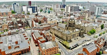
Statement of Representation
Providing details about the purpose of the consultation, how to view the material, how to submit comments, accessibility and privacy notice.

Archived 2025 Consultation Material
This is for information only

Further information
Explains the work already undertaken on the Plan and the new plan-making process
Leeds Local Plan Issues & Options Consultation Report
Summary of the Leeds Local Plan Issues & Options Consultation Summer 2025

Leeds Local Plan Scoping Consultation Document
We would like your views on which general topic areas the Leeds Local Plan should cover and how you would like to be consulted as the plan is developed.
Stay Informed
Follow our projects to get notified of upcoming engagements and the latest project related news.