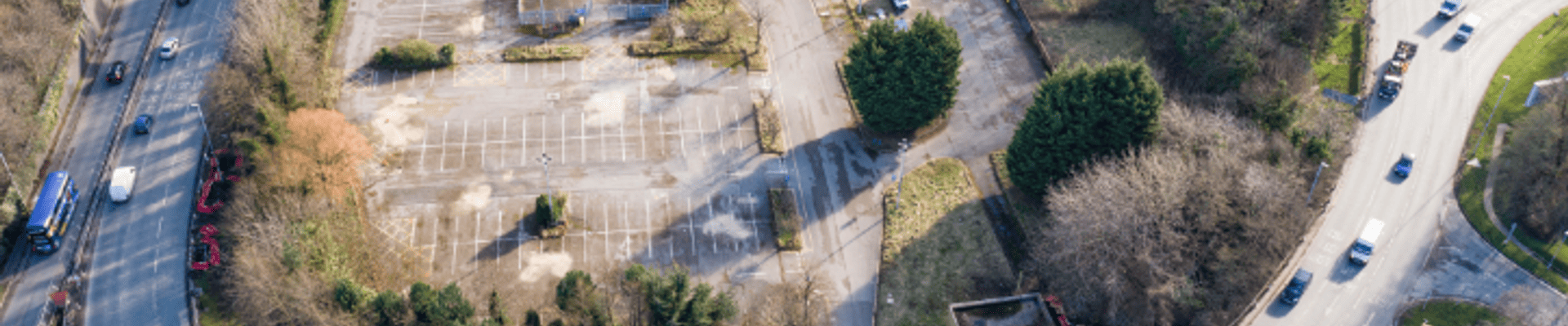
Connecting Leeds and West Yorkshire Combined Authority have been working in partnership to develop proposals to improve Armley Gyratory, a busy roundabout to the west of Leeds city centre.
Here’s some answers to frequently asked questions about the scheme.
If you have any further questions that are not covered in this document, please contact us at connectingleeds@leeds.gov.uk
The scheme
1. What is the Armley Gyratory?
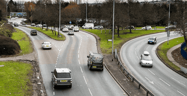
Armley Gyratory is an extremely busy signalised roundabout to the west of Leeds city centre. It acts as a major entry/ exit point for traffic as a key junction on the A58 (M) Leeds Inner Ring Road.
2. What is Connecting Leeds?
Connecting Leeds is part of Leeds City Council and aims to transform travel in Leeds for those that live, work and study in or visit the city. Connecting Leeds is delivering a range of city-wide transport improvements, aiming to support the development, growth, and success of the city of Leeds.
The council’s Connecting Leeds Transport Strategy sets out our vision for a city where you don’t need a car, where everyone has an affordable zero carbon choice in how they travel. This will help to deliver an integrated transport network within a city that is well-connected, healthy, and ambitious.
The improvements to Armley Gyratory are a key part of the Connecting Leeds ambition.
3. How is the Armley Gyratory improvements scheme linked to other transport projects being undertaken by Leeds City Council?
Armley Gyratory is funded by the West Yorkshire- plus Transport Fund City Centre package. This package funds a range of schemes within the centre of Leeds to facilitate city-wide transport improvements. Armley Gyratory is an important part of this and will enable the delivery of other projects to improve the city’s public realm and events spaces, as well as public transport and active travel schemes in the city centre, including at City Square. This is in line with the council’s health, climate, and inclusive growth goals.
4. What are the aims of the scheme?
The aims of the scheme are to:
- provide pedestrians and cyclists with more appealing and accessible routes around the gyratory; increase safety for all road users;
- improve the operation of the junction, allowing traffic to flow more freely, which will minimise traffic impacts on local roads;
- improve the local environment through new landscaping; and
- facilitate improvements elsewhere in the city, including at City Square, by creating capacity for traffic displaced from those locations.
The design
5. Why are the improvements to Armley Gyratory necessary?
The improvements are needed to allow traffic to flow more freely at the gyratory, as the junction currently experiences large queues of traffic at peak times, causing delays for motorists and bus users.
They will also address concerns raised through previous public consultation, which has highlighted concerns about the safety of the junction.
The current pedestrian and cycle facilities at Armley Gyratory are substandard and inaccessible to some users, reducing the likelihood of residents travelling into the city centre by foot or bike. The scheme will improve the ease and safety of travel for pedestrians and cyclists, promoting sustainable transport choices.
In addition, they will enable other city-wide improvement schemes, by creating capacity for traffic displaced from other locations, such as through traffic across the city centre.
6. Why has the design changed?
After two previous rounds of consultation, the design now is updated and complete. The changes have been made following a review of forecasted growth and changes in journey patterns; a review of the impact of other schemes planned in the city centre and across the wider Leeds network; and as a result of changes in the funding available for the scheme.
Although the design has changed, the proposals still take on board feedback, and aim to retain and enhance some of the key features that were most supported in previous consultations. This includes new landscaping, new and improved traffic lights, and improvements to pedestrian and cycle routes and crossings. Feedback has meant the new design includes improved safety, upgraded and enhanced walking and cycling connections, and on the highway allowing traffic to flow more freely, to provide extra capacity.
7. How has the design changed?
The main design changes include the removal of the cut-through road and pedestrian/cycle route across the central island. This route has been replaced with localised widening on the existing circulatory carriageway and upgrades to the pedestrian facilities on the eastern side of the gyratory.
The new proposed layout means a slightly quicker route for cyclists travelling between the city centre and New Wortley relative to the previous layout, as there are fewer signal-controlled crossings to use. Although it is slightly slower for pedestrians when the ramps are used than the previous layout, those that are able to use stairs will benefit from similar journey times relative to the previous layout.
Additionally, due to the reduced impact on the central island, the new design will preserve more trees than the previous iteration.
8. What assessments have been undertaken to inform the design?
In 2021, a transport assessment was carried out and submitted alongside the planning application.
This provided baseline data on current traffic flows through the junction and analysed how this would change because of the proposals. Traffic counts were undertaken, signalling and collision data were reviewed to help inform the design proposals.
The proposals were modelled using traffic data from Leeds City Council’s Strategic Transport model and City Centre AIMSUN model (a traffic-simulator software used to model urban transport networks).
Ground investigations undertaken since previous consultations and have informed the updated design.
Noise and Air Quality Assessments will also be completed to support the planning process.
9. How much will the scheme cost?
The scheme will cost £40.5 million, funded by the West Yorkshire- plus Transport Fund City Centre Package.
Benefits of the scheme
10. What benefits will there be for local residents?
Residents nearby will see improvements to the junction’s safety, operation, and ease of travel. For example, improvements to the gyratory will promote the use of more strategic routes and lessen the impacts of traffic on local roads.
The scheme will improve the pedestrian and cycle facilities at the junction to encourage the wider use of active transport into and around the city centre. New landscaping will create green pedestrian links while providing increased visibility between different road users, helping enhance the personal security of pedestrians and cyclists and minimise antisocial behaviour.
In addition, the proposed drainage system will look to address the issues of flooding at A58 Wellington Road North under the railway bridge.
11. How will the updated design impact traffic flow at the junction?
The scheme will allow traffic to flow more freely, with improved signalling (e.g., new traffic lights at the junction with Gelderd Road and at the entrance from A643 Ingram Road Distributor) and altered timings of the traffic lights. Widening and realignment of the existing carriageway will also increase the junction’s capacity, helping to create capacity for traffic displaced from elsewhere in the city.
12. How does the design improve the safety of the junction for motorists?
A key part of the improvements is the introduction of traffic lights at the junction with Gelderd Road, and a new signal-controlled junction on the entrance from Wellington Road. These new lights will make it easier and safer to enter the gyratory (the current approach is a give-way junction). Also, the timings of the lights at the gyratory will be amended, aiming to discourage drivers from running red lights.
13. How does the design improve the safety of the junction for pedestrians and cyclists?
A signal-controlled pedestrian and cycle crossing across B6159 Wellington Road will be introduced to provide a safe, continuous, and accessible route for pedestrians and cyclists around the gyratory. Cycling routes will be connected to existing routes, making it safer and easier to navigate the junction, and landscaping will increase the visibility of pedestrians and cyclists to other road users, improving their personal security whilst travelling. We will monitor and assess road safety at the junction after construction.
14. How will cycling and walking routes at the gyratory be improved?
Existing pedestrian routes will be upgraded to modern standards and made safer, more pleasant, and more accessible with new landscaping and footpath widening. New cycle routes will be introduced and connected to existing routes, making them easier and safer to travel by bicycle.
The new proposed layout means there is a slightly quicker route for cyclists travelling between the city centre and New Wortley relative to the previous layout, since there are fewer signal-controlled crossings to use.
Existing footbridges over the A643 and A58 will be replaced with dedicated, accessible pedestrian and cycle bridges. This will improve accessibility and safely accommodate both pedestrians and cyclists by using shallower ramp gradients.
Environment
15. How will the improvements scheme meet wider sustainability goals?
Improvements to pedestrian and cycling facilities at the junction will help to achieve the council’s wider vision of creating an active and green city, with further opportunities for more walking and cycling. These changes will hopefully encourage local communities to travel to the city centre via foot or bike and will therefore help to meet the council’s transport, climate and health & well-being goals.
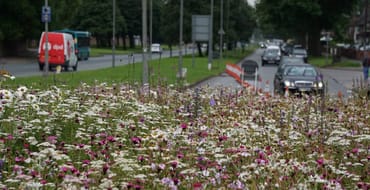
The new landscaping will see a mix of planting, including perennial wildflower meadow, shrubs, and semi-mature trees. These will be tolerant to air pollution and provide additional biodiversity. The scheme proposes using wildflowers over normal grass, as they require less maintenance throughout the year. As a result, landscaped wildflowers will reduce the amount of energy used for mowing each year and preserve biodiversity.
We will ensure that as far as possible materials used in the delivery of the scheme will be sustainable, easy to maintain and durable. Materials such as grasscrete (a grass paving design used as an alternative to concrete) will be used to improve and enhance the built road environment and contribute towards a more sustainable drainage system.
16. Why do trees need to be removed?
The current design preserves more trees than previously consulted on. But some trees will need to be removed to accommodate the new highway alignment and to provide greater visibility for pedestrians and cyclists travelling around the route. This is important to improve for safety and personal security of pedestrians and cyclists moving around the gyratory.
We’ve worked hard to minimise the number of trees that need to be removed, including thorough design iterations, and are engaging with community representatives to develop a replanting scheme that meets the needs of local people.
17. How many trees are being removed and what measures are in place to compensate for this?
For every one tree removed, three new trees will be planted.
- Approx. 220 trees are having to be removed to ensure the scheme can be delivered.
- Six trees have been identified as being transplanted (re-planted)
- 50 new trees are being planted on site
- 600+ new trees are being planted off site in local communities.
New landscaping at the gyratory will also aim to improve the local environment. Pedestrian and cycle routes will be enhanced via the establishment of green links around the gyratory, including through planting of new shrubs and perennial meadow along the route.
18. Does the local community have a say where the trees will be replanted or transplanted to?
We are engaging with community groups and local councillors to develop designs for offsite planting. We are aiming to plant and transplant trees in areas where they can have a lasting impact and are open to all suggestions. Areas already identified in New Wortley, Beeston, Holbeck, and Hunslet and Riverside. If you would like to suggest areas that would benefit from this tree planting, please get in contact with us at connectingleeds@leeds.gov.uk.
19. Why can’t all trees be transplanted?
There are a number of constraints on which trees can be transplanted, including the large girth of the trees, proximity to utilities and other trees, the project timescales, and land topography. The trees we are planning to transplant are semi-mature and we are aiming to move them to areas where they can enhance local public space and support pedestrian safety.
20. Why could the design not avoid loss of trees completely?
Improving traffic capacity at the gyratory involves the realignment and widening of some roads, which means that trees have to be removed. We have not been able to design out the removal of trees because the environment around the gyratory is highly constrained by existing land use and railway lines.
Tree removal will also provide greater visibility for pedestrians and cyclists travelling through the area. This is important to improve both the safety and personal security of pedestrians and cyclists travelling around the gyratory.
21. How will you be disposing of trees once felling has taken place?
We are currently considering the most sustainable and effective use of the removed trees. We anticipate recycling wood materials and developing specialist (hibernacula) piles from the trees’ off-cuts; these hibernacula piles act as places of refuge for wildlife to hibernate in the winter months and will facilitate the development of new habitats.
22. How will tree removal impact local habitats / biodiversity / wildlife?
Various measures have been put in place to ensure that the scheme’s impact on wildlife and biodiversity is minimal. During the works all tree felling will happen outside of nesting season (breeding bird season) to protect breeding birds. The additional tree planting, with three trees planted for every one removed, will also contribute to developing new habitats in areas approved by local communities.
An ecological appraisal and various habitat assessments have identified ecological constraints of the wider scheme. Site walkover surveys and desk based ecological studies are being used to identify protected or notable species, and the proposed development is assessed against relevant environmental legislation and planning policy, to ensure that the ecological appraisal is compliant, and capable of providing suitable mitigation recommendations.
The new landscaping proposals will additionally see a mix of planting, including perennial wildflower meadow and shrubs. These will be tolerant to air pollution and provide additional biodiversity. The scheme will seek the use of wildflowers over normal grass, as they require less maintenance throughout the year. As a result, landscaped wildflowers will reduce the amount of energy used for mowing each year and preserve biodiversity.
The scheme has been designed to minimise noise and air quality impacts to nearby residents as far as possible. Our studies have also concluded that the scheme will have no significant landscape or townscape visual impacts.
23. How does this tree removal align with the Leeds City Council’s plans to tackle the climate emergency?
The Armley Gyratory scheme aligns with our plan to tackle the climate emergency. In particular, the scheme will develop the city’s travel links and tackle congestion, helping address noise and pollution issues. By planting new trees at a three to one ratio to those removed and using sensitive landscaping, the scheme will also help support the development of new and improved green spaces in the local area.
Scheme delivery
24. What will be the impact of construction on other transport links and journey times?
The scheme will aim to minimise the impacts to journeys within the city centre as much as possible by co-ordinating with other works planned in the city. A construction strategy is also being formulated and details of the construction programme, including temporary routes for all travel modes, will be shared publicly prior to commencement.
25. How will disruption be managed during construction?
Due to the work being undertaken, unfortunately some disruption will be unavoidable. The council will work with its chosen contractor and plan construction considerately to keep potential noise impacts to a minimum and ensure residents remain informed. Where disruption is unavoidable, construction management plans will be produced and will outline how potential impacts will be mitigated. A communications plan is in place to keep local people and wider visitors informed, along with highways signage around the location and across the city.
Staying involved
26. What consultation has taken place to inform the proposals?
There have been two rounds of public consultation on the proposals. Between February and April 2018, a consultation was held on the different design options, and this provided initial feedback to help inform the development of the design. A preliminary design consultation was then conducted in August and September 2019, which included two public events. This gave attendees the opportunity to listen to the proposals, find out more information from the project team and provide feedback.
Feedback provided from both rounds of consultation are addressed within a Statement of Community Involvement, which was submitted as part of the planning application for the scheme. This document will set out how the updated design responds to the consultation feedback.
27. How can I stay updated with the latest announcements?
If you’d like to stay updated with the latest news and developments on the scheme, you can subscribe to alerts via Commonplace. Follow @ConnectingLeeds on Twitter and Facebook.
28. Where can I find out more information?
For more information, see the project website www.leeds.gov.uk/armleygyratory or contact connectingleeds@leeds.gov.uk.
You can also call us on 0113 395 6300.
Discover more
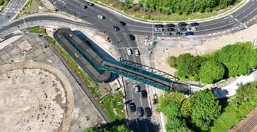
Construction footbridges
Final structure installation Wellington Road footbridge February 2025. Motorist and pedestrian impacts, with diversions.
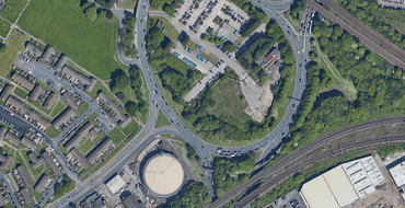
About the project and previous consultations
Understand the scheme, how journeys will change and view feedback
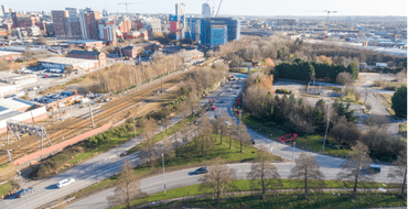
Landscaping
Plans and work to improve the landscaping in and around Armley Gyratory
Armley Gyratory Update
Learn more about the latest plans for Armley Gyratory.
The proposals
Have your say on our preliminary design for the improved gyratory.
Have your say!
View the proposals from the previous page.
Stay Informed
Follow our projects to get notified of upcoming engagements and the latest project related news.