
Learn more about the project
Find out more about the project.
Harringay Ladder Traffic and Transport Review
Learn more about the project
Harringay Ladder Traffic and Transport Review
Haringey is embarking on an ambitious programme to increase walking and cycling rates in the borough and is also seeking to tackle the implications of traffic and rat-running. This is needed to improve our air quality, respond to the climate change emergency we face, address health inequalities and make the borough a healthier place to live, work and rest. To progress these commitments, the Council will be consulting on its draft Walking and Cycling Action Plan this summer.
Between 2015 and 2017, the Council carried out a transport study of the Green Lanes area, which included extensive community engagement. The study can be found here: https://www.haringey.gov.uk/glats. The study recommended several changes supported by residents and businesses concerned about the Green Lanes area's traffic conditions. The study aimed to identify measures to:
• Improve the urban realm
• Rationalise traffic volume and routes
• Improve road safety for all road users
• Maintain or enhance bus service journey times and reliability
• Enhance pedestrian and cycle accessibility into and within the study area
• Improve the quality of life and health outcomes for residents.
Since the publication of the study in 2017, several measures have been introduced for the area, including the Wightman Road scheme, which has improved pedestrian safety and the public realm. The works also included the permanent traffic filtering of Warwick Gardens.
We now have an opportunity to review this stud's recommendations, what has been implemented so far, and the impacts, and the proposed Low Traffic Neighbourhood for St Ann’s (www.haringey.gov.uk/low-traffic-neighbourhoods). All of this also needs to consider the current traffic conditions and the community's concerns consider to arrive at a list of future actions needed to tackle traffic problems and increase walking and cycling rates in this area of the borough.
For this review, the previous study area has been redefined to include only the Ladder area – east of, and including, Green Lanes. For more information on the review, please see our Haringey webpage .
The ReviewThe Council is keen to hear from the community again. We do not intend to re-engage on the 2017 Transport Study but instead open this new dialogue with an up-to-date review of traffic and transport issues facing the area. We will use this new feedback alongside the 2017 study responses, recommendations, and measures, to work up a list of transport actions to take forward over the next three to five years.
The first stage of this review is to hear residents and businesses' views on the current issues you are facing in the area and the ways you would like to see it changed.
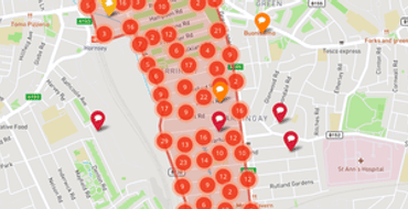
This map will be live until Sunday, 21st March 2021. If you are unable to access the map, you are still able to provide your views to the council using the following methods:
By email: HarringayLadderTTR@haringey.gov.uk
By phone: 0208 489 3433
By post : Transport Planning, Haringey Council, 40 Cumberland Road, Wood Green, London N22 7SG
We are also interested in building a database of interested persons, groups, and businesses in the area who wish to be kept up to date on this review. You can do this by signing up to this Engagement Map when you provide your feedback or using the methods above.
Next stepsWe will review the feedback from this engagement exercise, and the responses will be used to develop a list of actions to tackle the traffic problems and ways to increase walking and cycling in the area. More opportunities to get involved will follow as the review progresses.
We encourage you to get involved.
Harringay Ladder Traffic and Transport Review UpdateIn March 2022, two webinars were provided for members of the local resident and business community to attend as part of a new series of engagement activities on the Harringay Ladder Traffic and Transport Review. The purpose of these webinars was to share the findings of the 2017 Transport Study and the 2021 Public Engagement undertaken via Commonplace and to gather feedback on priorities for the area which would help shape what improvements the Council should consider for the area. We have since collected and analysed all the feedback received and an Interim Engagement Report has been prepared and can be found here .
In summary, the last phase of engagement drew several key observations:
• that roads in and around the Haringey Ladder are dangerous; roadside parking is a contributing factor,
• traffic and congestion are a cause of pollution,
• traffic should be reduced,
• HGVs are having a negative impact.
The next stage will include further public engagement in Autumn with the local resident and business community, where we will provide information on the data we have collected, both for traffic and parking as well as the analysis we have undertaken on the road traffic collisions that have occurred in the area. We will discuss the options we will be developing further and testing out through traffic signal modelling to understand if these would work and what the likely impacts and benefits these would bring. The modelling will consider the traffic conditions now and will be updated once we gather new traffic data in a few months following a short settling in period now that the St Ann’s Low Traffic Neighbourhood has come into effect.
If you would like to keep up to date with our progress, please subscribe to news updates on this site. We will write to the local community again with details of when the next engagement will take place. If you have any questions or queries, please contact this email address: harringayladderttr@haringey.gov.uk .
Stay Informed
Follow our projects to get notified of upcoming engagements and the latest project related news.