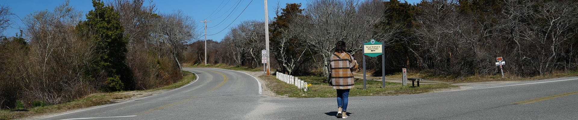
Wauwinet Road Sidepath
The Town has been awarded federal grants to design and implement a sidepath for active transportation users between Polpis Road and the Wauwinet Gatehouse. This proposed sidepath will improve safety and convenience for all users of Wauwinet Road by separating non-motorists from vehicular traffic. The path will also improve community connectivity, access to recreation and conservation lands, and complete another long-planned leg of the original 1977 Nantucket Bicycle Master Plan.
Frequently Asked Questions
What is a sidepath?
A sidepath is a paved linear path that is wider than a sidewalk. Sidepaths support walking, bicycling, and other mobility needs including babystrollers, wheelchairs, and rollerbladers. Typically, sidepaths are separated from traffic by landscape panels to improve safety but follow the general trajectory of an adjacent roadway. In some cases, sidepaths deviate slightly from the roadway based on the presence of streams, trees, and hills. Sidepaths are often referred to as shared use paths or multiuse paths: these terms all have the same meaning.
Why do we need a sidepath on Wauwinet Road?
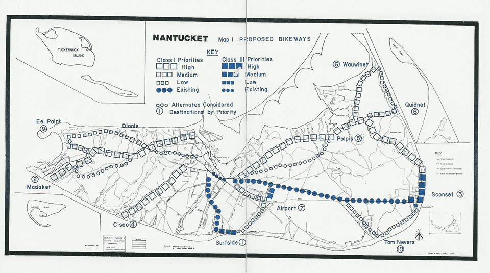
In 1977, the Town developed a master plan for bicycle facilities (shown in the map below). Residents and planners had the foresight to recognize the value of separating bicycles and pedestrians from vehicular traffic along Wauwinet Road, which has numerous twists, turns, and grade changes. While the vision for walking and bicycling for the island has flourished with the development of numerous paths, the need to address nonmotorists’ safety remains on Wauwinet Road. Beyond safety, Wauwinet Road facilitates access between the northeast corner of the island—encompassing beautiful beaches and conservation land—and the island’s core. These assets generate significant travel demand for nonmotorists and motorists alike. Separating nonmotorists from the vehicular travel path will improve convenience for all road users.
How much will the sidepath cost and how is it being funded?
The town was awarded three separate grants totaling $2,421,000 from the Federal Land Access Program (FLAP), a program managed by the Federal Highway Administration (FHWA). The FLAP program seeks to improve community access to federally-held conservation properties—in this case, the Nantucket National Wildlife Refuge. The implementation of a path will provide pedestrians, cyclists, and other rollers better access to the main point of embarkation for tours of the refuge.
Local funding up to $4,984,100 has been authorized by the Town for the FLAP grant’s local match, permitting, path easements, and other anticipated impacts to associated with the implementing the path. The town is working with the Federal Highway Administration to advance design of the path. Once this stage is complete, actual construction costs will be identified and shared on this website.
Who is managing this project—federal government or local government?
The design phase of the project will be managed by the Federal Highway Administration’s Eastern Federal Lands Highway Division. Their project management team will coordinate closely with local staff to ensure there are adequate and appropriate opportunities for engagement and review of concepts. The Select Board will need to endorse any design prior to advancing into any construction phase.
What’s happening right now and what’s the project timeline moving forward? Can we push the tempo a bit?
The design was initiated in the spring of 2023. Field survey and identifying other natural and cultural resources in the project area is on-going. Conceptual alternatives will be developed in spring 2024 with associated impacts identified to assist with identifying the preferred alternative. Once this stage is complete, a more refined timeline to complete permitting and engineering will be developed.
Where can I see the design on the path?
As of this update, there are no formal designs for the path. Conceptual design alternatives to be available in the spring of 2024. Once conceptual design alternatives are available, information about public engagement opportunities will be posted on this site. We encourage you to stay involved! Sign up in this page for notifications on this project.
Will this project be implemented all at once? Or will it be phased?
This will depend on ultimate construction costs, available funding, and ability to mitigate impacts identified in the permitting process. If sufficient funds are not available, or if environmental or other impacts cannot be mitigated, then mechanisms to support a phased approach will be explored.
Will this path impact conservation land and/or wetlands?
Because no design is complete, the extent of impacts is not fully identified. Design alternatives will be explored to limit impacts to the greatest extent possible. Where impacts are not avoidable, mitigation will be provided per the regulation and/or the discretion of the town’s conservation commission.
When were these FAQs last updated?
These FAQs were last updated September 25, 2023.
Oportunidades para participar

Mantenha-se informado
Receba notificações sobre as próximas atividades e as últimas notícias relacionadas com o projeto.
