
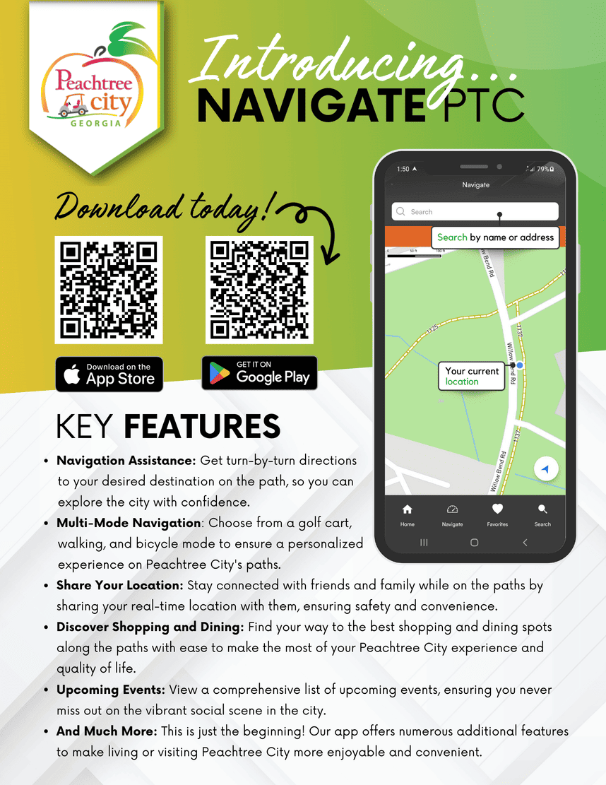
Path System Navigation App
Our city boasts a 100+ mile linear park also known as the multi-use path system however since its inception users have relied on a printed map to get around. Google map provides turn-by-turn directions on the path when in bicycle mode but does not provide instantaneous updates when a new path is opened, or changes need to be made. The implementation of a city-owned and operated navigation app will allow staff to make immediate updates, as needed.
Stay Informed
Get notified on upcoming engagements and the latest project related news.
Yasmin Julio
City Clerk/ Director of Executive Services
Creation and Implementation
Creation of Navigation Application
Late June 2023
Internal Testing (Staff members only)
9 months
Request for Beta testers
2 weeks