Flood Hazard Identification and Priority Setting
Understanding that flooding is a recurring concern for Renfrew County due to our location along the Ottawa River, we are committed to addressing this issue strategically and effectively. This website is specifically designed to share our latest initiative in flood management, a project that involves identifying flood hazards and setting priorities. We aim to proactively review the Ottawa River and main tributaries - Madawaska, Bonnechere and Petawawa Rivers, focusing on data acquisition, flood hazard modeling, and updated flood hazard maps to plan for a safer and more resilient County.
As we embark on this multi-phased project, this is a testament to our commitment to enhancing our flood mitigation efforts, adaptation to climate change, and upholding the safety of the residents and their properties. In partnership with Natural Resources Canada and the Ministry of Natural Resources and Forestry, Renfrew County and local municipalities are preparing for an effective response to any future potential flood mapping funding opportunities
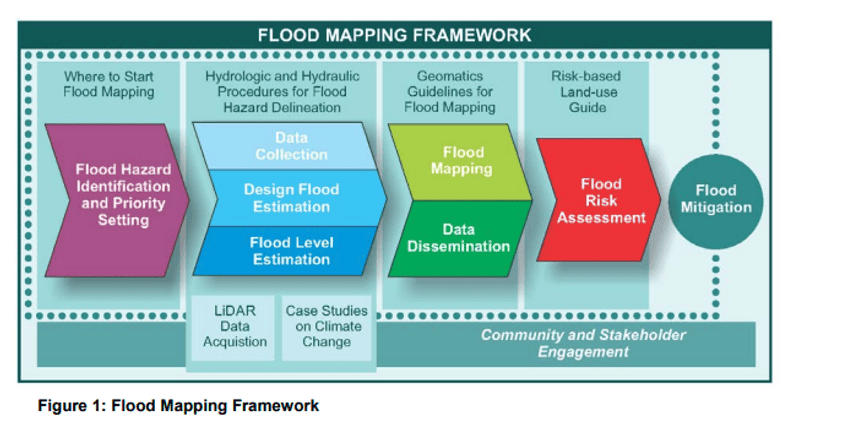
This project is aligned with the federal flood mapping framework (NRCan, 2018), of which the objectives of this project will be to
(1) identify current mapping status,
(2) identify shortfalls in current data and mapping,
(3) identify and prioritize areas for acquiring new mapping, and
(4) develop a plan to acquire data required for flood mapping and implement flood mapping across the county.
On this site you can find the first 4 reports that have been prepared regarding Flood Hazard Indentification and Priority Setting.