
Getting About in Yate Project Update - August 2026
Building on the previous update where we shared a broad summary of improvements, we thought it would be useful to show how your views have shaped the designs and plans for the Getting About in Yate Pr
Getting About in Yate
Building on the previous update where we shared a broad summary of improvements, we thought it would be useful to show how your views have shaped the designs and plans for the Getting About in Yate Project.
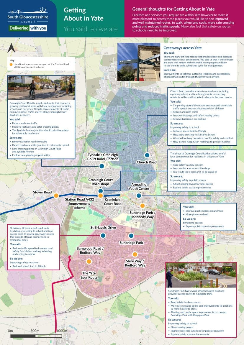
Below is a map showing what Yate Residents told us they would like as part of the Getting About project and how we are delivering on them.
The map includes insight into your views and how it’s informing the improvements taking place in areas such as Church Road, Tyndale/Cranleigh Road junction, Sunridge Park, St Briavels Drive and many more.
There are also some more general points of the use of Greenways and Getting About in Yate.
The map below show how feedback on Greenways is helping to shape the project:
Next Steps
The Full Business Case (FBC) that outlines the improvements we plan to make, the benefits they will bring and how they will be delivered, has now been approved, with plans progressing through the West of England Combined Authority’s governance process.
As usual, you can also explore the plans in more detail via the interactive map on the homepage of this site.
Thank you to everyone who has contributed so far and given feedback.
For further queries about the project, please contact: gettingaboutinyate@southglos.gov.uk
Stay Informed
Follow our projects to get notified of upcoming engagements and the latest project related news.