
Project
Scheme drawings
View or download the scheme drawings here.
Grovesend Road and Gillingstool active travel improvements
Click below if you could like to download or view the scheme drawings.
01 - The Plain to St John Street.pdf
02 - St John Street to Gillingstool.pdf
03 - Baptist Church to Pearce Close.pdf
04 - Pearce Close to Streamleaze.pdf
05 - Ellesmere to Medway Court.pdf
06 - Medway Court to Avon Close.pdf
07 - Grovesend Road roundabout.pdf
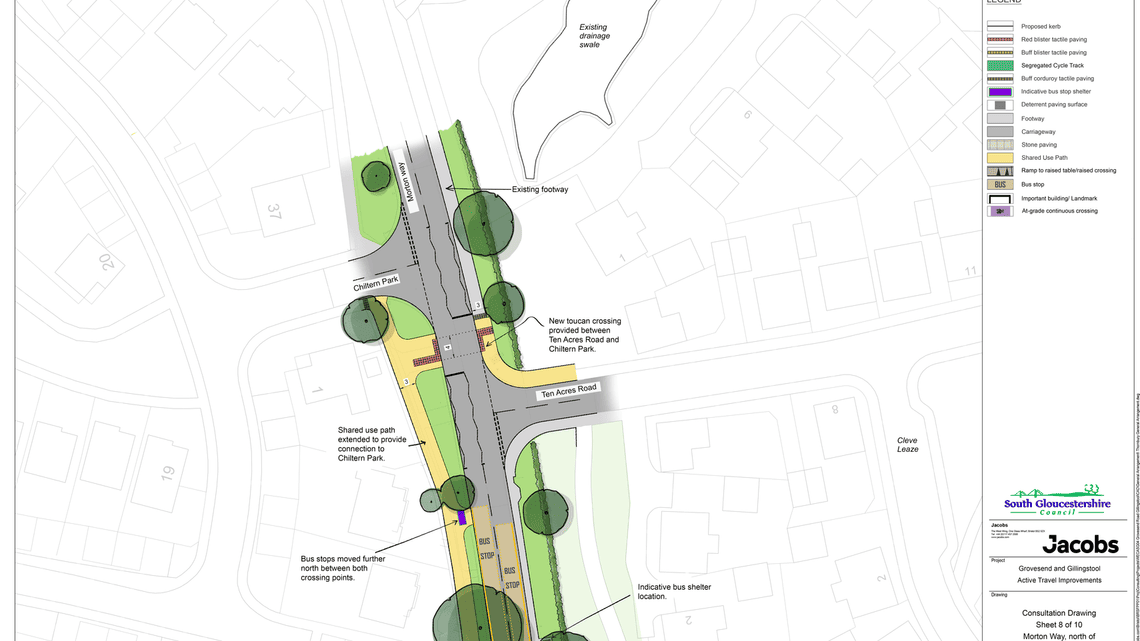
08 - Morton Way.pdf
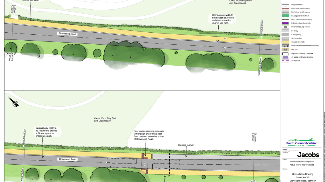
09 - Grovesend Road south of roundabout.pdf
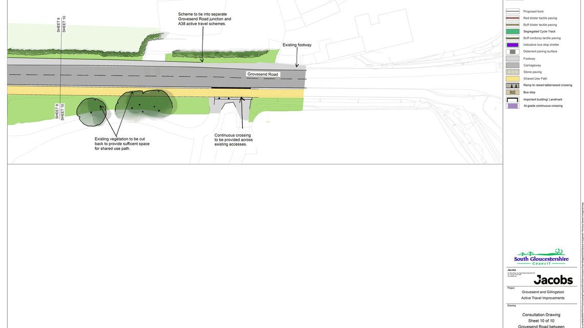
10 - Grovesend Road A38 end.pdf
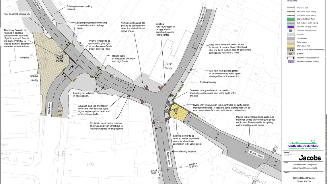
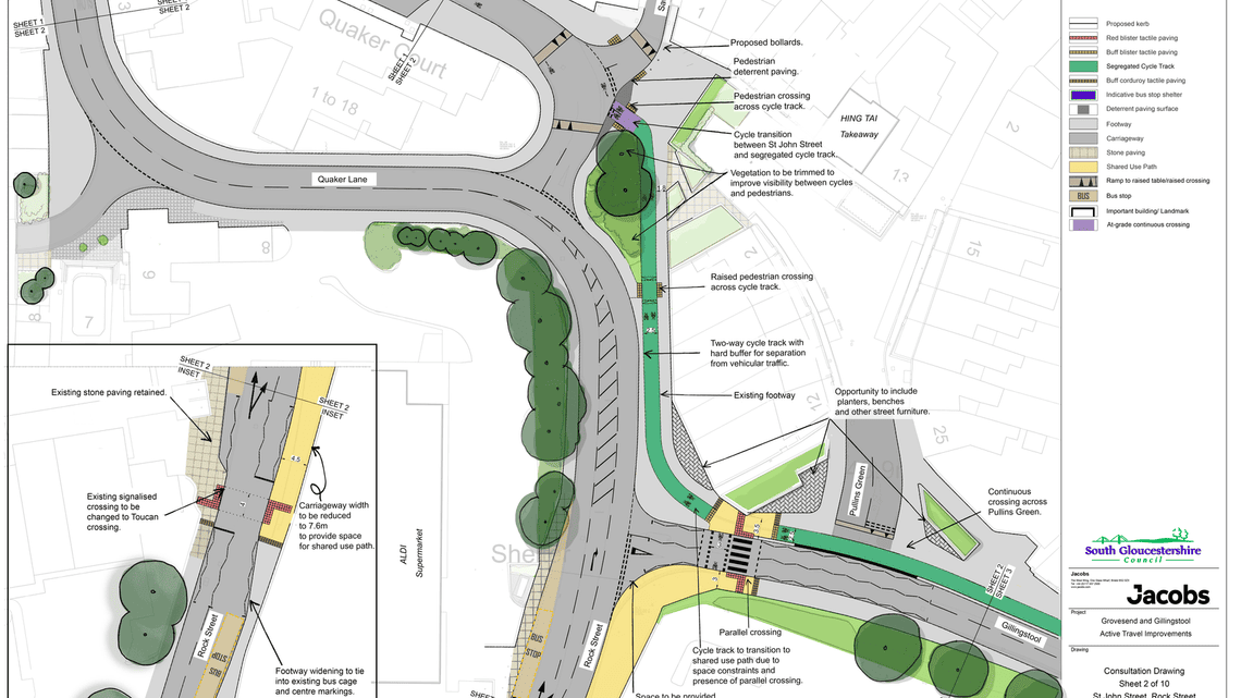
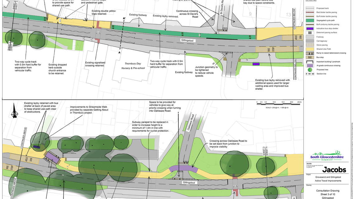
You can also preview the drawings below:
Scheme drawings 1 - 5
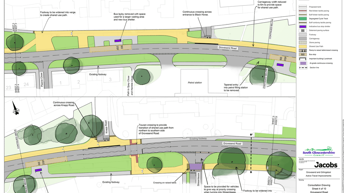
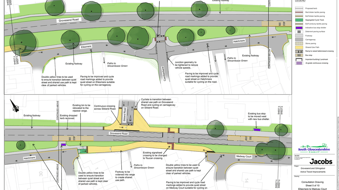
Scheme drawings 6 - 10
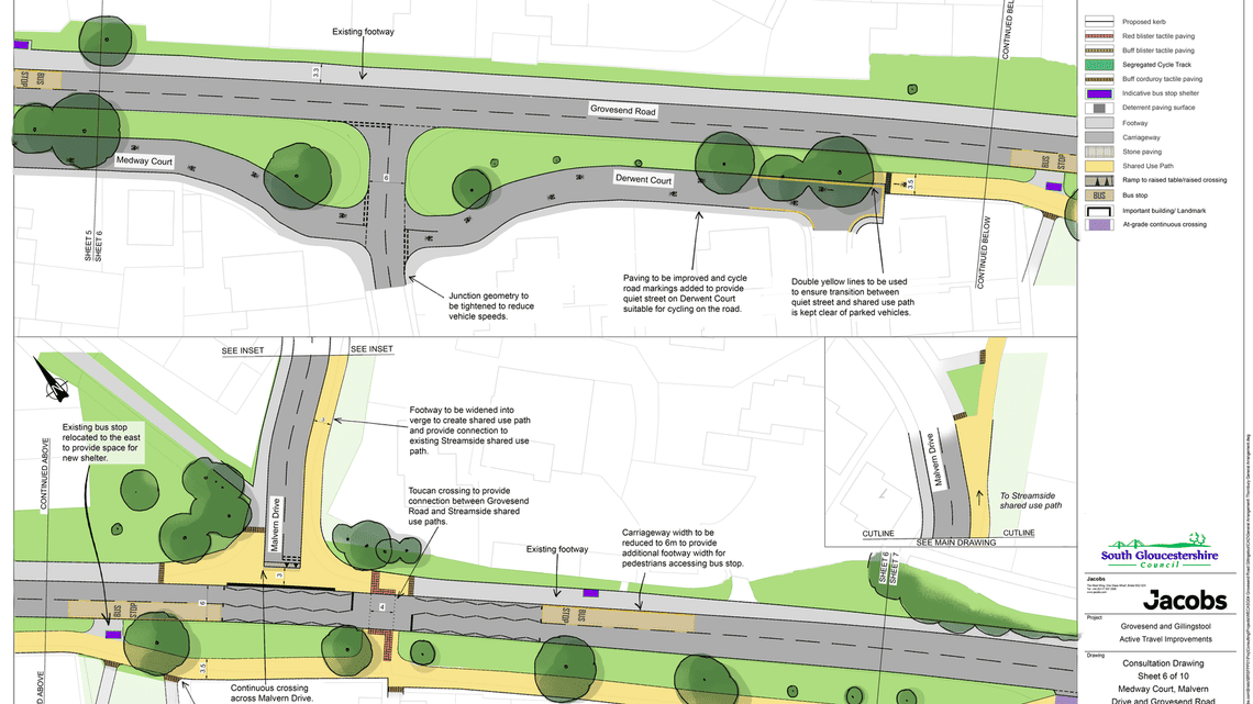
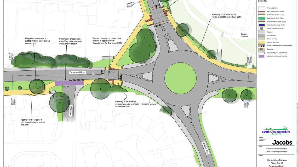
Discover more

Map of proposals
Navigate through the proposals on this map
Other nearby schemes
Find out about other active travel schemes in and around Thornbury.

Equality Impact Analysis and Assessment
Read our analysis of the potential impacts on different people and communities here.
Glossary of terms
Read definitions of terms you may not be familiar with.
Open
Respond to the consultation
Have your say on proposals for a new active travel route through Thornbury.
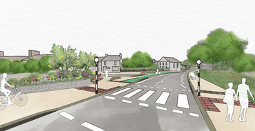
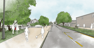
Visualisations
These are artist impressions of the scheme.

Frequently asked questions
We have answered your most commonly asked questions here.
Stay Informed
Follow our projects to get notified of upcoming engagements and the latest project related news.