
FAQs related to the Burpham to Guildford Active Travel Scheme
Read the latest frequently asked questions (FAQs), with answers, providing additional insights and information...
Section No. 1
What's happening?
- Installing one-way dedicated cycle paths on both sides of London Road
- Upgrading the existing roundabouts to provide safer crossings for cyclists and pedestrians
- Creating new crossing points
- Making improvements to existing junctions
- Upgrading bus stops
Why are we doing this?
We want to ensure our roads are safer and more accessible for children, pedestrians and cyclists travelling around Guildford, for now and in the future.
We are committed to making Guildford a greener place to live by reducing carbon emissions and deliver on our county's net zero ambition by 2050.
What is the case for linking Burpham to Guildford with a sustainable travel route?
Over the last couple of years, we have been working towards our goal of building a network of sustainable travel routes around Guildford for cyclists and pedestrians. Sustainable travel routes are designed to minimise car traffic and promote low impact ways to travel that are less harmful to the environment, such as walking and cycling. Each of the following reports identifies the A3100 as a key route for improvement as part of a wider network:
- Guildford Cycling Plan (Surrey County Council, 2015)
- Guildford Borough Transport Strategy (Guildford Borough Council, 2017)
- Guildford Cycle Routes Assessments Report (Guildford Borough Council, 2020)
The route from Burpham to Guildford has been prioritised because of current demand and the potential to encourage residents in Burpham and the surrounding area to cycle or walk to key destinations in Guildford.
Our goal is to create sustainable travel links to existing cycle routes along Clay Lane and Ladymead.
Costs and funding
How is the scheme funded?
The scheme is funded by central government through Active Travel. Read about the Active Travel Fund for roads and pavements at Surrey County Council.
What are the costs?
Following the conclusion of the engagement, the County Council will make a decision on if the scheme is to be built or not. If the decision is made to build, we will then talk to our contractor about the method of building and the costs associated. We will make the final costs public.
Why can't the money be spent on repairing potholes instead?
This money is ring-fenced for walking and cycling schemes. It cannot be spent on the maintenance of existing roads. The government wants to encourage more people to choose alternatives to public transport, making healthier habits easier and helping ensure the road, bus and rail networks are ready to respond to future increases in demand.
Timings
How long will the work last?
We currently anticipate that each of the three sections will take approximately 20 weeks to construct, but this is an estimation.
Further details on the traffic management proposals are available for the scheme's Section No. 1, Section No. 2, and Section No. 3.
Will the work clash with GCSEs and A Levels?
As part of our further engagement process, we plan to talk to residents and local schools and listen to their concerns about disruption during external exams.
Local impact
How do you propose to build the scheme?
We will keep the road open without closures or traffic lights during the day and propose night closures between 8pm and 5am. We will do this in consultation with affected residents and the approval of Guildford Borough Council Environmental Services
Further details on the traffic management proposals are available for the scheme's Section No. 1, Section No. 2, and Section No. 3.
Will late evening shoppers and diners, as well as residents, be permitted access during closures?
We will ensure that residents and those wishing to access businesses during the closures will be afforded access.
What percentage of the "Burpham stretch" is shared track for both pedestrians and cyclists?
Approximately 45% of the Burpham stretch is shared use. This includes the bus stops and signalised crossing points.
How many parking spaces will be removed beside Stoke Park?
We propose to reduce the number of parking spaces beside Stoke Park from the current 57 (in 4 zones) to 48. This equates to a reduction in parking bay length of 45m. The results parking surveys we have undertaken also indicate that there is adequate excess parking spaces available in the immediate vicinity to accommodate any parking displaced from the parking spaces beside Stoke Park.
Not everyone is able to walk or cycle and some people may not want to
We accept that not all residents are in favour of improving walking and cycling facilities. However, we are committed to reducing carbon emissions, improving air quality and most importantly, reducing accidents for pedestrians and cyclists.
Safety and Security
What are the design standards used to create the London Road scheme?
We have followed the guidance with Local transport note 1/20 and have ensured that we comply with required standards. We will also undertake safety audits to ensure that the scheme complies with safety standards and best practice.
Is the 1.5m separation of the Highway Code (for vehicles passing cyclists) applicable to cycle tracks?
While LTN1/20 recommends a minimum 0.5 metres separation between cycle paths and the carriageway in a 30mph urban zone (refer to Table 6-1 on page 54). It also recommends an absolute minimum horizontal separation of zero (0) m and our design meets this standard.
Is a Dutch style roundabout safe?
The only other Dutch style roundabout is in Cambridge and although in the media it has been reported that accidents have risen, this does not take into account that usage has increased by almost 50 per cent, equally, pedestrian usage has also risen by about 30 per cent.
What will the width of the road be once the works have finished?
The table below provides the widths we are proposing over the 1.245km length of the Burpham scheme. It shows that we are proposing widths in excess of 6.5m for 71% of the length of the scheme with a minimum carriageway width of 6.3m being proposed for 16% of the scheme length.
| Road width | 6.3m | 6.3-6.5m | 6.5m | 6.5-6.8m |
| Length (m) | 205 | 160 | 635 | 245 |
| % | 16% | 13% | 51% | 20% |
Please find below the post-scheme road widths for the A3100 London Road, from Boxgrove Roundabout to York Road section:
Road width | 6.3m | 6.3-6.5m | 6.5m | 6.5-6.8m |
Length (m) | 0 | 0 | 886 | 325 |
% | 0% | 0% | 73% | 27% |
Did you consult the emergency services?
We are in constant communication with the emergency services about proposals for the scheme and to discuss specific concerns. Whenever we apply for a traffic order to close a road, we consult with them as a requirement.
How will emergency services get through traffic at peak times with the proposed carriageway widths?
We have spoken to all the emergency services, and none have raised concerns about getting through traffic.
Are 'Floating Bus Stops' safe for visually impaired and disabled bus users?
At a Floating Bus Stop, cyclists are channelled behind people waiting for and getting on or off buses. Following feedback, we are reviewing some elements of the design of the scheme. When we have more details about the plan for Floating Bus Stops, we will share them here.
Will there be investment in bike security?
We plan to look at the issue of bike security in Guildford. When we have more details, we will share them here.
Carbon emissions
How will this scheme help towards Surrey County Council's target of becoming carbon neutral by 2050?
We are committed to making Guildford a greener place to live by reducing carbon emissions and deliver on our county's net zero ambition by 2050. This scheme will help us achieve our goals by offering more cycling and walking routes so residents can choose low carbon travel and rely less on cars and buses.
Will this scheme result in traffic gridlock and raise carbon emissions?
We aim to minimise disruption to residents and road users with the most effective traffic management plans while work takes place. We are currently reviewing some elements of the design of the scheme and when we have more details, we will share them here.
Discover more
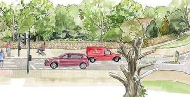
Traffic Modelling
Here you can review the report that covers traffic modelling for the Burpham to Guildford Active Travel Scheme route....
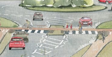
Cross Section Designs
Explore the Cross Section designs for each section of the Burpham to Guildford Active Travel Scheme.
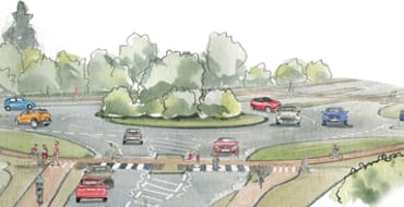
About the project...
Click here to learn more about the project...
Have your say...
Click here to take part in a survey about the Burpham to Guildford Active Travel Scheme...
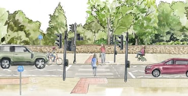
Start the journey here...
Explore the journey via three computer generated animations of traveling between Burpham and Guildford using the new active travel scheme...
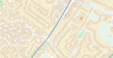
Section No. 1
The section of the scheme follows the A3100 London Road from the junction between Burpham Lane and New Inn Lane, and continues onwards to the Boxgrove Roundabout.

Additional Information
Access sources of information relevant to the scheme that includes health and well-being reports, downloadable PDFs, and more...
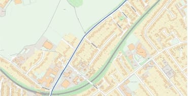
Section No. 3
The section of the scheme continues along the A3100 London Road, and commences from the Boxgrove Roundabout to the London Road junction with the A246 York Road.
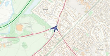
Section No. 2
The section of the scheme is focused on the Boxgrove Roundabout.
Stay Informed
Follow our projects to get notified of upcoming engagements and the latest project related news.