
Frequently Asked Questions
Click here to read about your most frequently asked questions.
Ashgrove Connects
Frequently Asked Questions
We have answered some of your most frequently asked questions on Ashgrove Connects to aid further understanding of the project. We’ll keep these updated as we progress through the project stages.
Q. Who is delivering the Ashgrove Connects Project?
The project is being progressed by Aberdeen City Council and funded by Sustrans as part of a programme of improvements across the city that will help provide everyone with more sustainable transport and lifestyle options.
Aberdeen City Council employed a consultant, Atkins, to work closely with the local community to deliver Stages 1 and 2 of the project up until 2022. In autumn 2024 Ironside Farrar were appointed to develop the concept design to Stage 3.
During the initial stage of the project, a Stakeholder Working Group has been formed to ensure community and stakeholder representatives are able to review and validate key outputs at each project stage as well as support the delivery team with communication to the wider community.
At various stages of the project, the working group will seek representatives from different street users such as local residents, institutions, community groups, emergency services and disability groups.
Q. What is the Roads Hierarchy Study and what does this mean for Ashgrove Connects?
Ashgrove Connects is a local project aimed at delivering on the priorities identified by local people and stakeholders, within the Council’s policy framework. Part of that framework is recent changes to the Councils roads hierarchy.
The system of roads classification is intended to direct motorists towards the most suitable routes for reaching their destination. It does this by identifying roads that are best suited for traffic.
All UK roads (excluding motorways) fall into the following 4 categories:
- Priority routes or A-roads: major roads intended to provide large-scale transport links within or between areas. These roads are generally the highest-grade roads in terms of design and serve ‘through traffic’ between primary destinations.
- Secondary routes or B-roads: roads intended to connect different areas, and to feed between A-roads and smaller roads on the network.
- Tertiary routes or Classified (C-roads): smaller roads intended to connect unclassified roads and A and B-roads, and often linking a housing estate or village to the rest of the network.
- Unclassified: local roads intended for local traffic. The vast majority of roads in the UK fall into this category.
As part of the roads hierarchy, Ashgrove Road West was reclassified from an A-road to a Classified Road (C–road) to match surrounding existing C-roads such as Ashgrove Road, Cornhill Road and Back Hilton Road.
Ashgrove Connects will explore the opportunities that this re-classification provides to develop proposals in line with the characteristics of C-roads.
Q. What is the Berryden Corridor Improvement Project and how will Ashgrove Connects compliment this?
Berryden Road facilitates journeys between the city centre, the north of Aberdeen and beyond. The corridor represents a pinch point in the city road network and has been identified as a route operating beyond its capacity leading to significant congestion and journey time delays, particularly at peak times.
The Berryden Corridor Improvement Project involves widening the existing road and junction improvements between Skene Square and Ashgrove Road and constructing a new section of road between Ashgrove Road and Kittybrewster roundabout.
The project will provide substantial benefits across the north of the city and beyond including improved journey times and connections, reduced congestion and improved conditions for walking and cycling. The project has full council and funding commitment and is likely to proceed within the next two years.
Ashgrove Connects will consider opportunities to compliment the proposed infrastructure changes through the Berryden Corridor Improvement Project
In line with the roads hierarchy, the intention is to ask the local communities surrounding Ashgrove Connects what they want to make of this opportunity by investigating what improvements could and should be made to their streets and public spaces.
Depending on input from the community, this could include proposals that give greater priority to people, enhance public space, improve access to shops and facilities, and give everyone the choice to travel by any means. The intention is not to increase road capacity on Ashgrove Road or Ashgrove Road West.
Should the Berryden Corridor not proceed, it may be less likely that the Ashgrove Connects Project would proceed. Further information on the Berryden Corridor Improvement Project can be found at: www.aberdeencity.gov.uk/berrydencorridor.
Q. What surveys have been undertaken for Ashgrove Connects and are these accurate considering changes to travel behaviour during the pandemic?
We have had independent surveys carried out to monitor traffic, speed and volume levels, pedestrian and cyclist movements, public life and parking demand.
Although the number of vehicle and people movements are returning to similar levels as before the pandemic, we also need to consider future travel patterns as part of Ashgrove Connects which are changing all the time and more difficult to predict.
The data we have collected through the surveys provide us with evidence of current movement levels but we are very much looking to the community to help inform this further.
Q. Can Ashgrove Connects consider traffic calming measures or will this negatively impact on emergency services?
Traffic calming measures can combine a mixture of features and be placed both on and off the road.
These features are not limited to speed signs, cameras or speed bumps but can also consider measures which narrow the road, build out the pavements, raise the road in longer sections and add greenery, colour and interest to an area.
We will continue to consult the emergency services throughout the project to ensure proposals work for everyone.
Q. Can traffic speeds be fixed now?
Reducing traffic speed and volume was clearly a priority for people who responded to the initial consultation and our surveys validate these concerns. It’s important to recognise that although this is a problem affecting many people in the Ashgrove Connects area, traffic speeds are not out with the range of other similar streets across the UK.
As traffic is perceived to be impacting on almost every aspect of place quality within Ashgrove Connects, it’s important we take a holistic approach to address this as proposals develop rather than trying to solve this in isolation.
Physically changing the layout of the streets will help to slow vehicle speeds while also enabling people to cross the road more easily, improve junctions and enhance the overall street environment for everyone.
Discover more
Watch the Stage 4 Webinar 2
Click here to catch up with a recording of the webinar that took place on Thursday 26 March 2026.
Watch the Stage 4 Webinar 1
Click here to catch up with a recording of the webinar that took place on Monday 23 February 2026.
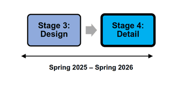
Stage 4 Update
Click here to find out more about Stage 4 and how you can stay involved.
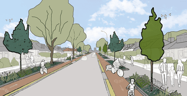
View the Concept Design
Click here to view the Concept Design that has been developed following your feedback on the Initial Design Ideas during Stage 2 of the project.

Findings from Stage 2
Click here to read about your feedback on the Initial Designs during Stage 2 of the project.
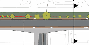
Stage 3 Design
Find out about the designs, and share your thoughts.
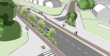
Ashgrove Road West (Stage 2)
Please click here to view the initial design ideas for Ashgrove Road West and read what people told us about these.
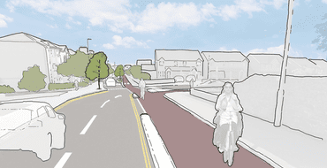
Ashgrove Road and Laurelwood Avenue (Stage 2)
Please click here to view the initial design ideas for Ashgrove Road and Laurelwood Avenue and read what people told us about these.

Watch the Stage 2 Webinar
Click here to catch up with a recording of the webinar that took place on Tuesday 28th June.
Stay Informed
Follow our projects to get notified of upcoming engagements and the latest project related news.