Normal Fire Department
Community Impact
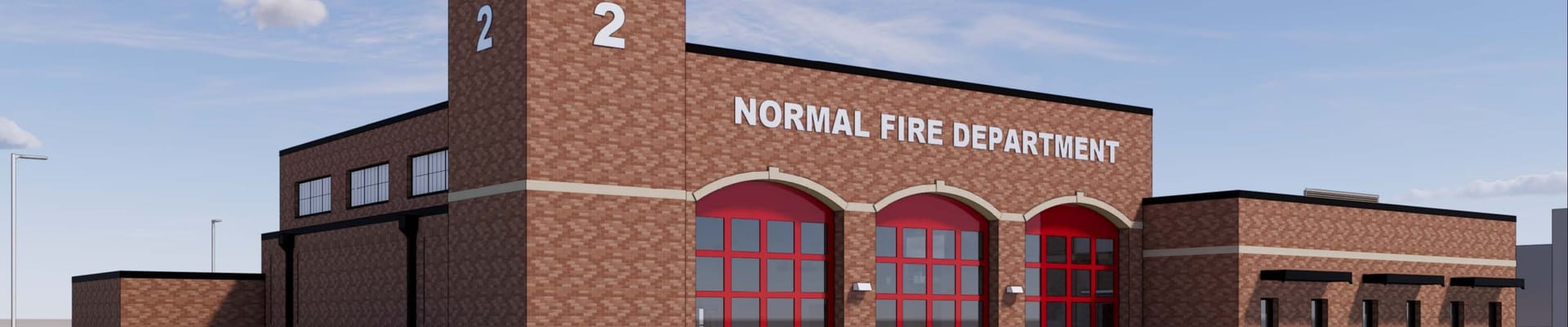
The Town of Normal plans to relocate Fire Station #2 to improve fire and emergency services to residents in northeast Normal where current response times range from nine to 10 minutes. The goal is to improve response times to between four and six minutes 90% of the time.
Relocating Fire Station #2 represents the second of a three-phase plan to properly locate stations throughout the community to address continued growth and expansion, especially on the east side of town.
The new station will reduce response times in the area and better distribute staff and equipment within the community. The northeast quadrant of Normal includes Normal Community High School, Eastview Christian Church, the Apostolic Christian Church the Village at Mercy Creek assisted living facility and numerous residential areas.
Construction & Occupation
Construction began in late 2024 and was complete in late 2025.
Before the station can be occupied, the Town awaits furniture delivery and alignment of emergency alerting services. The Town anticipates this will happen no later than the end of January 2026.
Upon occupation of new Fire Station #2, the fire station at College Avenue and Blair Drive will be decommissioned. The Town has not decided what to do with the location and is open to several options, including re-using or selling the property.
Documents and Resources
The following information provides additional information about the Fire Station Relocation.
- Fact Sheet/Questions and Answers: Visit this fact sheet for additional information about Town of Normal fire and emergency services.
- Data Analysis Presentation: This presentation was made at the Feb. 2, 2026 Council meeting.
- Feb. 2, 2026 Council Meeting: This video shares the entire presentation and following discussion about the data analysis presentation.
Maps
Below are two maps the Town of Normal uses when calculating response times within the municipality. To view the map legend, please click the drop-down menu in the top right corner of the map viewer. Swipe right to view the parts of the legend - depending on the size of your mobile device or tablet, you may need to scroll down in the legend to see the pagination arrows/dots.
To summarize: the maps provide a visual representation of the municipal boundaries. All Normal Fire stations are depicted on the map. Areas in blue are reachable in four minutes. Areas in purple are reachable in six minutes.
The ESRI ArcGIS Online Model reflects typical travel behavior and congestion patterns (not the Town of Normal’s validated emergency response times which consistently exceed those modeled predictions).
The ESRI Network Analyst Model from ArcGIS Pro Network reflects emergency driving conditions in Normal. This map is validated with CAD data, emergency vehicle drive times, and GIS modeling.
Stay Informed
Get notified on upcoming engagements and the latest project related news.

Timeline
Council authorized a three-phase plan to relocate the Normal Fire Department’s three fire stations to serve the community more effectively within acceptable response time parameters.
The Town completed construction of a headquarters fire station on Main Street, adjacent to the Illinois State University campus.
The Town acquired property at the northeast quadrant of the intersection of Shepard and Hershey Roads, adjacent to Blackstone Trails subdivision, for the to-be-relocated Fire Station #2.
Project Updates
Town of Normal breaks ground on Fire Station #2
Mayor Chris Koos and Core Construction President Tim Erickson spoke at the ceremony
Council approves new fire station with unanimous vote
Fire Station 2 will be built at the northeast corner of Hershey and Shepard Roads
Plans shared with Blackstone Subdivision residents
Learn about features of the new fire station